Route guide for visitors throughout Catalonia – Barcelona – Costa Brava – Catalan Pyrenees – Personalized experiences – Customized tour guide services – A small tribute to the wonderful city and land that saw us born – Transforming experiences into unforgettable memories - Magic Dreams Collection: exclusive universes inspired by Salvador Dalí and Gaudí. Niche perfumes, jewelry, lithographs, and collectible items celebrating the Mediterranean spirit.
In one of the most discreet and elegant corners of the Costa Brava, where the landscape speaks without artifice and time seems to slow down, lies Tamariu: a cove transformed into a destination, and a destination transformed into an experience. Unlike other locations along the …
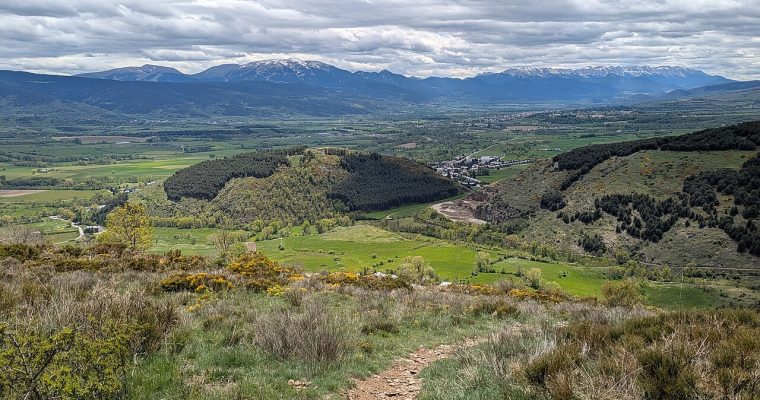
Puigcerdà: A Pyrenean paradise that awakens all the senses On the banks of the River Segre, embraced by the majestic Pyrenees, lies Puigcerdà, the capital of the Cerdanya region, at approximately 1,200 metres above sea level. Located just 150 km from Barcelona, the journey by …
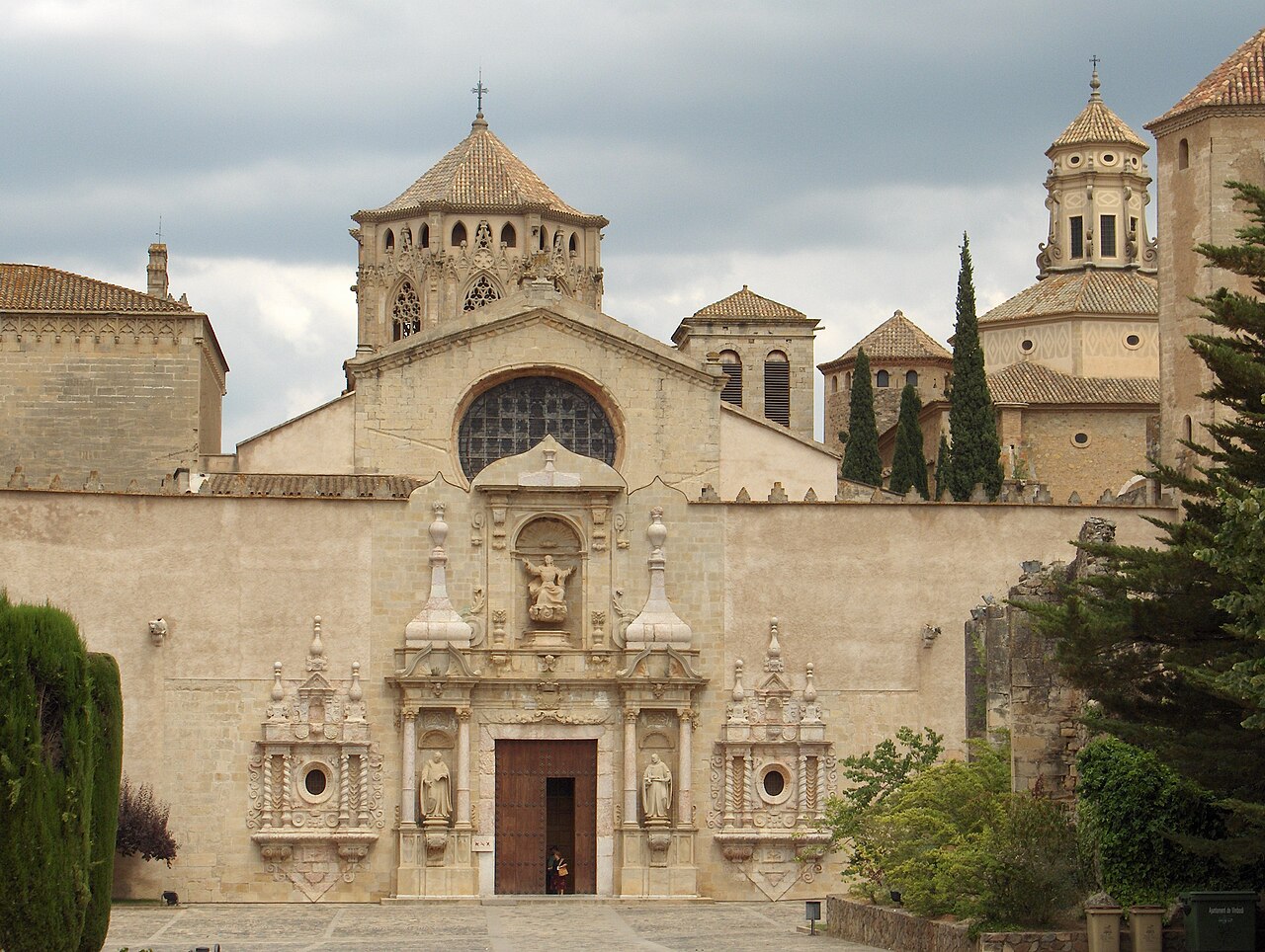
Hidden among the landscapes of the Conca de Barberà, in the province of Tarragona, stands one of Catalonia’s most extraordinary historical treasures: the Royal Monastery of Santa Maria de Poblet.
This impressive Cistercian monastery is much more than a beautiful medieval building. It is a place connected to the history of the Crown of Aragon, the Catalan royal dynasty, medieval monastic life and some of the most remarkable architectural traditions of Catalonia.
Declared a UNESCO World Heritage Site in 1991, Poblet is considered one of the largest and most complete Cistercian abbeys in the world.
If you are staying in Barcelona and would like to discover a different side of Catalonia, we highly recommend including Poblet in your itinerary.
Where is the Royal Monastery of Poblet?
The monastery is located in the municipality of Vimbodí i Poblet, in the Conca de Barberà region of Tarragona.
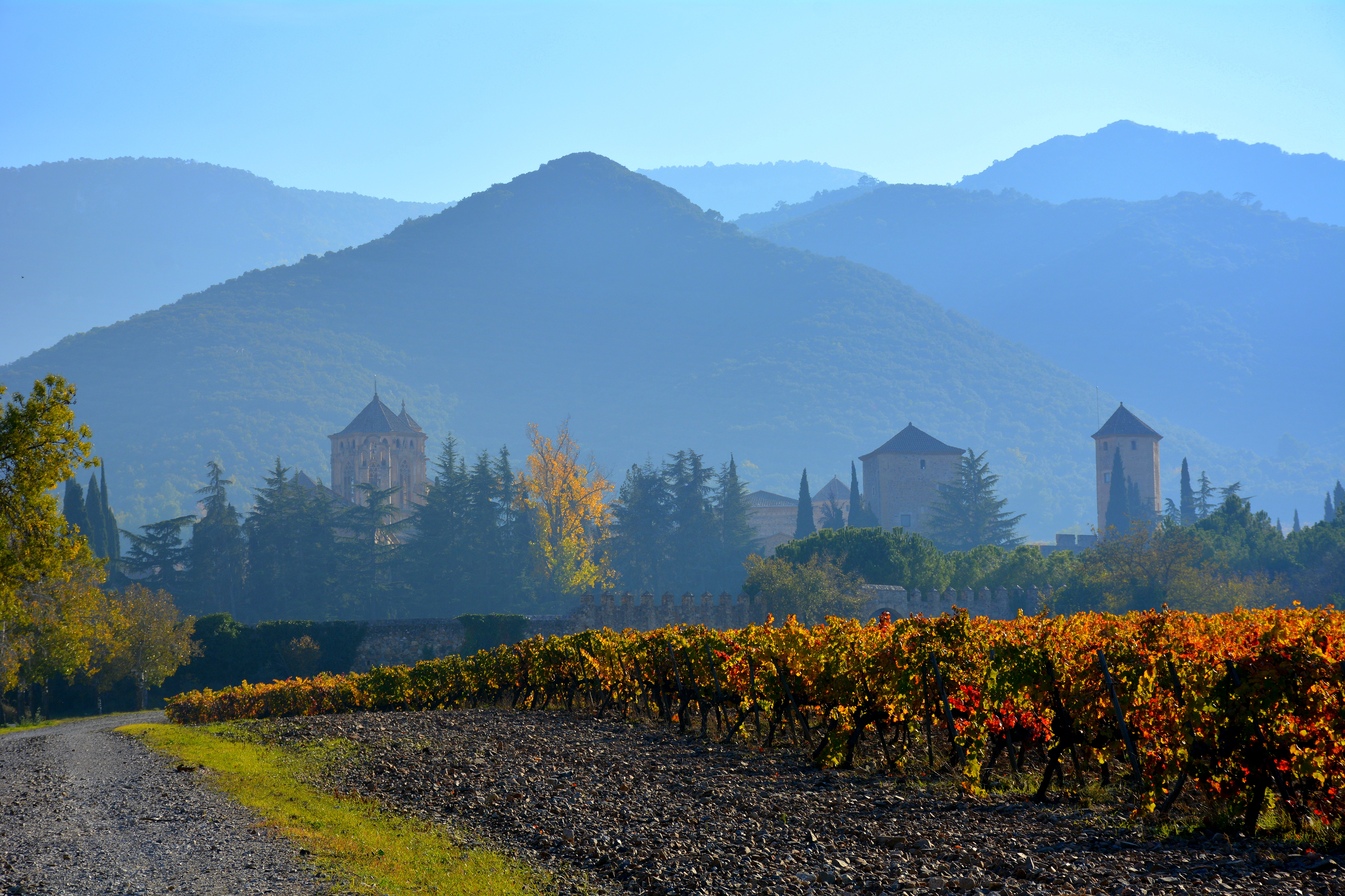
Its surroundings make the journey particularly attractive. The monastery is surrounded by forests, mountains and historic villages, creating an atmosphere that feels very different from the urban environment of Barcelona.
The location also makes Poblet an excellent destination for a cultural day trip from Barcelona.
How far is Poblet from Barcelona?
By car, the journey from Barcelona to Poblet is approximately 120 kilometres, depending on the exact route.
Under normal traffic conditions, the drive takes around 1 hour and 20 minutes to 1 hour and 30 minutes.
The usual route is via the AP-7 and AP-2, followed by the exit towards L’Espluga de Francolí and Poblet.
For visitors who prefer not to drive, there are also public transport options, although they require considerably more planning.
The nearest railway station is L’Espluga de Francolí, approximately 3 kilometres from the monastery.
A Brief History of Poblet
The history of Poblet begins in 1150, when the Cistercian monastery was founded in the context of the Christian expansion of the Crown of Aragon.
Over the following centuries, the monastery grew in importance and became one of the principal religious and political centres of the region.
Its relationship with the royal house became particularly significant.
Poblet eventually became the royal pantheon of the Crown of Aragon, and several kings and queens were buried here.
This royal connection transformed the monastery into much more than a religious institution. It became a powerful symbol of the medieval Crown of Aragon and an important centre of culture, administration and spirituality.
The Royal Pantheon
One of the most fascinating parts of Poblet is the Royal Pantheon, where members of the royal dynasties of Catalonia and Aragon were buried.
The tombs are located inside the monastery church, above the passageways between the columns.
Among the monarchs associated with the pantheon are Peter the Ceremonious, Martin the Humanist, Alfonso the Magnanimous and James II of Aragon, among others.
For visitors interested in medieval history, this is one of the most important highlights of the entire complex.
Walking through the church and seeing the royal tombs provides a direct connection with centuries of European history.
The Architecture of Poblet
Poblet is particularly interesting because it combines several architectural periods.
Its construction developed over centuries, and visitors can identify Romanesque, Gothic, Renaissance and Baroque elements throughout the complex.
However, Gothic architecture is particularly prominent in some of the monastery’s most important spaces.
The monastery was designed according to the principles of Cistercian architecture, which traditionally emphasized simplicity, functionality, light and spiritual contemplation.
At the same time, Poblet developed into an extraordinarily complex architectural ensemble.
The Three Enclosures of the Monastery
One of the most distinctive characteristics of Poblet is its organization into three main enclosures.
The complex is surrounded by defensive walls and towers, giving the monastery an imposing fortified appearance.
The First Enclosure
The first enclosure contains historic spaces that were connected with practical and everyday activities.
Among them are former stores, workshops and housing dating from later periods.
One of the most notable buildings is the Chapel of Saint George, a Gothic chapel dating from the 15th century.
This area provides an interesting introduction to the monastery before visitors reach its principal monumental spaces.
The Second Enclosure
The second enclosure leads visitors further into the historical heart of the complex.
Here you can find the Plaça Major, remains associated with the former hospital for the poor, the Romanesque Chapel of Santa Catherine and other historic spaces.
The architecture gradually becomes more monumental as you approach the main monastic enclosure.
The Third Enclosure
The third enclosure contains the heart of Poblet.
This is where visitors find the monastery church, the great cloister and many of the rooms associated with monastic life.
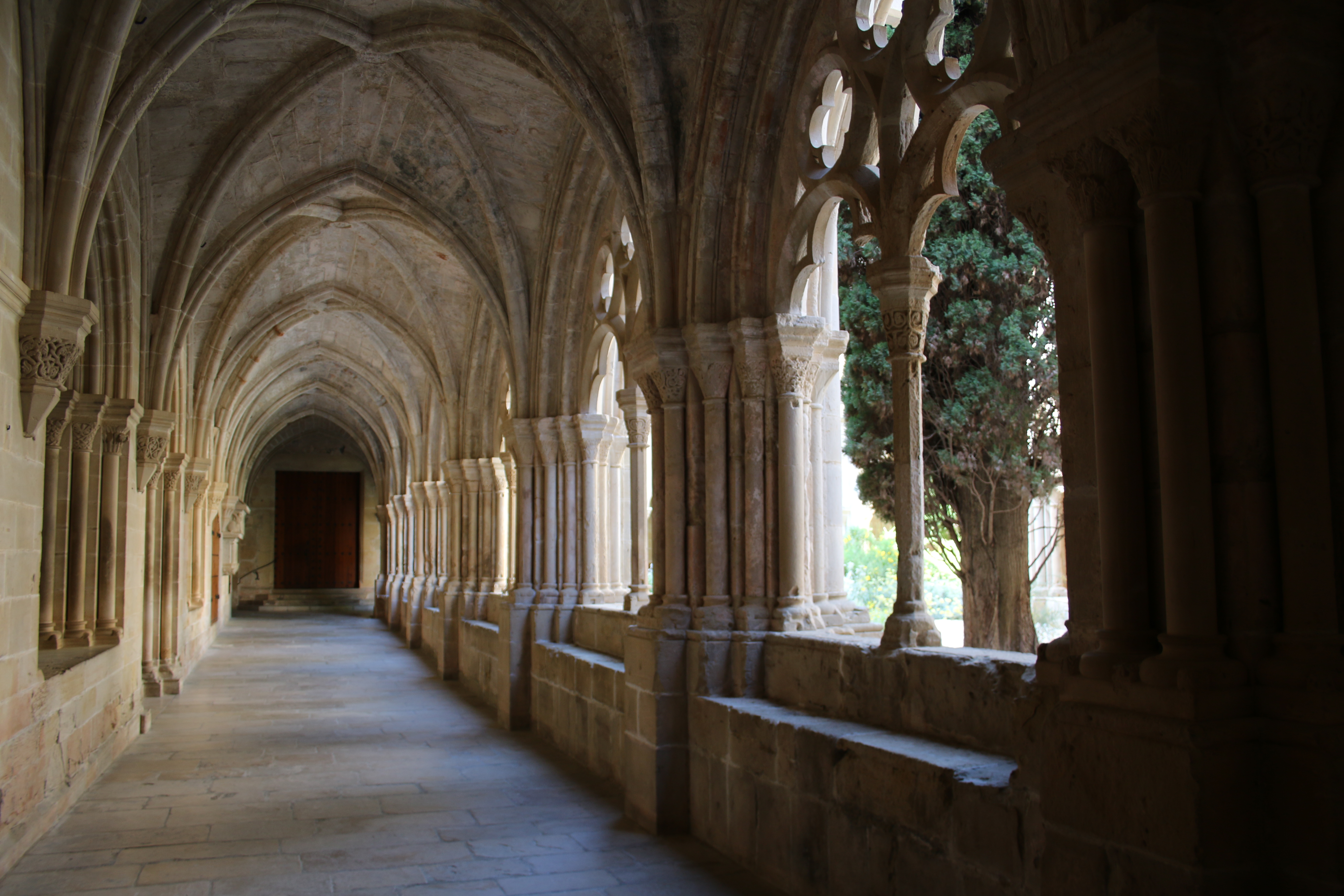
The cloister is particularly impressive and is one of the best places to appreciate the Gothic character of the monastery.
The Royal Gate and Defensive Walls
The monastery’s defensive character is impossible to miss.
The surrounding wall is approximately 11 metres high and extends for around 608 metres.
The fortifications were commissioned during the reign of Peter the Ceremonious, reflecting the political and strategic importance that Poblet had acquired.
The impressive Royal Gate was commissioned in the 14th century from the military engineer Guillem de Guimerà.
It is one of the most striking entrances to the monastery.
The Monastery Church
The church is at the centre of the monumental complex.
Its architecture follows the Cistercian tradition while incorporating Gothic elements.
The church has three naves, a transept and an ambulatory around the main altar.
The central nave is covered by a pointed vault, while the side aisles feature ribbed vaulting.
Inside, visitors can also admire the royal tombs and the impressive Renaissance alabaster altarpiece.
For many visitors, the combination of monumental architecture, royal history and religious symbolism makes the church one of the highlights of Poblet.
The Great Cloister
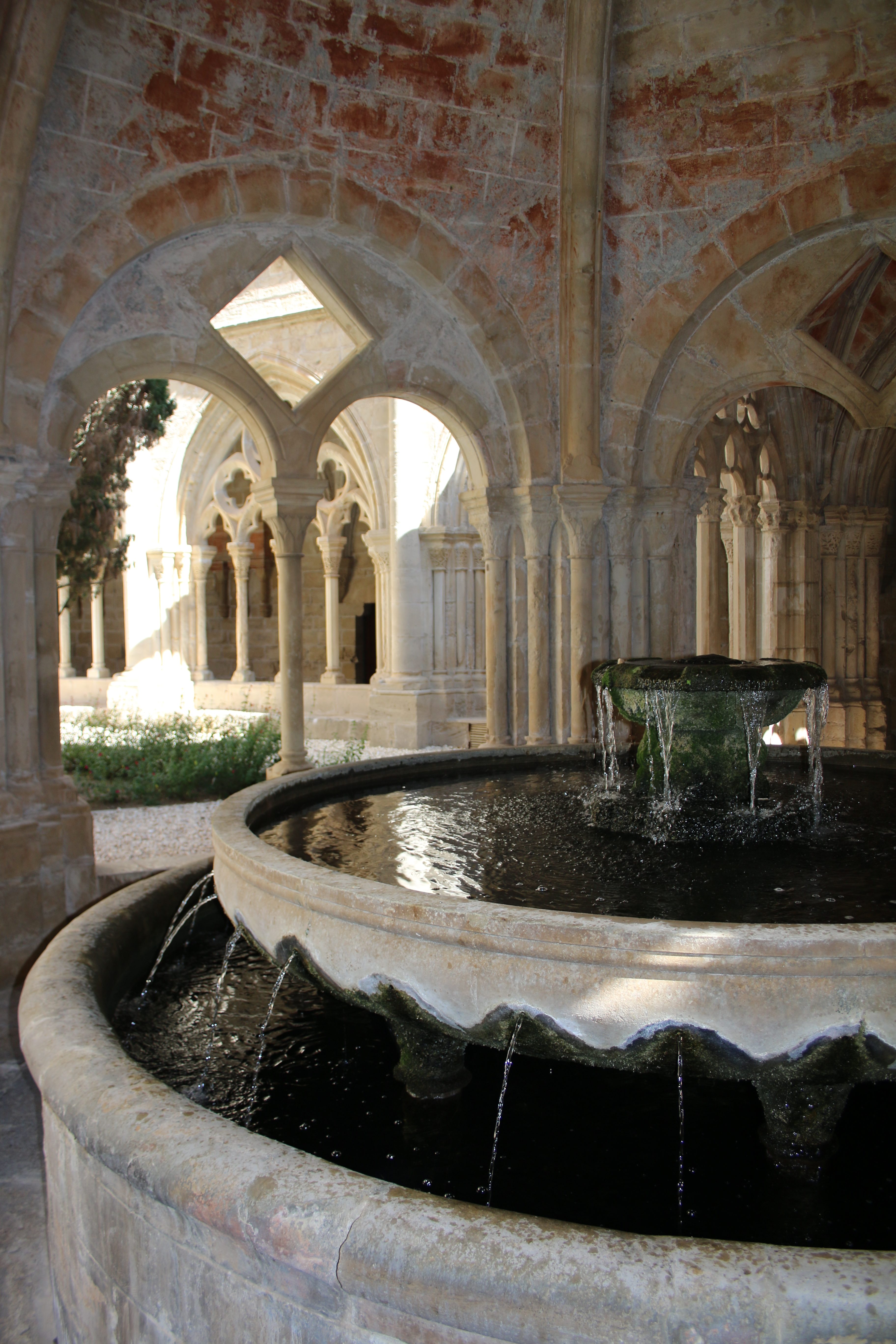
The great cloister is one of the most beautiful spaces in the monastery.
Its Gothic architecture creates a peaceful environment that contrasts with the defensive character of the exterior walls.
The cloister connected many of the monastery’s principal rooms and played an essential role in the daily life of the monks.
It is also one of the best places to appreciate the proportions, stonework and architectural details of Poblet.
The Chapter House
The Chapter House was one of the most important spaces in the daily life of the Cistercian community.
The monks gathered here to discuss matters concerning the monastery, listen to readings and deal with the administration of their community.
Its architecture reflects the importance of the space within monastic life.
The Refectory and Kitchen
The monastery also preserves spaces associated with the everyday life of the monks.
The refectory was where the community took its meals.
Nearby were the kitchen and other service areas required to support the monastic community.
These spaces help visitors understand that Poblet was not simply a monumental or religious building. It was a complete community designed around prayer, work, study and communal life.
The Scriptorium and Library
Poblet also became an important centre of learning.
The monastery had a library and scriptorium, where manuscripts were copied, preserved and studied.
The monks contributed to the transmission of knowledge, particularly in areas such as law and history.
This intellectual dimension is another reason why Poblet is so significant.
Its importance goes beyond architecture: it was also a centre of culture and knowledge.
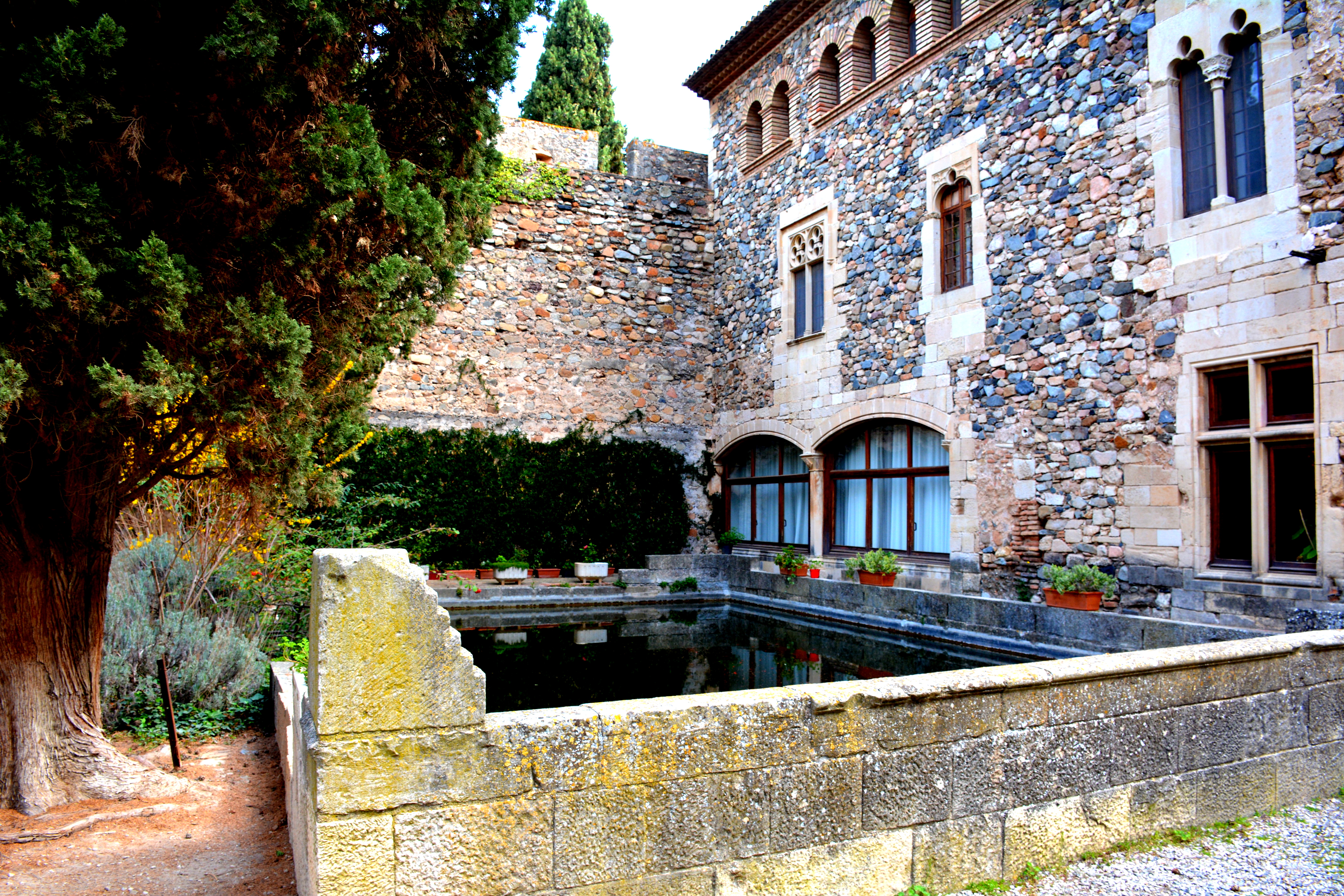
The Palace of King Martin
One of the most fascinating structures within the complex is the Palace of King Martin.
Construction began towards the end of the 14th century, although the building was never completely finished after the death of King Martin in 1410.
Its Gothic windows are particularly distinctive.
The interiors were later completed and reconstructed during the 20th century to accommodate historical collections.
The palace is an excellent example of the connection between the monastery and the royal court.
What Happened to Poblet?
The monastery experienced a dramatic period of decline during the 19th century.
In 1835, following the confiscation of church property in Spain, the monks were forced to leave Poblet.
The abandoned monastery suffered looting and deterioration, and many of its buildings were seriously damaged.
For decades, Poblet remained in a state of ruin.
Fortunately, restoration efforts eventually began, and monastic life returned in 1940.
The restoration of Poblet became one of the most important heritage projects in Catalonia.
Poblet and UNESCO
The Royal Monastery of Santa Maria de Poblet was declared a UNESCO World Heritage Site in 1991.
UNESCO recognizes Poblet as one of the largest and most complete Cistercian abbeys in the world.
Its importance lies not only in its architecture but also in its historical relationship with the Crown of Aragon, its royal pantheon and its extraordinary preservation as a complete monastic complex.
How Do You Visit the Monastery?
The tourist visit to Poblet can be completed independently using the official “Poblet, guía oficial” application.
We recommend bringing headphones so that you can comfortably follow the information during the visit.
In addition to the monumental area, the visit includes the museum and interpretation centre, providing further information about the history and significance of the monastery.
We recommend preparing your visit in advance and checking the opening times before travelling, particularly during public holidays and special dates.
Would you prefer to discover Poblet without worrying about the organization?
If you would like to experience the monastery in a more comfortable and personalized way, Magic Dreams Barcelona can organize the entire experience for you.
We can arrange a private excursion from Barcelona including private transportation, guide services, scheduling, gastronomy and all the essential details required for a relaxed and enjoyable day.
You will not have to worry about how to get there, where to park, how to organize your time or where to enjoy a good meal.
We take care of the logistics so that you can concentrate on discovering Poblet and enjoying its history.
For visitors looking for a private and carefully planned experience, we highly recommend combining culture, heritage, gastronomy and the beautiful landscapes surrounding the monastery.
If you are considering visiting the Royal Monastery of Poblet from Barcelona, Magic Dreams Barcelona can design the complete experience for you, adapting the itinerary to your interests, preferred pace and requirements.
Opening Hours
The official tourist opening hours vary according to the season.
Winter season
15 September – 14 June
Monday to Saturday: 10:00–12:30 and 15:00–18:00
Sundays and public holidays: 10:30–12:30 and 15:00–18:00
Summer season
15 June – 14 September
Monday to Saturday: 10:00–12:30 and 15:00–18:30
Sundays and public holidays: 10:30–12:30 and 15:00–18:30
Tickets are normally sold until 30 minutes before closing.
The monastery is closed all day on certain public holidays, including 1 January, 6 January, 25 December and 26 December.
We strongly recommend checking the official schedule before travelling because special opening times may apply on specific dates.
Ticket Prices
Current general admission prices include:
General admission: €10.50
Reduced admission: €7.50
School and university groups: €6
Combined Cistercian Route ticket: €18
The combined ticket includes Poblet, Santes Creus and Vallbona de les Monges.
Reduced admission applies to several categories, including seniors, children from 7 years old, students and certain other groups with the appropriate documentation.
How to Get to Poblet from Barcelona
By Car
Driving is the most convenient option, particularly if you would like to combine Poblet with other destinations in the area.
The journey from Barcelona takes approximately 1 hour and 20–30 minutes, depending on traffic and the route.
By Train
You can travel by train from Barcelona towards the Tarragona/Lleida area and reach L’Espluga de Francolí.
The station is approximately 3 kilometres from the monastery, meaning that you will need to arrange the final part of the journey.
By Bus
Bus connections are possible, but they generally require more planning and transfers.
For this reason, visitors who want to make the most of a single day often find private transportation considerably more comfortable.
Where to Eat Near Poblet
A visit to Poblet can easily be combined with lunch in the surrounding area.
Among the nearby options are:
Restaurant Hostatgeria de Poblet — located very close to the monastery and a convenient option for combining the visit with lunch.
Restaurant El Grèvol — located in Vimbodí and offering a more informal local dining option.
Restaurant Dels Torrents — another nearby choice for enjoying a meal during your visit.
Opening times can change according to the season, so we recommend checking availability before travelling.
For a private excursion with Magic Dreams Barcelona, we can also help coordinate the gastronomic part of your experience so that your day is organized smoothly from beginning to end.
What Can You Do Around Poblet?
A visit to the monastery can be extended into a broader cultural excursion.
The surrounding area offers opportunities to discover:
Historic villages in the Conca de Barberà
The Cistercian heritage of Catalonia
Forest landscapes surrounding Poblet
L’Espluga de Francolí
Montblanc and its medieval heritage
Other historic monasteries in the region
Local gastronomy and traditional Catalan cuisine
One particularly interesting option is the Cistercian Route, which connects Poblet with the monasteries of Santes Creus and Vallbona de les Monges.
7 Fascinating Facts About Poblet
1. It is a royal burial place
Poblet became the royal pantheon of the Crown of Aragon, making it one of the most important royal burial sites in Catalonia.
2. It is a UNESCO World Heritage Site
Poblet has been recognized by UNESCO since 1991 because of its exceptional historical and architectural value.
3. It is a fortified monastery
Unlike many monasteries, Poblet has imposing defensive walls and towers, reflecting its historical importance.
4. It combines different architectural periods
Romanesque, Gothic, Renaissance and Baroque elements can all be found throughout the complex.
5. Monastic life returned in the 20th century
After decades of abandonment following the events of 1835, the monastic community returned in 1940.
6. It was an important centre of knowledge
The monastery developed an important library and scriptorium, contributing to the preservation and transmission of historical knowledge.
7. It remains one of Catalonia’s great historical landmarks
Today, Poblet is one of the most important examples of Cistercian heritage in Europe and one of the most remarkable cultural destinations in Catalonia.
Why Visit Poblet from Barcelona?
If you are staying in Barcelona, Poblet offers the opportunity to experience a completely different side of Catalonia.
Instead of focusing only on Barcelona’s urban attractions, you can discover medieval architecture, royal history, monastic traditions and spectacular landscapes in a single day.
We highly recommend Poblet for travelers interested in history, architecture, culture and authentic Catalan heritage.
And if you would rather enjoy the experience without worrying about transportation, reservations or logistics, Magic Dreams Barcelona can take care of the entire journey for you.
From the moment you leave Barcelona until your return, we can coordinate the vehicle, guide, itinerary, gastronomy and the details that make the difference between simply visiting a monument and enjoying a truly memorable cultural experience.
We invite you to discover the Royal Monastery of Poblet and experience one of Catalonia’s most fascinating historical treasures.
Iglesia del monasterio, parte de la Epístola. Sepulcros reconstruidos por Federico Marés Deulovol en 1944 – José Luis Filpo Cabana, CC BY 3.0 , via Wikimedia Commons.
Arcos del claustro – Francis Raher, CC BY 2.0 , via Wikimedia Commons.
Monestir de Poblet, Vimbodí – Angela Llop de España, CC BY-SA 2.0 , via Wikimedia Commons.
Monasterio, otoño, viñas, cisterna – By Angela Llop – https://www.flickr.com/photos/angela_llop/26730740849/, CC BY-SA 2.0, https://commons.wikimedia.org/w/index.php?curid=91000669.
Monasterio de Poblet – By FrDr – Own work, CC BY-SA 4.0, https://commons.wikimedia.org/w/index.php?curid=109229564.
Monasterio de Poblet – By FrDr – Own work, CC BY-SA 4.0, https://commons.wikimedia.org/w/index.php?curid=109229889.
Alrededores del Real Monasterio de Poblet – By LBM1948 – Own work, CC BY-SA 4.0, https://commons.wikimedia.org/w/index.php?curid=120602240.
History, architecture, legends and one of the Maresme’s most extraordinary fortresses There are places that seem to belong to another era. Places where towers, battlements, courtyards and medieval galleries blend with stained glass, mosaics, sculptures and Modernist details. Santa Florentina Castle, in Canet de Mar, …
About 100 kilometres from Barcelona, Rupit i Pruit emerges among mountains, forests and cliffs as one of those villages that seem to belong to another era. The journey from Barcelona by car takes approximately 1 hour 20 minutes to 1 hour 40 minutes, depending on …
A short guide to discovering one of the Costa Brava’s most extraordinary natural treasures.There are landscapes that are not simply seen, but felt, explored and remembered.Cap de Creus Natural Park is one of them.At the easternmost point of the Iberian Peninsula, where the final foothills of the Pyrenees descend towards the Mediterranean Sea, lies one of the most distinctive territories of the Costa Brava. Here, rocks resemble sculptures, the tramuntana wind shapes the vegetation, hidden coves preserve their rugged beauty, and the sea conceals some of the most valuable underwater ecosystems along the Catalan coastline.Located in the Alt Empordà region of the province of Girona, Cap de Creus represents an extraordinary fusion of nature, geology, biodiversity, history and Mediterranean culture.Here, the landscape is far more than a backdrop. It is the result of millions of years of geological transformation, the persistent action of wind and water, and a long-standing relationship between humankind and a territory that is as beautiful as it is demanding.It is no coincidence that Salvador Dalí found an inexhaustible source of inspiration in this corner of the Empordà. Its unusual rock formations, open horizons, contrasting light and almost surreal atmosphere seem to belong to a world suspended between reality and dreams.
For travellers seeking authentic destinations in the Mediterranean, Cap de Creus offers something increasingly valuable: the opportunity to discover a landscape that has retained its own powerful identity.
A Natural Park Between Land and Sea
Cap de Creus Natural Park was established in 1998 and became Catalonia’s first maritime-terrestrial natural park.
Its distinctive character lies in the joint protection of the peninsula’s terrestrial landscapes and an extensive marine area. Cliffs, rocky coves, islets, ravines, ancient agricultural terraces, Mediterranean scrubland, underwater meadows and exceptionally rich seabeds coexist within this protected environment.
The park encompasses areas of the municipalities of Cadaqués, El Port de la Selva, La Selva de Mar, Llançà, Vilajuïga, Pau, Palau-saverdera and Roses, among other areas associated with its natural and scenic surroundings.
Each part of the park offers a different experience.
Around Cadaqués, visitors will find small bays, coastal paths and landscapes closely associated with Dalí’s life and work. Further north, the coastline becomes more rugged, with steep cliffs, secluded inlets and remarkably isolated corners. In the southern sector, around Roses and Cape Norfeu, rock formations, coves and Mediterranean habitats create another distinctive landscape.
This diversity makes Cap de Creus an especially rewarding destination for hiking, nature photography, birdwatching, botany, geology, diving and peaceful escapes from everyday life.
The park can be explored on foot, admired from the sea, studied through its geological outcrops or simply appreciated from one of its viewpoints, where the full scale of the landscape becomes apparent.
Unique Geology: Millions of Years Written in Stone
An Open-Air Geological Museum
Cap de Creus is one of Catalonia’s most remarkable geological sites and a territory of considerable interest to both specialists and enthusiasts of Earth sciences.
Its exposed rock formations reveal Palaeozoic rocks, complex deformation structures and evidence of the tectonic processes that contributed to the formation of the Pyrenees.
Metamorphic rocks are particularly abundant, especially schists and phyllites, although gneisses, marbles, quartzites, amphibolites and other rock types are also present. Certain areas contain igneous rocks, including granodiorites, as well as much more recent volcanic formations.
It is important to distinguish between the age of the original materials and the time when they were transformed. Some of the sediments that eventually became these rocks were deposited during the Palaeozoic Era, while much of their metamorphism and folding is associated with the Hercynian, or Variscan, orogeny, approximately 300 million years ago. Later, the formation of the Pyrenees deformed the rock sequence again, producing particularly complex geological structures.
What Is a Metamorphic Rock?
A metamorphic rock is a rock that has undergone mineralogical and structural changes as a result of variations in pressure, temperature or fluid circulation, without melting completely.
At Cap de Creus, these processes have produced rocks with a wide variety of textures, colours and structures.
Schists display a characteristic alignment of minerals along planes, allowing them to split into layers. Phyllites have fine surfaces with a silky sheen, while gneisses are often distinguished by alternating light and dark mineral bands.
Marble forms through the transformation of carbonate rocks. Quartzite is rich in quartz and resistant to erosion, while amphibolites contain dark minerals that reflect their particular composition and metamorphic conditions.
This variety helps explain why the landscape changes so dramatically from one area to another and why some rock surfaces display grey, ochre, pink or greenish tones.
Erosion: How Rocks Become Sculptures
One of the most characteristic images of Cap de Creus is that of twisted, perforated and seemingly impossible rock formations.
Their appearance results from the interaction of geological processes and erosion.
First, tectonic deformation fractured, folded and rearranged the rocks. Over time, water, waves, wind and weathering gradually wore away the more vulnerable areas. Differences in resistance between minerals and rock types encouraged the formation of cavities, grooves, sharp ridges and rounded surfaces.
The result is a landscape of rocky pinnacles, platforms, small arches, hollows and extraordinary shapes that seem to change expression with the light.
The tramuntana wind plays an important role in this visual identity, although it does not act alone. Marine erosion, rainfall, temperature changes and the internal structure of the rocks all contribute to the process.
This is why Cap de Creus has become a major reference point for field geology. It is not simply a beautiful coastline to admire, but a place where visitors can observe the processes that have shaped and transformed a territory over hundreds of millions of years.
The Landscape That Inspired Salvador Dalí
Between Reality and Surrealism
To understand Salvador Dalí’s relationship with Cap de Creus, we must visit Cadaqués and, in particular, Portlligat.
Here, the artist discovered a landscape that brought together many of the defining elements of his creative universe: ambiguous shapes, open horizons, striking contrasts, eroded rocks and light capable of completely transforming our perception of space.
Rock formations may resemble animals, faces or human figures. The same stone can appear to take on different identities depending on the viewing angle. Long evening shadows and surfaces polished by the water reinforce this sense of strangeness.
Places such as Cala Culleró, Cala Culip and the surroundings of Portlligat allow visitors to experience this relationship between landscape and perception.
This does not mean that every geological formation corresponds to a specific work by Dalí. Rather, the territory as a whole offers a valuable insight into his artistic sensibility.
The Portlligat House-Museum, developed from former fishermen’s huts that the artist gradually transformed over the years, is an especially rewarding visit to complete the experience.
Here, nature and art seem to engage in a continuous dialogue.
The sea fills the windows’ horizons. Light transforms the rooms. Objects acquire unexpected meanings. The landscape outside seems to extend into the house itself.
For a cultural escape along the Costa Brava, combining Cadaqués, Portlligat and Cap de Creus offers a perspective that goes far beyond conventional sightseeing.
Mediterranean Botany: Plants That Learn to Live with the Wind
Vegetation Adapted to Extreme Conditions
The flora of Cap de Creus is one of the most distinctive and fascinating elements of its natural heritage.
At first glance, the landscape may appear austere. Low scrubland, rocky slopes and wind-exposed surfaces dominate many areas. Yet this apparent simplicity conceals an extraordinary diversity of plant life.
Plants must survive several environmental stresses: summer water shortages, intense sunlight, shallow soils, salt carried by sea spray and the force of the tramuntana.
These conditions have encouraged highly specialised adaptations.
Some species develop small, tough leaves or protective surfaces that reduce water loss. Others grow in compact, cushion-like forms that minimise exposure to the wind. Certain plants can even survive in tiny rock crevices where soil particles and moisture accumulate.
Rockroses, Heaths, Rosemary and Mastic Trees
In the park’s inland areas, extensive Mediterranean scrub communities can be found, including heathlands and rockrose-dominated vegetation, depending on the composition of each plant community.
Characteristic species include different rockroses, such as the narrow-leaved rockrose (Cistus monspeliensis) and the sage-leaved rockrose (Cistus salviifolius), together with heaths, rosemary, mastic trees and other plants adapted to summer drought.
In some areas, grasses and small dry grasslands are also present. Their composition depends on the nature of the substrate, wind exposure, the history of wildfires and traditional land use.
The landscape also preserves traces of its agricultural past. Former vineyards, terraces and dry-stone walls form a mosaic of open spaces, scrubland and small abandoned plots.
These features remind us that Cap de Creus is not a wilderness entirely untouched by human activity. For centuries, agriculture, grazing and land management helped shape the landscape we see today.
Broom, Carob Trees and Mediterranean Vegetation
Broom, together with various thorny shrubs, forms part of plant communities adapted to dry, sunny terrain.
Carob trees occur in favourable parts of the Mediterranean landscape, although they do not dominate every habitat in the park. Wild olive trees, mastic trees, junipers and other woody species are also present, depending on altitude, soil conditions and exposure.
In more sheltered and humid areas of the Rodes mountain range, woodland formations containing holm oaks and cork oaks survive, along with small patches of riparian vegetation.
This transition between open landscapes, scrubland, woodland and damp ravines is one of the main reasons for the peninsula’s botanical diversity.
Cap de Creus’s Botanical Treasure
One of the most remarkable plants is Seseli farrenyi, a species with an extremely restricted distribution associated with this territory and of considerable conservation importance.
Other notable species include Roussillon sea lavender (Armeria ruscinonensis) and several species of sea lavender in the genus Limonium, adapted to the conditions of rocky coastal environments.
These plants thrive in habitats where salinity, wind and a lack of soil prevent many other species from surviving.
Their importance goes beyond their beauty. They illustrate ecological specialisation and demonstrate how small coastal areas can support exceptional biodiversity.
Some of these species receive specific legal protection and are vulnerable to habitat disturbance, trampling and visitor pressure. It is therefore essential to remain on marked paths and avoid collecting plants or seeds.
Vegetation Also Tells the Story of the Land
The present-day vegetation is the result of a combination of natural and human influences.
Wildfires, the abandonment of former farmland, grazing and the evolution of scrubland have altered the distribution of plant communities.
The persistent effect of the tramuntana adds another factor, increasing moisture loss and depositing salty aerosols on leaves.
The result is a distinctive botanical mosaic: a seemingly barren territory in which every plant occupies a place determined by wind, soil and water availability.
For nature lovers, spring is one of the most rewarding times to observe flowering plants and discover details that often go unnoticed during the drier summer months.
Terrestrial Wildlife: Small Inhabitants of a Vast Landscape
The wildlife of Cap de Creus is closely linked to the diversity of its habitats.
Cliffs, scrubland, former agricultural fields, woodland and rocky outcrops provide shelter, food and breeding grounds for numerous species.
Although some animals are difficult to spot, the park is particularly rewarding for visitors who enjoy patient and respectful wildlife observation.
Terrestrial Mammals
Mammals associated with the Mediterranean environment include species such as foxes, wild boar, badgers and various small mammals that inhabit scrubland, woodland and transitional areas.
Their activity tends to be more discreet during the hottest hours of the day. Tracks, footprints and droppings can provide more evidence of their presence than a direct sighting.
In such an exposed landscape, ravines and densely vegetated areas play an important role as refuges.
Insects and Other Invertebrates
Invertebrates are an essential part of the park’s biodiversity, although they frequently go unnoticed.
Among the most notable species is the land snail Mastigophallus rangianus, endemic to Cap de Creus and of particular conservation interest.
Another remarkable species is Saga pedo, a large bush-cricket associated with herbaceous vegetation and scrubland. Its reproductive biology is especially unusual because its known populations reproduce through parthenogenesis, without requiring fertilisation by males.
These animals remind us that the ecological importance of a natural area does not depend solely on large or easily photographed species.
Protecting small invertebrates is also essential to maintaining healthy ecosystems.
Herpetology: Reptiles and Amphibians Among the Rocks
Life Among Rocky Outcrops and Scrubland
Herpetology, the study of reptiles and amphibians, reveals another dimension of Cap de Creus.
Reptiles are well adapted to dry, sunny Mediterranean environments. Lizards and other small reptiles may be found in scrubland, along path edges, around dry-stone walls and on rocky outcrops, where they use crevices for shelter.
One species characteristic of Mediterranean environments in the surrounding region is the Algerian sand racer (Psammodromus algirus), which uses low vegetation and open spaces to move around and search for insects and spiders.
Other reptile species native to the region may also occur, depending on the habitat and local conditions.
Snakes, where present, play an important ecological role as predators of small vertebrates and invertebrates. They should never be chased or handled. The appropriate response is to keep a safe distance and allow them to move away.
What About Amphibians?
Amphibians need water to complete their life cycles, so their distribution depends more heavily on the availability of ponds, streams, springs and other damp habitats.
In a territory characterised by summer drought and limited surface water, these habitats are particularly valuable.
Following rainfall, certain damp locations may experience increased amphibian activity. However, conditions vary across the park, and visitors should not expect to find these species on every route.
The best time to observe reptiles is generally during the milder periods of the year, particularly in spring and, depending on weather conditions, early autumn.
In all cases, wildlife observation should take place without lifting rocks, destroying shelters or capturing animals.
Ornithology: Cap de Creus as a Birdwatching Destination
A Remarkable Territory for Birdwatching
Cap de Creus is an important birdwatching destination thanks to its variety of terrestrial and marine environments, its cliffs and its geographical position in the western Mediterranean.
Resident species coexist with migratory birds that use the coastline and the Pyrenean region as part of their seasonal movements.
Cliffs provide resting and breeding sites. Scrubland and open areas offer food and shelter for numerous terrestrial birds. The sea, meanwhile, provides feeding grounds for various pelagic and coastal species.
Birds of Prey and Cliff-Dwelling Birds
Species of particular interest include Bonelli’s eagle, the peregrine falcon and the Eurasian eagle-owl, which are associated with rocky habitats and relatively undisturbed areas.
Observing birds of prey requires patience and a suitable viewing location. Sometimes, a bird appears as a tiny silhouette against the horizon before quickly disappearing behind a cliff.
The presence of a species in the park does not guarantee that it will be seen during a particular visit.
Distance, weather, the breeding season and food availability all influence bird activity.
Seabirds
Along the coast, visitors may encounter gulls, terns and other birds associated with the shoreline. The European shag is particularly characteristic of rocky coastal habitats, where it can sometimes be seen resting on rocks and spreading its wings to dry them.
Shearwaters and northern gannets may also appear while travelling or feeding in open waters.
Storms and strong winds can change birdwatching opportunities by influencing both bird movements and their distribution at sea.
Migration and Seasonal Changes
Spring and autumn are particularly interesting seasons for observing migratory birds.
During these periods, Cap de Creus forms part of a wider migration landscape used by species associated with the coast, open habitats and woodland.
To enjoy birdwatching, we recommend bringing binoculars, avoiding nesting areas and remaining on authorised routes.
Responsible observation reveals a natural heritage that may otherwise go unnoticed during a quick visit to the lighthouse or the best-known coves.
Marine Wildlife: A Mediterranean Full of Life
A Different Landscape Beneath the Surface
The richness of Cap de Creus does not end at the shoreline.
Beneath the water lies a mosaic of rocky seabeds, submerged walls, caves, crevices, sandy areas and seagrass meadows that provide shelter for an extraordinary variety of organisms.
Clear water, diverse substrates and differences between exposed and sheltered areas encourage a wide range of marine communities.
Rocky seabeds support fish, crustaceans, molluscs, sponges, algae and organisms that form complex benthic communities—that is, communities associated with the seabed.
Mediterranean Fish
Species found in the park’s marine habitats include white seabream, saddled seabream, salema, red scorpionfish and dusky grouper.
Seabream move across rocky seabeds in search of food among algae and small invertebrates. Salema primarily feed on plant material, while red scorpionfish use their camouflage to remain motionless and capture prey.
The dusky grouper, a particularly prized sight among divers, uses crevices and cavities for shelter.
Suitable waters may also support European seabass and various pelagic fish, including sardines, which move through the water column.
The presence of each species depends on depth, season, temperature and habitat characteristics.
Octopuses, Lobsters and Other Invertebrates
Octopuses are iconic inhabitants of rocky seabeds. Their ability to change the colour and texture of their skin allows them to blend into rocks and algae.
European lobsters and spiny lobsters occupy rocky shelters, while various crustaceans and molluscs contribute to the functioning of benthic communities.
In the more complex areas of the seabed, every crevice can become a small ecosystem.
Gorgonians and Coralligenous Habitats: Underwater Gardens
One of the most fascinating features of the underwater landscape is the presence of gorgonians and coralligenous communities.
Gorgonians are colonial animals that form branching structures, providing shelter and increasing habitat complexity. Their shapes resemble small underwater trees, and where they grow densely, they create remarkably beautiful seascapes.
Coralligenous habitats, meanwhile, are communities formed by organisms that build calcareous structures and the many species associated with them.
Red coral (Corallium rubrum), a species of considerable ecological and historical importance, is also present in certain parts of Cap de Creus.
These environments are sensitive to physical disturbance, the removal of organisms and certain human activities. They should therefore be observed without touching them and in accordance with diving, fishing and navigation regulations.
Posidonia Seagrass Meadows: The Forests of the Mediterranean
Meadows of Posidonia oceanica are among the most important ecosystems in the Mediterranean.
Although they are often mistaken for algae, posidonia is a marine flowering plant with roots, stems, leaves, flowers and fruits.
Its meadows provide shelter for countless organisms, serve as feeding and nursery grounds for fish and other animals, help store carbon and stabilise seabed sediments.
They also play an important role in coastal protection against waves. Naturally accumulated deposits of seagrass leaves on some beaches can help reduce coastal erosion.
Cap de Creus also contains other marine flowering plants, including Cymodocea nodosa and species of the genus Zostera, distributed according to substrate characteristics and environmental conditions.
These ecosystems are essential to understanding the ecological value of the park and the importance of protecting both the land and the seabed.
Can You See Dolphins?
The marine environment around Cap de Creus is also interesting for cetacean watching.
Bottlenose dolphins and other cetacean species may be found in the surrounding waters, although sightings are never guaranteed and depend on sea conditions and the animals’ movements.
If we are fortunate enough to see dolphins from the shore or during a boat trip, we should maintain a safe distance and avoid pursuing them, surrounding them or interfering with their movements.
Marine wildlife is not an organised spectacle. It is a living part of the ecosystem that deserves to be observed with respect.
The Climate of Cap de Creus: The Realm of the Tramuntana
A Mediterranean Climate with a Character of Its Own
Cap de Creus has the general characteristics of a Mediterranean climate, with warm, relatively dry summers, mild winters and rainfall concentrated during certain periods of the year.
However, its geographical position and exposure to the wind give it a distinctive character.
The undisputed protagonist is the tramuntana, a northerly wind that can blow with considerable force, particularly during certain weather conditions.
It changes the perceived temperature, increases evaporation and can make walking, boating and other outdoor activities more difficult.
Spring: Flowers, Light and Pleasant Temperatures
Spring is one of the best seasons to discover the park’s botanical diversity.
Scrubland becomes more active, wildflowers appear and temperatures are generally favourable for walking.
It is also an interesting time for birdwatching and exploring the trails without the intense heat of summer.
Nevertheless, it is advisable to bring a windproof layer and check the weather forecast before setting out.
Summer: Coves, Sea and Long Days
Summer is the most popular season for enjoying the coves and coastal scenery.
Long days and warm temperatures favour swimming, kayaking and other water-based activities when sea conditions permit.
However, this is also the period of greatest tourist pressure, intense sun exposure and elevated wildfire risk.
When the tramuntana blows, the sea can become unsuitable for swimming or boating, even when the air temperature feels pleasant.
Autumn: Tranquillity and Contrasting Light
Autumn can be particularly appealing to visitors seeking tranquillity, landscape photography and walking.
Fewer visitors, changing light and the return of rainfall allow the territory to be experienced from a different perspective.
It is also an interesting period for observing migratory birds, although weather conditions can change rapidly.
Winter: The Wildest Landscape
In winter, Cap de Creus reveals one of its most dramatic faces.
Wind, waves and changing skies intensify the rugged character of the cliffs and rock formations.
Conditions can nevertheless be demanding. Check forecasts carefully, avoid cliff edges during strong winds and stay away from exposed rock platforms when waves are high.
In this territory, weather is not a secondary consideration. It is an essential part of the experience and determines which activities are safe at any given time.
Cap de Creus Lighthouse: An Icon Overlooking the Mediterranean
Cap de Creus Lighthouse is one of the Costa Brava’s most recognisable landmarks.
Located at the peninsula’s easternmost point, it stands on a rocky promontory overlooking the Mediterranean Sea and the open horizon.
The present lighthouse was inaugurated in 1853 and remains an important reference point for maritime navigation.
Its location creates an extraordinary sense of isolation. The terrain is rugged, the vegetation is adapted to extreme conditions, and the sea surrounds much of the landscape.
A Viewpoint Over the Horizon
From the lighthouse area, visitors can admire cliffs, islets, small inlets and wide expanses of open sea.
The light constantly changes the colours of the rocks and water. Early in the day, the landscape may take on soft, silvery tones. At midday, contrasts become more intense, while towards the end of the day, the rocks can glow with golden hues.
It is an ideal place for landscape photography, contemplation and observing changing weather conditions.
Sunrises and sunsets depend on the season, the visible horizon and atmospheric conditions. The cape’s eastern orientation does not mean that the sun rises from exactly the same point throughout the year.
How to Reach the Lighthouse
The road from Cadaqués to the lighthouse is narrow and winding, crossing a protected natural landscape.
During certain dates and time slots, restrictions are imposed on private motor vehicles to reduce pressure on the natural environment. During these periods, a shuttle bus service operates from the Corral d’en Morell car park in Cadaqués.
These restrictions vary according to the season and annual calendar. Before travelling, it is essential to check the park’s official information and confirm shuttle timetables.
Visitors should not assume that they will always be able to drive to the lighthouse or that the same rules will apply every summer.
The Coves of Cap de Creus: Small Mediterranean Treasures
Cala Jugadora
Cala Jugadora is one of the best-known spots near the lighthouse.
Its landscape combines rocks, transparent water and a coastline with a wonderfully wild appearance. It is ideal for visitors who want to discover the beauty of the coast beyond urban beaches.
Access may involve walking over uneven ground, so suitable footwear is recommended. Check the route conditions before setting out.
Cala Culleró
Cala Culleró stands out for its rock formations and the variety of textures found throughout the landscape.
The contrast between rock and sea illustrates the close relationship between geology and the visual character of Cap de Creus. It is one of the places that help explain why the area is so strongly associated with Dalí.
Cala Culip
Cala Culip lies in the northern part of the park, within a rocky coastal landscape of considerable natural interest.
It is a good choice for visitors seeking hiking and landscape observation rather than the facilities of a conventional beach.
Cala Tavallera
In the El Port de la Selva area, Cala Tavallera is a secluded inlet whose access requires careful planning.
The walk is part of the experience. Bring sufficient water, sun protection and enough time for the return journey.
Portlligat and Its Small Bays
Portlligat offers a different view of the coastline: a sheltered bay, islets that reshape the horizon and a close relationship between the maritime landscape and Dalí’s artistic history.
It is an excellent choice for combining nature, culture and a leisurely visit to Cadaqués.
Important: The wilder coves do not always have lifeguards, showers, bars or other facilities. Many have pebble beaches and may be difficult to access for people with reduced mobility. Check the route, sea conditions and any access restrictions before visiting.
Hiking: Discovering the Park Step by Step
Cap de Creus has trails that reveal its different environments, from the lighthouse surroundings to the Roses and El Port de la Selva areas and former agricultural landscapes.
Choose a route according to the time available, the walkers’ experience, the elevation gain and the weather.
Walking Around the Lighthouse
A visit to the lighthouse can be combined with a short walk along the marked trails in the surrounding area.
This is a good option for discovering the rock formations, observing coastal vegetation and admiring the Mediterranean from different viewpoints.
The duration depends on the route selected and the time spent taking photographs or interpreting the landscape.
Routes from Cadaqués
From Cadaqués, visitors can organise walks towards Portlligat and different sections of the coastline.
These walks reveal the transition between the village, traditional paths, coves and Mediterranean vegetation.
Some routes include steep sections and uneven surfaces, so not all are suitable for every visitor.
Excursions Towards El Port de la Selva
The El Port de la Selva area offers a different landscape, with paths crossing open spaces, former agricultural terraces and rocky stretches of coastline.
Before undertaking a long hike, check that all planned paths are open. Some tracks are subject to seasonal restrictions or closures for safety, conservation or wildfire prevention.
The park’s official information on terrestrial trails is the best starting point for choosing an appropriate route.
What to Pack for a Hike
Hiking footwear with good grip.
Sufficient drinking water, especially in summer.
Sun protection, a hat and sunglasses.
A windproof layer.
A mobile phone with a charged battery and a route checked in advance.
Food for longer walks.
Binoculars if you want to observe birds.
Do not leave marked paths in strictly protected areas or enter closed sections.
Marine Tourism: Kayaking, Snorkelling and Scuba Diving
The sea is one of the main ways to experience the landscape of Cap de Creus.
In suitable conditions, kayaking offers a different perspective on the coastline, allowing visitors to discover small rocky inlets and observe how the terrain changes along the way.
Snorkelling provides opportunities to discover fish, algae and small organisms in shallow water, while scuba diving reveals more complex underwater environments and deeper marine communities.
However, marine activities must always be planned according to sea conditions and current regulations.
The tramuntana can turn an apparently simple excursion into a dangerous activity. Kayaking or taking a small boat out is not recommended when wind, waves or forecasts are unfavourable.
In protected areas, navigation, anchoring, diving and fishing may be subject to specific conditions. Respect buoys, avoid anchoring on posidonia seagrass meadows and do not touch marine organisms.
The best experience does not involve getting as close as possible to wildlife, but observing it without disturbing its behaviour.
History, Heritage and the Culture of the Empordà
Although Cap de Creus is best known for its natural beauty, its landscape also preserves an important cultural heritage.
Dry-stone walls, ancient terraces, traditional paths and remains of agricultural activities recall the historic relationship between the inhabitants of the Empordà and a territory shaped by drought, wind and difficult terrain.
The surrounding area also contains archaeological and monumental heritage, including dolmens, ancient settlements and structures associated with rural and maritime history.
The Monastery of Sant Pere de Rodes, located in the Rodes mountain range, is one of the region’s most rewarding cultural destinations.
Its setting helps visitors understand the relationship between mountainous terrain, historic routes and the Mediterranean landscape.
This combination of nature and heritage makes Cap de Creus suitable not only for active holidays, but also for cultural trips, photography escapes and leisurely explorations of the Alt Empordà.
Mediterranean Gastronomy: Flavours of the Sea and the Land
The Cap de Creus experience can also be discovered through its cuisine.
In Cadaqués, El Port de la Selva and Roses, visitors will find food influenced by local fish, seafood, rice dishes and Mediterranean culinary traditions.
The cuisine of the Empordà combines maritime heritage with agricultural produce, and recipes vary according to the town and season.
Dishes and products worth looking for include locally sourced fish when available, seafood rice, traditional fish stews known as suquets de peix, regional anchovies and wines from the Empordà wine region.
The best approach is to choose establishments that work with seasonal produce and ask which fish come from local catches.
Dining Near the Lighthouse
The restaurant located near Cap de Creus Lighthouse offers a dining experience closely connected to the surrounding landscape.
Its location makes a meal an opportunity to slow down, admire the Mediterranean and enjoy an environment very different from an urban setting.
Check opening times, menus and access arrangements in advance, especially during the high season and on days when traffic restrictions apply.
For a more complete experience, you can also combine a visit to the lighthouse with a meal in Cadaqués or El Port de la Selva, where a wider variety of restaurants and services is available.
How to Get to Cap de Creus from Barcelona
By Car: The Most Flexible Option
The road distance between Barcelona and Cadaqués is approximately 170–180 kilometres, depending on your starting point and chosen route.
The journey generally takes around two and a half to three hours, although it may take longer during summer weekends, holiday departure and return periods, or peak tourist season.
The usual route follows the AP-7 towards Girona and Figueres, continuing towards Roses and finally Cadaqués along the GI-614 road.
The final stretch is winding and requires careful driving. Once in Cadaqués, bear in mind that parking may be limited and that driving to the lighthouse is not always permitted.
Where to Park
Cadaqués has public car parks and parking areas whose availability and charges may vary according to the season.
When access to the lighthouse is regulated, the park provides the Corral d’en Morell car park, from which the shuttle bus departs.
If your plan includes visiting the old town, Portlligat and several coves, consider whether it is more practical to leave your vehicle parked and travel on foot or by authorised transport.
By Bus from Barcelona
Intercity bus services connect Barcelona and Cadaqués at certain times, operated by Moventis/Sarfa.
Journey times depend on the service and number of stops. Before planning a day trip, check the outbound and return schedules, as frequency may vary according to the season.
Tickets and timetables can be checked through Moventis.
This option avoids parking difficulties but offers less flexibility for visiting different parts of the park.
By Train and Bus
Cadaqués does not have a railway station.
One alternative is to take a train to Figueres and continue by bus to Cadaqués, provided the timetables allow a suitable connection.
The Figueres-Vilafant high-speed railway station and the conventional Figueres railway station are different, so check carefully which station is specified on your ticket and how to connect with the bus service.
Train services can be checked through Renfe, while road connections are available through Moventis.
This combination is particularly useful for visitors wishing to avoid driving, although connections need to be planned in advance.
Can You Visit Cap de Creus in One Day?
Yes. A day trip from Barcelona is possible, but it is best to prioritise.
A reasonable plan is to leave early, arrive in Cadaqués, visit the village or Portlligat, travel to the lighthouse if access conditions allow and leave time for lunch before returning.
If you want to undertake a long hike, visit several coves and spend time observing wildlife, it is preferable to allow at least two days.
The distance is not particularly great, but winding roads, access times and the need to walk mean that the territory requires more time than a map alone might suggest.
Park Access and Restrictions: Important Information for 2026
Cap de Creus is a protected natural area, and access conditions may change according to the time of year, wildfire risk and conservation measures.
For the 2026 season, official regulations establish restrictions on motorised traffic towards the tip of Cap de Creus on certain dates and during specific time slots.
During regulated periods, access by private car and motorcycle on the road between Cadaqués and the lighthouse is restricted for unauthorised vehicles. The designated alternative is the shuttle bus from Corral d’en Morell.
Conditions may also change if the highest level of wildfire danger is declared.
Before setting out, check:
The access restrictions in force on your chosen date.
Shuttle timetables and availability.
Parking arrangements.
Any trail and track closures.
Weather alerts and the current wildfire risk level.
The main reference point is the official Cap de Creus Natural Park access information.
Do not rely solely on information from previous years, as dates and timetables may change each season.
When to Visit Cap de Creus
There is no single best time to visit. The ideal season depends on what you want to experience.
Spring: Particularly recommended for botany, walking and birdwatching. Temperatures are generally pleasant, and plant life becomes more active.
Summer: Ideal for enjoying the sea, coves and water-based activities when the wind conditions are favourable. It is also the busiest season, with greater visitor numbers and more access restrictions.
Autumn: An excellent choice for tranquillity, photography and hiking. Weather conditions can be variable, so check the forecast.
Winter: Offers a more austere and wild landscape, with striking contrasts of light and episodes of strong wind. Greater attention to safety is required.
For a first visit combining landscape, nature and culture, spring and early autumn often offer an attractive balance between temperatures, visitor numbers and opportunities for exploration.
Tips for Enjoying a Protected Natural Area
The beauty of Cap de Creus also depends on how we choose to visit it.
To minimise our impact, we recommend:
Staying on marked paths.
Never collecting plants, fossils or other natural objects.
Not feeding animals or approaching their shelters.
Taking all rubbish away and avoiding single-use plastics.
Never anchoring over posidonia seagrass meadows.
Checking regulations for navigation, fishing and land access.
Avoiding fires and following wildfire prevention instructions.
Staying away from cliff edges during strong winds.
Carrying sufficient water and sun protection.
Respecting wildlife and breeding areas.
In strictly protected areas, following authorised routes is particularly important.
Responsible tourism does not diminish the freedom of the experience. It helps ensure that these landscapes remain intact for future generations.
An Essential Destination for Mediterranean Tourism
Cap de Creus is much more than a natural park.
It is a place where we can study rocks transformed by ancient tectonic processes, discover plants adapted to extreme conditions, watch birds soaring above cliffs and explore a Mediterranean Sea full of life.
It is also a territory of cultural memory, traditional paths, small fishing villages and gastronomy deeply connected to the landscape.
Its proximity to Cadaqués and Portlligat adds an artistic and historical dimension to any visit. Its geology makes it an exceptional destination for landscape interpretation. Its biodiversity places it among the most interesting natural areas along the Catalan coast.
And its constantly changing character, shaped by wind, light and sea, ensures that every visit is different.
Here, it is not enough to arrive at the lighthouse, take a photograph and leave.
It is worth walking slowly, studying the shapes of the rocks, discovering vegetation growing between the cracks, pausing to watch a bird of prey and understanding that the visible landscape is only one part of a much more complex ecosystem.
Cap de Creus with Magic Dreams Barcelona
At Magic Dreams Barcelona, we believe that discovering a destination means going beyond its best-known attractions.
That is why an escape to Cap de Creus can become a personalised experience combining nature, culture, gastronomy and wellbeing.
We can organise a private day trip from Barcelona, a romantic weekend getaway or a nature-based experience incorporating Cadaqués, Portlligat, the lighthouse, hiking routes and a carefully selected range of restaurants in the Empordà.
We can also create experiences for photography enthusiasts, geology lovers, botanists and birdwatchers, adapting each itinerary to the desired activity level, season and weather conditions.
A sunrise over the sea.
A walk among rocks millions of years old.
A hidden cove.
A table filled with local Empordà produce.
A conversation as the light transforms the horizon.
Because a truly special journey is measured not only by the places we visit, but by what we feel while we are there.
The Cradle of Light
At Cap de Creus, the light is constantly changing.
In the morning, it can be soft and silvery. At midday, it brings out the textures of the rocks with striking intensity. At sunset, it transforms the cliffs and sea surfaces into a succession of golden, pink and violet tones.
The tramuntana clears the horizon and changes the way we perceive the landscape. Waves draw white lines between the rocks. Plants bend towards the ground, adapted to a force that has become part of their identity.
Perhaps it is this combination of elements that makes Cap de Creus so difficult to forget.
Here, nature never stands still.
It transforms before our eyes.
And within that constant transformation, we discover one of the Mediterranean’s most authentic expressions.
The Memory of Cap de Creus
There are destinations we visit.
There are destinations we remember.
And there are others that eventually become part of the way we see the world.
Cap de Creus belongs to this last category.
A place where the land preserves the memory of millions of years, where plants withstand the force of the wind, where the sea conceals underwater gardens and where light transforms the simplest shapes into extraordinary works of art.
At Magic Dreams Barcelona, we invite you to discover it slowly, with curiosity and with all five senses.
Without rushing.
With respect for nature.
With time to observe.
Because there are landscapes we simply admire…
and others, like Cap de Creus, that stay with us forever.
Discover Vall de Núria Vall de Núria is one of those places that surprises you from the very first moment. Located in the heart of the Eastern Pyrenees, within the municipality of Queralbs, the valley is surrounded by mountains, forests, alpine meadows and peaks rising …
There are places you visit to admire a work of art. And there are others where you step directly into a story. Gala Dalí Castle in Púbol belongs to the second category. In this small village in the Baix Empordà, Salvador Dalí transformed a medieval …
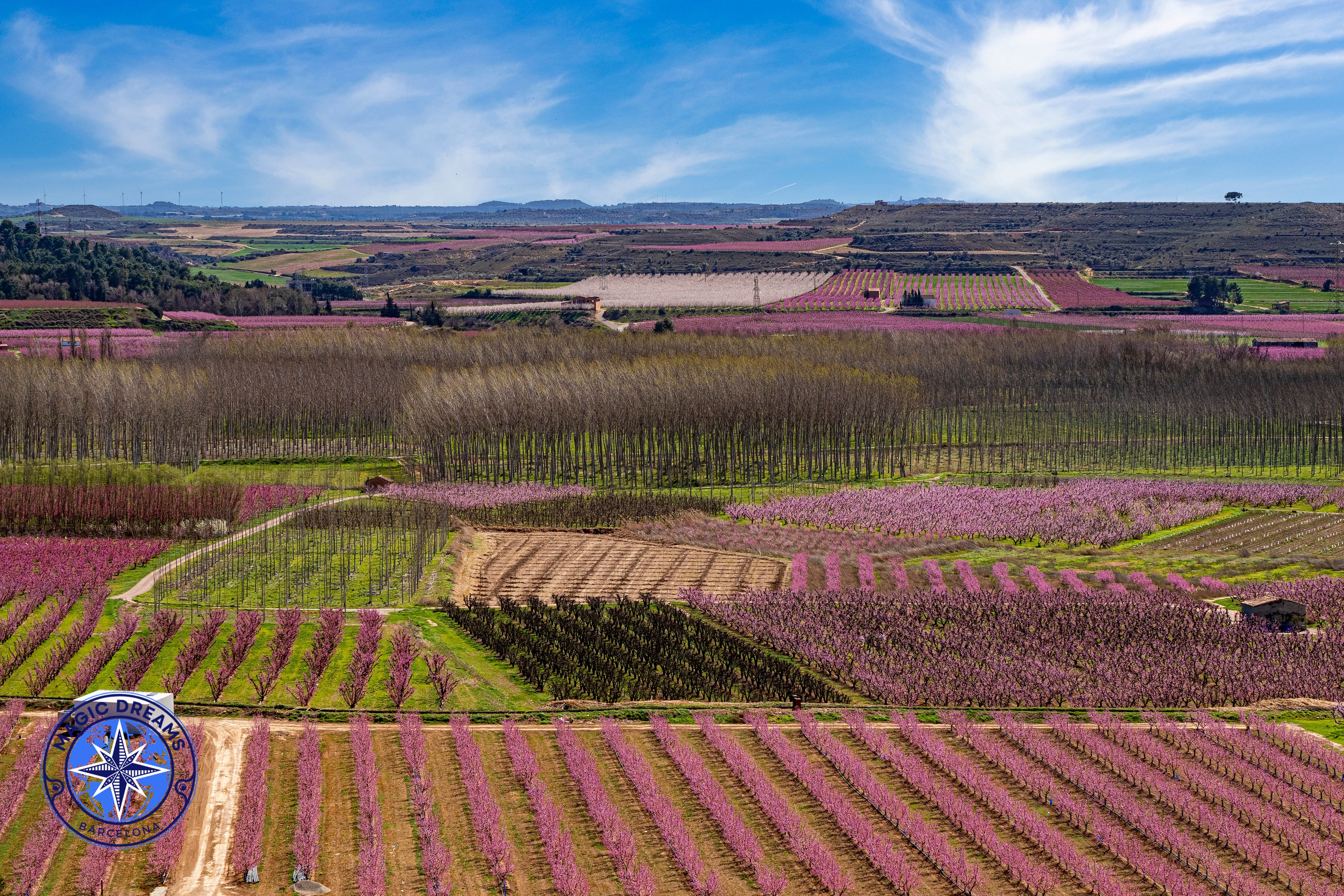
The pink sea of the Segrià, where fruit trees, history and rural tradition come together
There are places that transform completely for a few weeks each year.
Aitona is one of them.
Located in the western part of the Segrià, in the province of Lleida, this agricultural town becomes a spectacular landscape of colour every spring, when thousands of fruit trees burst into bloom.
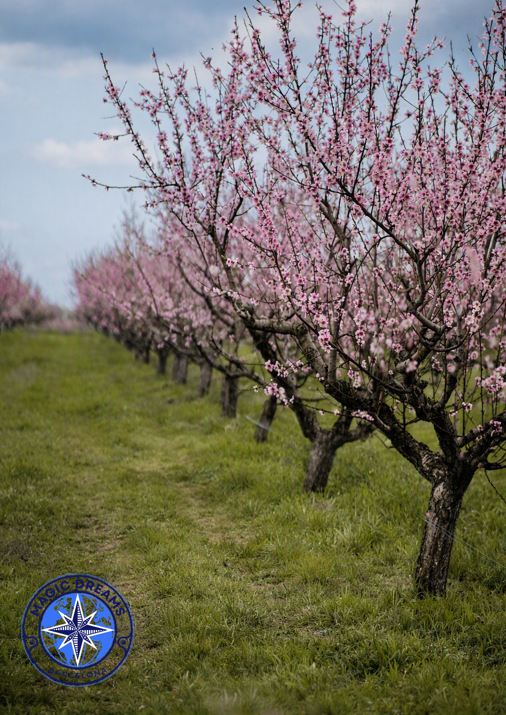
The most recognisable are the peach trees, whose pink flowers create the extraordinary scenery that has made Aitona one of Catalonia’s most famous blossom destinations.
But Aitona is much more than a beautiful photograph.
Behind every flowering tree lies a story of water, agriculture, family farming, local traditions and the transformation of the rural landscape.
And this is precisely what makes the experience so special.
Where Is Aitona?
A rural landscape shaped by the River Segre
Aitona is located in the Segrià comarca, in western Catalonia, approximately 25 kilometres southwest of the city of Lleida.
The municipality lies along the River Segre, whose water has historically played a fundamental role in the development of local agriculture.
The landscape combines irrigated farmland, dryland areas, orchards, small elevations and wide agricultural horizons.
Today, fruit farming is one of the defining features of the area.
When spring arrives, those orchards become one of the most extraordinary natural spectacles in Catalonia.
How Far Is Aitona from Barcelona?
A perfect day trip into the Catalan countryside
Aitona is approximately 180 kilometres from Barcelona by road, and the journey generally takes around two hours by car, depending on traffic and the route chosen.
That makes it an excellent destination for a day trip from Barcelona.
A typical experience can begin early in the morning, allowing enough time to explore the flowering orchards, discover the local heritage, enjoy lunch and return to Barcelona in the evening.
During the blossom season, travelling early is particularly recommended.
The light is softer, the landscape is quieter and the experience is generally more peaceful.
The History of Aitona
A territory shaped by water, agriculture and different cultures
Aitona has a long history closely connected to the River Segre and irrigation agriculture.
Its historical development is associated with an Islamic-period castle, with documentation dating back to at least the early 12th century.
After the Christian conquest during the 12th century, the Muslim population remained an important part of local society for generations, contributing knowledge and practices related to agriculture and irrigation.
This heritage is essential to understanding the region.
Water did not simply make farming possible.
It helped shape the entire landscape.
Irrigation channels, canals and agricultural systems transformed the surrounding land and established a farming tradition that continues today.
Aitona Castle
History overlooking the orchards
The remains of Aitona Castle stand on the hill overlooking the town.
The fortress originated during the Islamic period and occupied a strategic position over the surrounding territory.
Its elevated location provides a particularly interesting perspective over the agricultural landscape.
During blossom season, the contrast is striking:
medieval ruins above a horizon filled with flowering fruit trees.
It is one of the best ways to appreciate how history and agriculture coexist in Aitona.
Aitona and Its Fruit Trees
An economy built around the orchard
Aitona is deeply agricultural.
Irrigated land is dominated by stone-fruit orchards, while dryland areas include olive trees, almond trees and cereals.
Among the characteristic fruit trees of Aitona and the surrounding area are:
Peach trees
Nectarine trees
Flat peaches
Flat nectarines
Apricot trees
Pear trees
Quince trees
Cherry trees
Peaches, nectarines and flat peaches are particularly important to the local agricultural economy.
During summer, the same trees that create the famous spring landscape produce the fruit that becomes one of the area’s agricultural signatures.
The flowers are only the beginning.
Aitona in Bloom
When the orchards become a sea of colour
The great spectacle usually begins between late February and March, although the exact timing changes from year to year according to temperatures, winter conditions and the development of each variety.
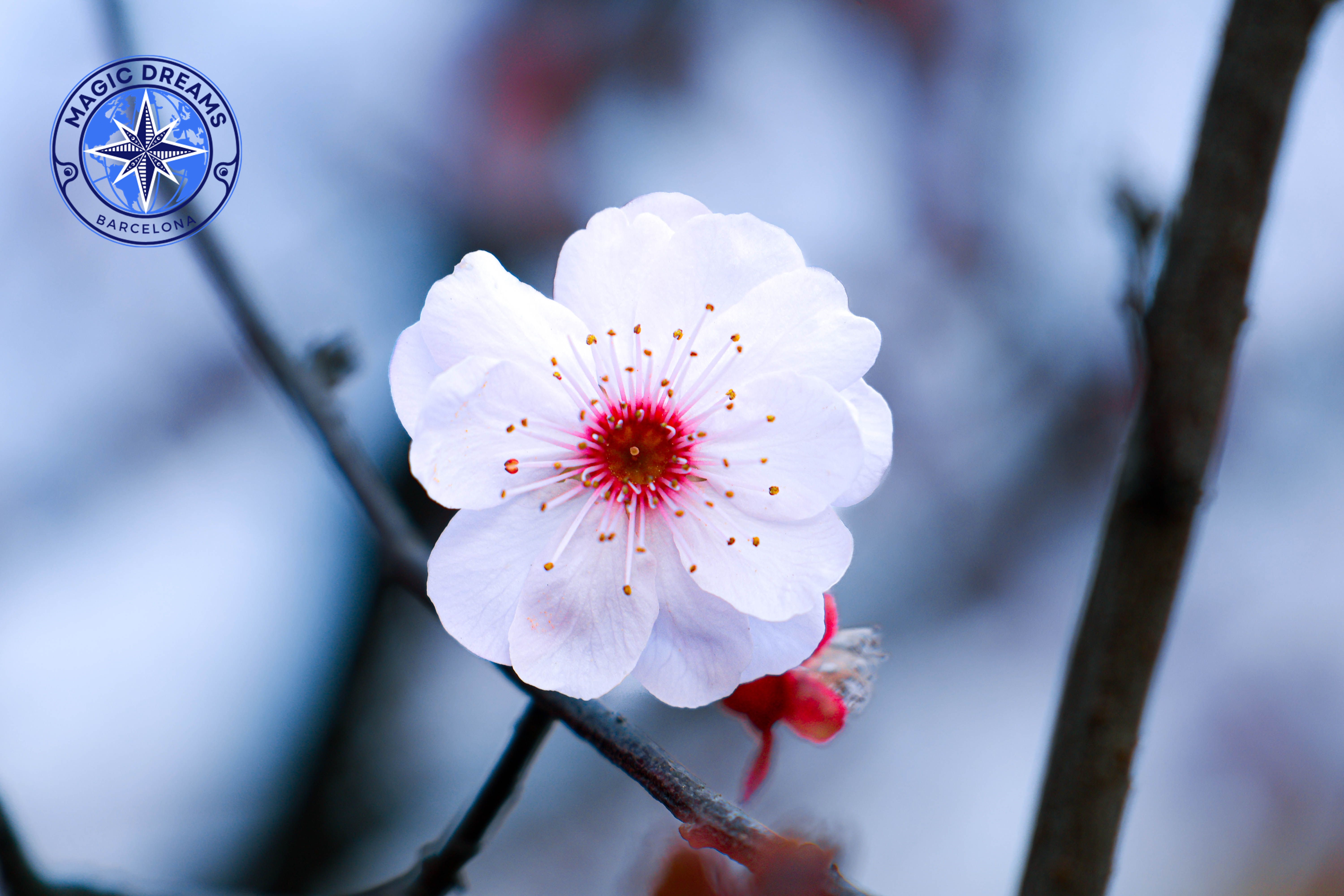
Peach trees are especially famous for their pink blossoms, which create the characteristic colour associated with Aitona.
Nectarines and other fruit trees contribute additional shades and create contrasts between different orchards.
The flowering period can last several weeks, but there is no single guaranteed date.
That is why checking the official Fruiturisme blossom updates before travelling is so important.
What Makes the Blossom So Special?
Different trees, different colours
One of the most fascinating aspects is that not every fruit tree blossoms in exactly the same way.
Peach trees, nectarines and flat peaches are especially recognisable for their pink flowers.
Other species produce paler blossoms, creating a more varied landscape as the season progresses.
But blossom is not simply a visual spectacle for local farmers.
It is a crucial stage in the agricultural cycle.
Temperature, wind, rain and frost can all affect the future harvest.
So behind the beauty of the orchards there is also a great deal of agricultural knowledge and work.
When Is the Best Time to Visit?
The perfect moment depends on the year
There is no fixed calendar date.
The blossom season usually falls between late February and March, but warmer or colder winters can bring flowering forward or delay it.
For visitors particularly interested in peach blossom, March is generally the key month.
The best approach is to check the current blossom conditions and Fruiturisme’s official programme before travelling.
This is especially important because a difference of just a few days can completely change the appearance of the orchards.
Fruiturisme
Much more than a blossom photo
Aitona developed Fruiturisme to turn its agricultural landscape and fruit-growing traditions into a genuine visitor experience.
The project helps visitors discover the orchards while learning about the local agricultural cycle.
During blossom season, guided experiences can include:
Orchard visits.
Guided walks.
Agricultural explanations.
Photography opportunities.
Heritage visits.
Nature experiences.
Local gastronomy.
But Fruiturisme does not stop when the blossoms disappear.
Throughout the year, experiences focus on different stages of the fruit cycle, including apricots, cherries, peaches, nectarines and flat peaches, among other local products.
This is what makes the destination particularly interesting.
The blossom is only one chapter of the story.
The Route of the Flowering Tree
Walking among the orchards
One of the best-known experiences is the Ruta de l’Arbre Florit, or Route of the Flowering Tree.
The route combines the agricultural landscape with local heritage and natural surroundings.
Depending on the itinerary, visitors can discover:
Fruit orchards.
The River Segre.
The historic centre.
Sant Antolí Church.
Sant Joan de Carratalà.
The Cova del Pare Palau.
Genó archaeological site.
Sant Gaietà Chapel.
There are also routes that can be explored on foot or by bicycle.
During blossom season, organised tours can provide access to the orchards while avoiding the need to drive between different rural tracks.
Aitona by Bicycle
The countryside at a slower pace
Cycling is one of the best ways to appreciate Aitona’s agricultural landscape.
Quiet rural paths make it possible to travel among orchards, irrigation channels and open fields while experiencing the scale of the landscape without rushing.
Electric-bike experiences also offer a comfortable way to explore the area while learning about the different stages of fruit production.
For those looking for a more immersive experience, a bicycle tour can turn the visit into an entire morning or afternoon adventure.
The River Segre
The water behind the landscape
The River Segre is one of the essential elements of Aitona’s identity.
Its waters have supported local agriculture for centuries, together with the network of irrigation channels and agricultural infrastructure developed around the valley.
When you look across the flowering orchards, it is easy to focus only on the trees.
But the river explains why this agricultural landscape exists in the first place.
Water, soil and human work created the Aitona we see today.
Sant Joan de Carratalà
Heritage among the orchards
The Hermitage of Sant Joan de Carratalà is one of the heritage sites associated with the Fruiturisme experience.
Its setting is particularly attractive because it combines history with the agricultural landscape.
It is possible to move from flowering orchards to historic religious architecture within the same journey.
That combination of nature, agriculture and heritage is one of Aitona’s greatest strengths.
The Cova del Pare Palau
A quieter and more spiritual corner
The Cova del Pare Palau is associated with the Catalan religious figure Francesc Palau.
The site introduces a different dimension to the Aitona experience, combining landscape with spirituality and contemplation.
For visitors interested in the cultural side of the region, it is an interesting complement to the orchards and agricultural routes.
The Agricultural Landscape
Aitona is not only about flowers
Perhaps the most important thing to understand is that Aitona should not be seen simply as a spring photography destination.
The real interest lies in understanding the landscape.
Look at the carefully aligned trees.
Observe the irrigation systems.
Think about the work carried out by farmers throughout the year.
See the flowers in March.
Then imagine the fruit developing through spring.
Finally, return in summer and you will find an entirely different landscape filled with peaches, nectarines and other fruit.
The flower is only the beginning.
From Blossom to Harvest
One landscape, four seasons
Aitona offers something remarkable: the opportunity to observe an agricultural cycle almost in its entirety.
Spring
The trees blossom and the landscape turns pink and white.
Late Spring
The flowers disappear and the first fruits begin to develop.
Summer
The orchards become productive and the harvest begins.
Autumn and Winter
The trees rest, fields change, and preparations begin for the next agricultural cycle.
This continuity gives the landscape a meaning that goes far beyond its visual beauty.
Aitona Gastronomy
The fruit also reaches the table
Local fruit is not only part of the landscape.
It is also part of the area’s gastronomy.
Peaches, nectarines, apricots and other fruits can be incorporated into desserts, preserves and even savoury dishes.
Fruiturisme has also promoted culinary experiences built around locally grown fruit, highlighting the connection between agriculture and the local table.
The result is a cuisine that reflects its surroundings:
fresh, seasonal and strongly connected to the land.
Where to Eat
Aitona offers several local establishments where visitors can stop for a traditional meal, including restaurants and cafés in the municipality.
For a more complete experience, it is worth combining the blossom route with a local lunch based on traditional Catalan and Lleida cuisine.
During the flowering season, reservations are particularly advisable because visitor numbers can increase considerably.
Where to Stay
Experience Aitona beyond a day trip
Although Aitona is easily accessible as a day trip from Barcelona, staying overnight offers a completely different experience.
The surrounding area includes rural accommodation and country houses surrounded by orchards, allowing visitors to experience the agricultural landscape at a much slower pace.
Another practical option is staying in Lleida, which offers a wider selection of hotels while remaining close enough for a day visit to Aitona.
For a romantic or premium experience, rural accommodation surrounded by fruit trees is particularly attractive.
Waking up among the orchards allows you to experience the landscape before the day begins.
How to Get There
Car, public transport or organised experiences
The easiest option from Barcelona is by car, particularly if you want to combine several attractions.
Aitona is also connected with Lleida by public transport, while local taxis are another possibility.
During the blossom season, organised Fruiturisme excursions can be especially convenient for visitors who prefer not to navigate agricultural roads themselves.
The best option depends on whether the priority is flexibility, comfort or simply enjoying the landscape without worrying about driving.
Photography and the Light of Aitona
A landscape made for slow observation
Aitona is particularly beautiful during the early morning and late afternoon.
Soft light reveals the colour of the flowers and creates depth between the rows of trees.
At sunset, the pink blossoms can take on warmer tones, creating a completely different atmosphere.
But there is one essential rule:
these are working agricultural fields.
Visitors should remain on designated paths, avoid entering private orchards and follow local instructions.
The best way to preserve the landscape is to enjoy it without interfering with the farming activity.
Aitona Beyond Blossom Season
The flowers last weeks; the fruit lasts much longer
One of Fruiturisme’s greatest achievements has been turning the agricultural cycle into a year-round tourism experience.
Once the blossoms disappear, other experiences begin.
Fruit ripening.
Harvesting.
Tasting.
Cycling.
Walking.
Learning.
The landscape changes continuously, but its identity remains.
This makes Aitona a destination worth returning to in different seasons.
Responsible Tourism
A beautiful landscape that is also a workplace
The increasing popularity of blossom tourism has made responsible visitor behaviour especially important.
Aitona is not a public garden.
It is an active agricultural landscape.
Farmers work here throughout the year.
That means:
Do not enter private orchards.
Do not climb trees.
Do not break branches.
Do not leave rubbish.
Use designated paths.
Follow local signs and instructions.
Respecting the farmers is part of experiencing Aitona properly.
Aitona with Magic Dreams Barcelona
Discovering the countryside through a different lens
At Magic Dreams Barcelona, we believe that Aitona should be experienced rather than simply photographed.
For a more complete experience, we can also organise an overnight stay in rural surroundings.
The Premium Magic Dreams Barcelona Touch
A Premium Magic Dreams Barcelona experience can include private transportation, personalised guidance, selected gastronomic experiences and a carefully designed itinerary adapted to your pace.
The objective is not simply to show you a field full of flowers.
We want you to understand the landscape, the farmers, the fruit cycle and the cultural identity behind what you see.
That is what turns a day trip into a genuine experience.
The Pink Sea of the Segrià
For a few weeks each year, Aitona becomes extraordinary.
Thousands of flowers.
Rows of trees stretching towards the horizon.
The River Segre.
The old castle.
The wide agricultural plain.
And the unmistakable colours of spring.
But when the flowers disappear, the magic does not disappear with them.
The flowers become fruit.
The fruit grows.
Summer arrives.
The harvest begins.
And the cycle starts again.
Perhaps that is the true beauty of Aitona.
It is not simply the place where the trees bloom.
It is a place where you can witness how a landscape becomes food, culture, work, memory and identity.
And that is why visiting Aitona in bloom is not simply about seeing flowers.
It is about witnessing the beginning of a story that continues throughout the year.
Perspectiva Aitona Magic Dreams Barcelona.
Detalle flor melocotonero Magic Dreams Barcelona.
Perspectiva Aitona Magic Dreams Barcelona.
Flor Aitona Magic Dreams Barcelona.
Paisaje Aitona Magic Dreams Barcelona.
Flor de melocotoneros en Aitona Magic Dreams Barcelona.
Campo de melocotoneros a pie Aitona Magic Dreams Barcelona.
Some places surprise you with their landscapes, others with their history, and some because of the unique circumstances that make them truly exceptional destinations. Llívia combines all three. Located in the heart of Cerdanya, at an altitude of around 1,224 metres, Llívia is a Catalan …