Route guide for visitors throughout Catalonia – Barcelona – Costa Brava – Catalan Pyrenees – Personalized experiences – Customized tour guide services – A small tribute to the wonderful city and land that saw us born – Transforming experiences into unforgettable memories - Magic Dreams Collection: exclusive universes inspired by Salvador Dalí and Gaudí. Niche perfumes, jewelry, lithographs, and collectible items celebrating the Mediterranean spirit.
Located on Barcelona’s most iconic beach, the Mirador Vela is an exceptional viewpoint offering vistas that merge the majestic Mediterranean Sea with the city’s skyline. This viewpoint and its accompanying pedestrian staircases were designed by the studio External Reference Architects, under the direction of architect …
Situado en la playa más emblemática de Barcelona, el Mirador Vela es un punto panorámico excepcional, que ofrece vistas que fusionan el imponente mar Mediterráneo con la silueta urbana de la ciudad. Este mirador y las escaleras peatonales que lo acompañan fueron diseñados por el …
Historia, arqueología, paisaje y esencia mediterránea en la Costa Brava
Existen de la Costa Brava en los que el paisaje parece contener la memoria de quienes lo habitaron hace miles de años. Empúries es, sin duda, uno de ellos.
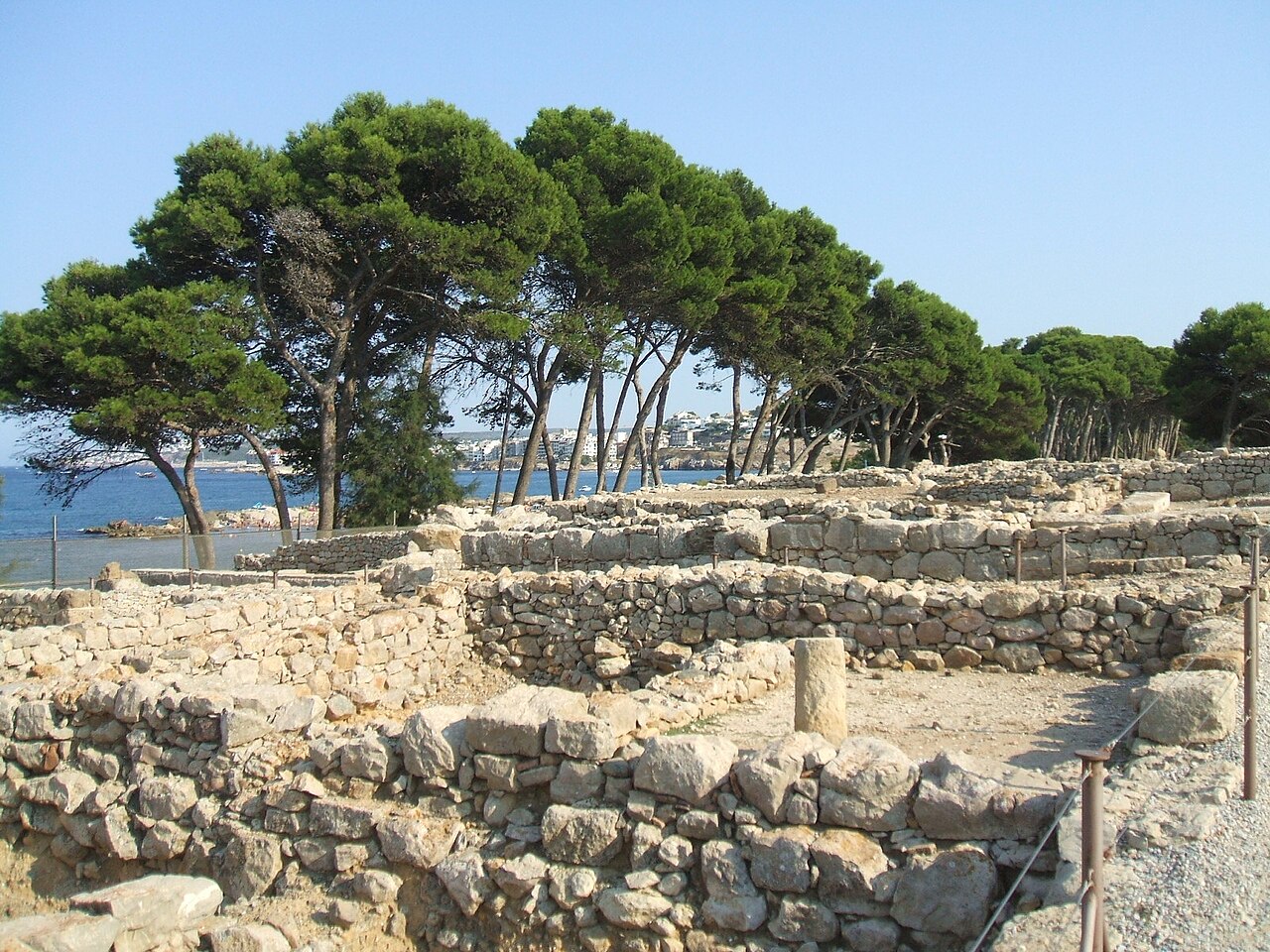
Situado frente al Mediterráneo, entre L’Escala y Sant Martí d’Empúries, este extraordinario enclave arqueológico permite caminar entre los restos de una antigua ciudad griega y una posterior ciudad romana, contemplando al mismo tiempo el mar que durante siglos fue la gran vía de comunicación de estas tierras.
Empúries no es únicamente un conjunto de ruinas. Es un lugar donde historia, arqueología, arquitectura, paisaje y Mediterráneo se fusionan en un mismo escenario.
Y quizá esa sea una de las razones por las que su visita resulta tan especial: aquí no solo se observan vestigios del pasado, sino que se comprende cómo diferentes culturas llegaron por mar, se establecieron en este territorio y transformaron para siempre la historia de la península Ibérica.
Un paisaje elegido por los antiguos navegantes
La situación geográfica de Empúries fue determinante para su desarrollo.
El enclave está situado en el extremo sur del golfo de Roses, en una zona abierta al Mediterráneo y protegida por el relieve del litoral del Empordà.
Frente a las antiguas ciudades se extiende un paisaje extraordinariamente mediterráneo: playas, dunas, vegetación de costa, campos agrícolas y el horizonte azul del golfo de Roses.
El entorno natural actual ayuda a comprender por qué este lugar resultó tan atractivo para los navegantes de la Antigüedad.
La costa era mucho más que un paisaje.
Era una ruta comercial, una puerta de entrada y un punto de encuentro entre culturas.
Los primeros griegos llegan a Empúries
Emporion, el mercado del Mediterráneo
La historia de Empúries se inicia con la llegada de comerciantes griegos procedentes de Focea, en Asia Menor.
Hacia comienzos del siglo VI a. C. se establecieron en una pequeña isla o península situada frente a la costa, en el área de la actual Sant Martí d’Empúries.
A este primer asentamiento se le conoce como Palaiapolis, la ciudad antigua.
Con el tiempo, la población griega se expandió hacia el continente y nació la ciudad que conocemos como Emporion.
El propio nombre resulta revelador.
Emporion hace referencia a un lugar de comercio, un mercado o enclave mercantil.
La actividad de sus habitantes estaba estrechamente vinculada al intercambio de productos entre el mundo griego y las comunidades indígenas del territorio.
Cerámica, vino, aceite, productos manufacturados y otros bienes circulaban por este puerto mediterráneo, mientras que los comerciantes obtenían productos procedentes del interior de la península.
Empúries se convirtió así en uno de los grandes puntos de contacto entre las culturas mediterráneas y las poblaciones locales.
Una ciudad griega junto al mar
La ciudad griega fue creciendo y desarrollando sus propios espacios urbanos.
Sus habitantes construyeron viviendas, calles, espacios religiosos y zonas destinadas a la actividad comercial.
A diferencia de la posterior ciudad romana, el urbanismo griego se adaptó en gran medida a las características del terreno.
Entre los restos conservados destacan diferentes viviendas, espacios públicos y edificios religiosos que permiten reconstruir parcialmente la vida de la antigua Emporion.
Uno de los elementos más fascinantes de la visita es precisamente poder observar cómo una ciudad mediterránea de hace más de dos mil años estaba organizada alrededor de sus espacios públicos y religiosos.
Asclepio: una de las imágenes más famosas de Empúries
El dios griego de la medicina
Entre las piezas arqueológicas asociadas a Empúries destaca la célebre escultura de Asclepio, el dios griego relacionado con la medicina y la curación.
La pieza, realizada en mármol, se convirtió con el tiempo en uno de los grandes símbolos visuales del yacimiento.
La escultura fue hallada en 1909 y durante mucho tiempo se identificó como una representación de Asclepio.
Las investigaciones posteriores han planteado también otras interpretaciones sobre la identidad exacta de la figura, aunque tradicionalmente continúa siendo conocida como el Asclepio de Empúries.
Su presencia recuerda la importancia que tenían los espacios religiosos en la vida cotidiana de las ciudades antiguas.
El encuentro con Roma
Cuando Empúries entra en la historia romana
La relación entre Empúries y Roma se inició en el contexto de la Segunda Guerra Púnica.
Los romanos desembarcaron en Emporion en el año 218 a. C., en un momento decisivo del enfrentamiento entre Roma y Cartago.
El puerto ofrecía una posición estratégica extraordinaria para las operaciones militares romanas en la península.
A partir de entonces, la presencia romana fue aumentando progresivamente.
Empúries se convirtió en uno de los puntos desde los que Roma consolidó su influencia en el nordeste de Hispania.
La ciudad griega y la ciudad romana coexistieron durante un tiempo hasta que el modelo urbano romano terminó imponiéndose.
La ciudad romana
Un nuevo urbanismo frente a la ciudad griega
La ciudad romana de Emporiae se construyó junto al asentamiento griego.
Su planificación responde a una concepción urbana muy diferente.
Las calles fueron organizadas siguiendo un trazado más regular, con espacios públicos monumentales y una estructura urbana adaptada a las necesidades de la sociedad romana.
El foro constituía el corazón político, religioso y comercial de la ciudad.
Alrededor de este espacio se encontraban edificios públicos y zonas destinadas a la actividad económica y social.
Caminar actualmente por las calles de la antigua ciudad romana permite imaginar una población mucho más compleja de lo que inicialmente podría sugerir el paisaje actual.
Las casas romanas y sus mosaicos
Uno de los grandes atractivos arqueológicos de Empúries son los restos de las antiguas viviendas.
Algunas de ellas pertenecieron a familias de cierto nivel económico y presentan patios, habitaciones decoradas y pavimentos de mosaico.
Los mosaicos son especialmente importantes porque permiten acercarse a la vida cotidiana de las élites romanas.
Geometrías, motivos vegetales, escenas mitológicas y composiciones decorativas exhiben el gusto artístico de sus propietarios.
Entre los pavimentos conservados está el famoso mosaico del sacrificio de Ifigenia, una de las piezas más destacadas del conjunto arqueológico.
El foro romano
El centro de la vida pública
El foro era uno de los espacios esenciales de cualquier ciudad romana.
En Empúries, este gran espacio público estaba rodeado de edificios relacionados con la administración, la religión y la vida política.
Aquí se desarrollaban actividades públicas y ceremoniales y se concentraba buena parte de la vida oficial de la ciudad.
Actualmente, las estructuras conservadas permiten comprender la monumentalidad que llegó a alcanzar Emporiae durante su etapa romana.
Las murallas y la puerta de la ciudad
Las defensas de Empúries constituyen otro de los elementos fundamentales del recorrido.
Las murallas protegían la ciudad y delimitaban el espacio urbano.
En diferentes puntos del yacimiento todavía pueden reconocerse restos de las estructuras de defensa y de los accesos a la ciudad.
Estos elementos permiten entender que Empúries no era simplemente un puerto comercial, sino una ciudad plenamente integrada en las redes políticas y militares del Mediterráneo antiguo.
La llegada del cristianismo
Con la transformación del mundo romano, Empúries también experimentó cambios.
Durante la Antigüedad tardía aparecen nuevas formas de ocupación y diferentes espacios vinculados al cristianismo.
La evolución de Empúries refleja así el proceso de transformación que afectó a todo el Mediterráneo occidental después de la época clásica.
La ciudad que había nacido como colonia comercial griega y posteriormente había sido integrada en el mundo romano fue perdiendo progresivamente su protagonismo.
El abandono de Empúries
Cuando una ciudad desaparece
A partir de los siglos III y IV d. C., Empúries empezó a perder importancia.
El centro de actividad económica y política de la región se desplazó hacia otros lugares y la antigua ciudad fue quedando progresivamente abandonada.
Con el paso de los siglos, muchas de sus estructuras quedaron enterradas.
Como sucedió en infinidad de yacimientos antiguos, las piedras de las construcciones fueron reutilizadas en edificios posteriores.
El antiguo esplendor de Empúries quedó oculto bajo la tierra durante siglos.
Sant Martí d’Empúries
El pueblo que conserva la memoria medieval del antiguo enclave
Muy cerca del yacimiento arqueológico encontramos Sant Martí d’Empúries, un pequeño núcleo histórico que conserva un extraordinario carácter medieval.
Sus calles, plazas y edificios permiten completar la experiencia arqueológica con otra etapa de la historia del territorio.
La iglesia de Sant Martí, las antiguas murallas y las casas del núcleo histórico crean un conjunto de gran interés patrimonial.
Pasear por Sant Martí y después descender hacia el mar permite realizar un recorrido excepcional: desde la Edad Media hasta las antiguas ciudades griega y romana.
El paseo marítimo de Sant Martí d’Empúries
Historia y Mediterráneo en un mismo recorrido
Una de las experiencias más agradables del entorno es recorrer el paseo litoral que conecta Sant Martí d’Empúries con L’Escala.
El itinerario discurre junto al Mediterráneo y permite contemplar algunas de las playas más características de este sector del Empordà.
El paisaje combina:
Playas de arena.
Dunas.
Vegetación mediterránea.
Acantilados bajos.
Restos arqueológicos.
El golfo de Roses.
El perfil del Cap de Creus.
En determinados puntos pueden observarse restos relacionados con las antiguas estructuras portuarias y con la navegación de época clásica.
Es un recorrido especialmente atractivo al amanecer o durante las últimas horas de la tarde, cuando la luz mediterránea transforma completamente el paisaje.
Las playas de Empúries
Un litoral marcado por la historia
Las playas que rodean Empúries ofrecen un contraste extraordinario con las ruinas.
Aquí el visitante puede pasar de contemplar columnas, mosaicos y antiguos edificios a caminar descalzo por la arena frente al mismo mar que utilizaron los navegantes griegos hace más de dos mil años.
Entre los espacios más destacados encontramos:
El Portitxol
Una pequeña playa de gran belleza situada junto al conjunto arqueológico.
Sus aguas y su entorno rocoso ofrecen una imagen profundamente mediterránea.
Les Muscleres
El litoral de Les Muscleres combina pequeñas zonas de arena con formaciones rocosas y aguas transparentes.
Es uno de los paisajes más característicos de esta parte de la costa.
Moll Grec
El nombre hace referencia a la tradición portuaria del antiguo enclave.
Aunque las estructuras actuales deben interpretarse desde el punto de vista arqueológico, el lugar permite imaginar la importancia que tuvo el mar para Emporion.
El paisaje de dunas
Uno de los elementos naturales que hacen especial este entorno es su sistema dunar.
Las dunas constituyen un ecosistema frágil que protege el litoral frente a la dinámica marina y alberga una vegetación especialmente adaptada a las condiciones de viento, salinidad y escasez de agua.
Esta vegetación mediterránea de costa forma parte inseparable del paisaje de Empúries.
La combinación de dunas, pinos, playas y restos arqueológicos crea uno de los escenarios más singulares de la Costa Brava.
El viento de tramontana
El carácter del Empordà
La tramontana forma parte de la identidad de este territorio.
Este viento del norte puede alcanzar una intensidad considerable y ha influido durante siglos en la arquitectura, la vegetación, la navegación y la vida cotidiana del Empordà.
En Empúries, la tramontana se percibe especialmente durante los días despejados, cuando el aire limpio permite contemplar con extraordinaria claridad el golfo de Roses y el perfil del Cap de Creus.
La luz después de un episodio de tramontana puede ser espectacular.
El cielo adquiere una transparencia excepcional y el Mediterráneo exhibe tonalidades que cambian constantemente según la hora del día.
Las excavaciones de Empúries
Más de un siglo de arqueología
Las excavaciones arqueológicas sistemáticas se inciaron en 1908.
Desde entonces, generaciones de arqueólogos han trabajado en la recuperación y estudio del yacimiento.
La investigación continúa actualmente y ha permitido conocer cada vez mejor la evolución histórica del enclave.
Empúries es especialmente excepcional porque conserva, en un mismo espacio arqueológico, una ciudad griega y una ciudad romana.
Esta convivencia convierte al yacimiento en un lugar de enorme valor para comprender la transición entre el mundo griego y el mundo romano en el Mediterráneo occidental.
Un museo para comprender Empúries
El Museo de Arqueología de Cataluña – Empúries complementa la visita al yacimiento con una importante colección arqueológica.
Las piezas expuestas permiten contextualizar los restos que encontramos durante el recorrido y comprender mejor la vida cotidiana de las personas que habitaron Empúries.
Entre los objetos encontramos:
Esculturas.
Cerámicas.
Elementos arquitectónicos.
Inscripciones.
Objetos domésticos.
Monedas.
Piezas relacionadas con el comercio.
Elementos religiosos.
La combinación entre museo y yacimiento resulta fundamental para interpretar correctamente la historia del lugar.
Empúries: mucho más que unas ruinas
Visitar Empúries significa caminar por uno de los grandes capítulos de la historia mediterránea.
Aquí llegaron comerciantes griegos atraídos por las posibilidades de intercambio.
Aquí se estableció una comunidad que desarrolló una ciudad y una cultura propias.
Aquí desembarcaron las tropas romanas durante la Segunda Guerra Púnica.
Y desde aquí Roma empezó a consolidar su presencia en el nordeste de la península.
Con el paso de los siglos, las ciudades fueron desapareciendo, pero el paisaje permaneció.
El Mediterráneo sigue frente a las antiguas murallas.
La tramontana continúa atravesando el Empordà.
Las playas siguen recibiendo las olas.
Y las piedras que durante siglos permanecieron ocultas bajo tierra nos permiten reconstruir una historia que empezó hace más de dos mil quinientos años.
Una experiencia para descubrir sin prisas
Empúries merece ser visitada con tiempo.
Una experiencia completa puede empezar en Sant Martí d’Empúries, continuar por el paseo litoral y las playas, entrar posteriormente en el yacimiento arqueológico y terminar contemplando el Mediterráneo desde alguno de los puntos elevados del recorrido.
La visita puede combinarse con una ruta por L’Escala, conocida por su tradición marinera y por sus famosas anchoas, o con una excursión hacia otros paisajes del Alt Empordà.
También es posible continuar hacia el norte y descubrir el entorno del golfo de Roses y el Cap de Creus, creando un recorrido en el que naturaleza, gastronomía, historia y Mediterráneo se fusionan constantemente.
Empúries al atardecer
Hay momentos especialmente recomendables para disfrutar del entorno.
Al final de la tarde, cuando el sol desciende sobre el Mediterráneo, las antiguas piedras adquieren tonalidades doradas y el paisaje cambia por completo.
Las ruinas, las playas y el mar forman entonces una composición extraordinariamente evocadora.
Es fácil comprender por qué este enclave fue elegido hace más de dos mil quinientos años por aquellos primeros navegantes griegos.
Empúries sigue teniendo aquello que ellos encontraron: un lugar estratégico, un paisaje extraordinario y un Mediterráneo que continúa siendo el gran protagonista.
Empúries y la esencia de la Costa Brava
La Costa Brava suele asociarse a calas de aguas transparentes, pueblos marineros y paisajes espectaculares.
Pero su verdadera riqueza aparece cuando se descubre también su historia.
Empúries representa perfectamente esa combinación.
Grecia, Roma, el Mediterráneo, el Empordà y la cultura catalana se fusionan aquí en apenas unos kilómetros.
Por este motivo, visitar Empúries no debería entenderse simplemente como una excursión arqueológica.
Es una manera de descubrir otra Costa Brava: una Costa Brava de comerciantes y navegantes, de antiguas ciudades, de mosaicos y templos, de playas y dunas, de tramontana y de paisajes que han permanecido prácticamente unidos al Mediterráneo durante miles de años.
Y quizá sea precisamente esa continuidad la que hace que Empúries siga siendo, tantos siglos después, uno de los lugares más fascinantes de Cataluña.
Moneda griega, circa 241-218 a. C. – By Classical Numismatic Group, Inc. http://www.cngcoins.com, CC BY-SA 3.0, https://commons.wikimedia.org/w/index.php?curid=2991260.
Mosaico del Sacrificio de Ifigenia , arra el momento dramático en el que los griegos, varados en el puerto de Áulide por falta de viento para viajar a Troya, deciden sacrificar a Ifigenia (hija del rey Agamenón) para aplacar la ira de la diosa Diana. Se cree que es una copia romana fiel (fechada hacia el siglo I a. C.) de una famosa pintura griega del siglo IV a. C. atribuida a Timantes.
Muralla griega en Neápolis – By LeZibou – Own work, CC BY-SA 3.0, https://commons.wikimedia.org/w/index.php?curid=4294112.
Estatua de Asclepio – Por KaischiB from Mainz, Germany – empúries_18, CC BY-SA 2.0, https://commons.wikimedia.org/w/index.php?curid=82365450.
Detalle ruinas de la ciudad Greco – Romana de Castelló d’Empúries.
Detalle ruinas de la ciudad Greco – Romana de Castelló d’Empúries.
Detalle ruinas de la ciudad Greco – Romana de Castelló d’Empúries.
Detalle ruinas de la ciudad Greco – Romana de Castelló d’Empúries.
Detalle ruinas de la ciudad Greco – Romana de Castelló d’Empúries.
Detalle mosaico de la ciudad Greco – Romana de Castelló d’Empúries.
Detalle detalle gaviota sobre una piedra de la ciudad Greco – Romana de Castelló d’Empúries.
Detalle mosaico de la ciudad Greco – Romana de Castelló d’Empúries.
There are places where history is not simply told — it is felt. On the Costa Brava, overlooking the Mediterranean, the archaeological site of Empúries offers an extraordinary journey through more than two thousand years of history. Here, the remains of an ancient Greek settlement …
History, heritage, beaches and coves of the Costa Brava Roses is a Catalan municipality in the Alt Empordà comarca, in the province of Girona, located on the northern coast of the Gulf of Roses, south of Cap de Creus, in the heart of the Costa …
Historia, patrimonio, playas y calas de la Costa Brava
Roses es un municipio catalán de la comarca del Alt Empordà, en la provincia de Girona, situado en la costa norte del golfo de Roses, al sur del Cap de Creus, en plena Costa Brava.
Se trata de una población mediterránea, marinera y turística, con urbanizaciones, hoteles, playas, calas y dos puertos —de pesca y deportivo—, que se ha convertido en uno de los principales destinos turísticos del litoral catalán para visitantes de todas partes del mundo.
Su bahía combina largas playas de arena con un litoral mucho más abrupto hacia el este, donde aparecen acantilados, caminos de ronda y gran variedad de calas integradas en el Parque Natural del Cap de Creus. Entre ellas destacan Canyelles Petites, la Almadrava, Murtra, Rostella, Montjoi, Pelosa, Jóncols y las pequeñas calas de Calitjàs y Canadell.
Roses es, además, uno de esos lugares en los que el paisaje mediterráneo y la historia aparecen unidos de una manera excepcional. Griegos, romanos, visigodos, habitantes medievales, soldados de la época moderna y visitantes contemporáneos han dejado su huella en este territorio.
Cómo llegar desde Barcelona
Roses desde Barcelona
Roses está situada aproximadamente a 152–155 km de Barcelona por carretera.
Desde Barcelona, el trayecto habitual es de aproximadamente 1 h 45 min a 2 h, dependiendo del punto de salida, el tráfico y la temporada. La ruta se realiza principalmente por la AP-7 en dirección norte y posteriormente por las carreteras que conducen hacia Figueres y Roses.
En autobús
Existe conexión directa desde la Estació d’Autobusos Barcelona Nord hasta Roses. El trayecto suele durar aproximadamente 2 h 10 min, aunque puede variar según el servicio y las condiciones del tráfico.
En tren + autobús
Roses no dispone de estación ferroviaria. Una de las alternativas consiste en viajar en tren desde Barcelona hasta Figueres y continuar desde allí en autobús hasta Roses.
El trayecto completo suele situarse alrededor de 2 h 50 min–3 h 25 min, dependiendo de la combinación.
Para recorrer las calas del Cap de Creus, especialmente las más alejadas, el coche resulta la opción más práctica, aunque algunas zonas tienen regulación específica de acceso de vehículos y muchos de los rincones más naturales requieren caminar.
Roses y sus orígenes
Un territorio habitado desde la prehistoria
Los primeros rastros de asentamientos humanos en el término municipal de Roses están situados en las montañas que rodean el actual núcleo urbano.
En el llamado Cau de les Guilles se han encontrado restos arqueológicos correspondientes al Paleolítico superior o Magdaleniense, considerados entre los testimonios humanos más antiguos localizados en el municipio.
En el paraje conocido como Casa Cremada encontramos diferentes monumentos megalíticos, entre ellos el Dolmen de la Creu d’en Cobertella, el Dolmen del Llit de la Generala y otros restos funerarios, además de menhires y cistas.
Estos monumentos constituyen una muestra extraordinaria de la presencia humana en el territorio durante la Prehistoria y permiten comprender que la bahía de Roses ya era un espacio de ocupación y tránsito mucho antes de la llegada de griegos y romanos.
Rhode, la ciudad griega
La primera gran puerta mediterránea
La historia clásica de Roses está estrechamente relacionada con Rhode, la antigua colonia griega situada en el área que actualmente ocupa la Ciudadela.
La cronología exacta de la fundación de Rhode continúa siendo objeto de debate histórico. Las fuentes antiguas relacionaron tradicionalmente su origen con los rodios, mientras que la arqueología ha documentado restos griegos que permiten situar la presencia urbana consolidada, como mínimo, entre los siglos V y IV a. C.
Durante el periodo helenístico, especialmente entre los siglos IV y III a. C., Rhode alcanzó una notable prosperidad económica.
Su posición estratégica en el golfo de Roses permitía controlar las comunicaciones marítimas y comerciales del Mediterráneo occidental.
La colonia llegó a tener una gran importancia mercantil y acuñó moneda propia. Entre las piezas relacionadas con Rhode aparece la conocida dracma con la rosa, símbolo asociado a la ciudad.
Hoy, una parte esencial de aquella ciudad puede contemplarse dentro del recinto de la Ciudadela de Roses, donde se conservan restos del barrio helenístico y de la posterior ciudad romana.
La llegada de Roma
Rhode bajo la influencia romana
La presencia romana en Roses está documentada desde finales del siglo III y comienzos del siglo II a. C., en el contexto de la expansión romana por el nordeste de la península Ibérica.
El texto tradicional de la historia de Roses ha relacionado la llegada romana con las campañas militares de la Segunda Guerra Púnica. Sin embargo, conviene distinguir entre las tradiciones históricas y aquello que actualmente puede demostrarse mediante la arqueología.
La Rhode griega sufrió un importante declive después de las guerras púnicas y de la expansión romana. Más tarde, el asentamiento volvió a adquirir importancia durante época romana tardía.
La Ciudadela permite observar esta continuidad histórica: su interior alberga restos de la colonia griega de Rhode y posteriormente de la ciudad romana, además de vestigios de épocas medievales y modernas.
El misterio del templo de «Venus»
Historia, tradición y arqueología
Uno de los elementos más evocadores de la historia antigua de Roses es la referencia a un supuesto templo dedicado a Venus.
Las fuentes históricas tradicionales han relacionado una representación de la antigua Roses con la existencia de un templo de Venus situado en las montañas.
Sin embargo, no existe actualmente un templo de Venus identificado arqueológicamente en Roses.
Por ello, la referencia debe entenderse como una tradición histórica vinculada a las fuentes antiguas y a las interpretaciones posteriores, y no como un monumento conservado que pueda visitarse actualmente.
Esta circunstancia no resta interés al relato. Al contrario: convierte la historia de Roses en un territorio lleno de preguntas todavía abiertas.
La arqueología sí ha confirmado la extraordinaria importancia de la ciudad antigua de Rhode y de su posterior ocupación romana, cuyos restos pueden contemplarse actualmente en la Ciudadela.
La ciudad romana
Comercio, agricultura y salazón
Durante época romana se desarrollaron diferentes actividades económicas en el territorio.
La industria cerámica tuvo un papel importante y también existieron villas agrícolas destinadas a la producción de vino, aceite y cereales.
La proximidad del mar favoreció igualmente la actividad de pesca y la transformación del pescado.
En la Ciudadela se conservan restos arqueológicos correspondientes a la ocupación romana, mientras que las investigaciones han permitido documentar diferentes fases de la ciudad entre época republicana y la Antigüedad tardía.
La bahía de Roses continuaba siendo, por tanto, un espacio estratégico de comunicación, intercambio y navegación.
El Puig Rom
El castrum visigótico
Entre los siglos VI y VII, el territorio experimentó una transformación importante.
En el Puig Rom encontramos un asentamiento fortificado de época visigoda que constituye uno de los elementos arqueológicos más destacados de Roses.
Su posición elevada permitía controlar visualmente la bahía y las rutas de acceso al territorio.
El Puig Rom representa una nueva etapa de la historia de Roses: después del mundo clásico, el paisaje vuelve a organizarse alrededor de una posición de defensa elevada.
La Ciudadela de Roses
Veinticinco siglos de historia en un solo recinto
La Ciudadela de Roses es probablemente el lugar imprescindible para comprender la historia de la población.
El recinto reúne restos de la colonia griega de Rhode, la ciudad romana, elementos paleocristianos y visigodos, el monasterio románico de Santa María, la villa medieval y las fortificaciones de época moderna.
La fortificación renacentista fue construida en el siglo XVI y ocupa un enorme recinto amurallado.
En la actualidad, la Ciudadela funciona también como espacio cultural y museo arqueológico.
Qué se puede visitar:
Restos de la colonia griega de Rhode.
Restos de la ciudad romana.
Necrópolis paleocristiana.
Vestigios visigodos.
Monasterio románico de Santa María.
Restos de la villa medieval.
Fortificaciones renacentistas.
Museo Arqueológico.
Sala de exposiciones.
Actividades culturales y familiares.
La visita permite recorrer una historia de más de dos mil años prácticamente sin abandonar el mismo espacio.
Castillo de la Trinidad
La fortaleza que domina el golfo de Roses
El Castillo de la Trinidad, también conocido como Castillo de la Poncella, es una de las grandes construcciones de defensa de Roses.
Fue construido en 1544, durante el reinado de Carlos I, como complemento estratégico de la Ciudadela.
Su diseño en forma de estrella y sus gruesos muros estaban concebidos para resistir el impacto de la artillería.
Desde su terraza se obtiene una de las mejores panorámicas sobre la bahía de Roses, el puerto, el litoral y el Cap de Creus.
Durante la Guerra de la Independencia fue destruido parcialmente por las tropas francesas.
Actualmente se ha recuperado como monumento y espacio cultural, con visitas guiadas, actividades familiares y propuestas especiales durante el verano.
El conjunto megalítico de Roses
Cinco mil años mirando al Mediterráneo
Las montañas de Roses conservan un conjunto excepcional de construcciones megalíticas.
Entre los lugares más destacados están:
Dolmen de la Creu d’en Cobertella.
Dolmen del Llit de la Generala.
Dolmen del Cap de l’Home.
Menhires de Casa Cremada.
Diferentes cistas y estructuras funerarias.
Estos monumentos permiten descubrir un Roses muy diferente al de las playas y hoteles: un territorio prehistórico donde las comunidades humanas ya utilizaban las montañas como espacios funerarios y simbólicos.
Punta Falconera
Acantilados, Mediterráneo y memoria militar
Punta Falconera constituye uno de los lugares más espectaculares del litoral de Roses.
El cabo está situado en la entrada del golfo y forma parte del paisaje del Cap de Creus.
Además de su valor natural, conserva restos militares y antiguos búnkeres relacionados con la defensa de la bahía.
Uno de los recorridos más interesantes es el camino de ronda entre la Almadrava y Cala Montjoi, que pasa por Punta Falconera y permite contemplar los restos de las antiguas instalaciones militares.
La ruta oficial tiene 4,4 km, una duración aproximada de 2 horas, un desnivel positivo de 193 metros y dificultad moderada.
Roses durante la Guerra Civil
Los refugios antiaéreos
Durante la Guerra Civil española, Roses sufrió bombardeos y se construyeron diferentes refugios para proteger a la población civil.
El más conocido y visitable actualmente es el Refugio Antiaéreo de la plaza de la Paz.
El refugio conserva los pasillos y permite aproximarse a uno de los episodios más difíciles de la historia contemporánea de Roses.
Entre 1939 y 1948 también se construyeron en Punta Falconera diferentes instalaciones militares destinadas a la defensa de la bahía ante una posible invasión.
La transformación turística
De villa marinera a destino internacional
A partir de la década de 1960 se produjo una fuerte expansión turística.
El desarrollo de hoteles, apartamentos y urbanizaciones transformó la trama urbana y extendió Roses a lo largo del litoral.
Se creó un amplio paseo marítimo y Santa Margarida se desarrolló mediante una red de canales navegables que permite a determinadas embarcaciones acceder hasta las proximidades de las viviendas.
El turismo pasó a convertirse en uno de los principales motores económicos del municipio.
Las playas y calas de Roses
Una costa para descubrir a pie, en coche o desde el mar
Roses ofrece una costa de contrastes: playas urbanas y familiares junto a pequeñas calas salvajes rodeadas de acantilados.
Las playas y calas del municipio disponen de sistemas de gestión ambiental EMAS e ISO 14.001, y muchas de las zonas del Cap de Creus son especialmente interesantes para el senderismo, el snorkel y el submarinismo.
Playa Canyelles Petites
Arena dorada y aguas transparentes
Canyelles Petites está situada aproximadamente a 3 km del centro de Roses.
Desde el centro:
A pie: aproximadamente 40–45 minutos.
En coche: unos 7–10 minutos, dependiendo del tráfico.
Transporte público: existen servicios hacia las zona de costa, aunque conviene comprobar los horarios de temporada.
Es una playa de arena fina y dorada, aguas transparentes y fondo arenoso, protegida de la tramontana.
Servicios:
Salvamento y socorrismo.
Lavapiés.
Pasarelas.
Acceso para personas con movilidad reducida.
Restaurantes.
Hotel.
Quioscos.
Alquiler de tumbonas y sombrillas.
Alquiler de patines.
Zona de anclaje de embarcaciones.
Es una de las mejores opciones para familias.
Playa de la Almadrava
La gran playa protegida de la tramontana
La Almadrava está situada aproximadamente a 5 km del centro de Roses.
Desde el centro:
A pie: aproximadamente 1 h–1 h 15 min.
En coche: unos 10–15 minutos.
Autobús: dispone de parada de autobús.
La playa tiene unos 500 metros de longitud y unos 25 metros de ancho.
Servicios:
Salvamento y socorrismo.
Lavapiés.
Pasarelas.
Acceso para personas con movilidad reducida.
Restaurantes.
Hoteles.
Quioscos.
Tumbonas y sombrillas.
Alquiler de patines y kayaks.
Zona de anclaje.
Aparcamiento no vigilado.
Es una de las mejores opciones si se busca combinar playa cómoda, servicios y paisaje.
Playa dels Palangrers
Una pequeña playa junto al puerto
Está situada aproximadamente a 1 km del centro urbano, después del puerto de pesca.
Desde el centro
A pie: unos 15–20 minutos.
En coche: unos 4–5 minutos.
Tiene unos 140 metros de longitud y combina arena y roca.
Servicios:
Balizamiento.
Salvamento y socorrismo.
Lavapiés.
Papeleras.
Aparcamiento no vigilado.
Parada de autobús.
Es además una zona interesante para practicar actividades relacionadas con el medio marino, incluido el snorkel.
Playa de Bonifaci
Una pequeña joya entre Canyelles y Almadrava
La playa de Bonifaci está situada entre Canyelles Petites y la Almadrava.
No se accede directamente en vehículo hasta la playa: se llega a pie por el camino de ronda desde cualquiera de las dos playas.
Tiempo aproximado:
Desde Canyelles Petites: unos 15–25 minutos.
Desde la Almadrava: unos 20–30 minutos.
En coche: se llega hasta Canyelles o Almadrava y se continúa caminando.
Es una pequeña cala de aguas limpias y cristalinas, formada por arena gruesa y guijarros.
Servicios:
Balizamiento.
Papeleras.
Amarrador flotante para embarcaciones.
Cala Murtra
Naturaleza salvaje y silencio
Cala Murtra está situada aproximadamente a 10 km de Roses.
Es una cala solitaria, de paisaje salvaje, formada por guijarros y piedras, donde se practica el nudismo.
Desde el centro
En coche: aproximadamente 20–25 minutos hasta la zona de acceso.
A pie: requiere una ruta de senderismo; el tiempo depende del punto exacto de inicio y del itinerario elegido.
No se puede acceder con vehículos motorizados directamente hasta la cala.
Servicios:
Dispone principalmente de balizamiento de la zona de baño.
Es, por tanto, una cala para quienes buscan naturaleza y tranquilidad más que servicios turísticos.
Además, Cala Murtra forma parte de las zonas donde se han desarrollado itinerarios de snorkel responsable de 300 y 600 metros, pensados para descubrir la biodiversidad marina.
Cala Rostella
Una pequeña cala de aguas turquesas
Cala Rostella está situada aproximadamente a 10 km de Roses.
Es una cala pequeña, virgen y rodeada de acantilados.
Desde el centro
En coche: aproximadamente 20–25 minutos hasta el punto de acceso.
A pie: requiere caminar desde la zona de acceso por un sendero; el tiempo puede variar según el punto donde se aparque.
No se puede llegar en vehículo motorizado directamente hasta la arena.
Servicios:
Balizamiento de la zona de baño.
Es una de las mejores opciones para quienes buscan un entorno natural y poco urbanizado.
Cala Montjoi
El paisaje que hizo historia en la gastronomía
Cala Montjoi está situada aproximadamente a 12 km del centro de Roses, dentro del Parque Natural del Cap de Creus.
Desde el centro:
En coche: aproximadamente 25–30 minutos, según tráfico y condiciones de la carretera.
A pie: existe el camino de ronda desde la Almadrava; el tramo oficial hasta Montjoi tiene 4,4 km y unas 2 horas, pasando por Punta Falconera, Cala Murtra y Cala Rostella.
Cala Montjoi es una cala amplia, formada por arena gruesa y guijarros, y ofrece refugio natural a las embarcaciones.
Servicios:
Balizamiento.
Bar y restaurante.
Papeleras.
Es también un lugar especialmente relacionado con la historia de «El Bulli», el célebre restaurante de Ferran Adrià que estuvo situado en esta cala.
La gastronomía de Roses y del Empordà encuentra aquí uno de sus escenarios más emblemáticos.
Cala Calitjàs
Una pequeña cala entre Montjoi y la Pelosa
Cala Calitjàs está situada aproximadamente a 14 km del centro de Roses.
Es una pequeña cala de unos 110 metros, rodeada de acantilados y aguas transparentes.
Acceso:
No se llega directamente en vehículo hasta la cala.
Se puede acceder en coche por la pista de costa hasta la zona próxima y continuar a pie por el camino de tierra que une Montjoi y Jóncols.
Servicios
Balizamiento de la zona de baño.
No dispone de la infraestructura turística de las playas urbanas, por lo que conviene llevar agua, protección solar y todo lo necesario para pasar unas horas en la naturaleza.
Cala Pelosa
El refugio del Cap Norfeu
Cala Pelosa está situada aproximadamente a 15 km de Roses, siguiendo la carretera de la costa que conduce hacia Jóncols.
Desde el centro:
En coche: aproximadamente 30–40 minutos.
A pie: posible mediante itinerarios de senderismo, aunque no es una caminata urbana sencilla y requiere buena preparación.
La cala está protegida por el Cap Norfeu y presenta arena gruesa.
Servicios:
Balizamiento.
Bar y restaurante.
Papeleras.
Pantalán flotante.
Es una excelente opción para combinar baño, paisaje y gastronomía mediterránea.
Cala Canadell
La pequeña cala salvaje del Cap Norfeu
Cala Canadell está situada entre Jóncols y la Pelosa, al pie de la península del Cap Norfeu.
Es una pequeña cala de apenas 60 metros, formada por guijarros y cantos rodados.
Acceso:
El acceso es principalmente a pie desde los caminos de la costa.
No existe acceso motorizado hasta la propia cala.
Servicios:
Balizamiento de la zona de baño.
Es uno de esos rincones donde la naturaleza domina completamente sobre la infraestructura turística.
Cala Jóncols
El final de la carretera y el principio de la naturaleza
Cala Jóncols se encuentra aproximadamente a 18 km del centro de Roses.
Desde el centro:
En coche: aproximadamente 35–45 minutos.
A pie: requiere una ruta de senderismo de varias horas.
Por mar: también es posible llegar mediante determinadas excursiones y servicios marítimos.
La carretera de la costa llega hasta la zona de la cala.
Es una cala virgen, de paisaje salvaje y acantilados escarpados, especialmente interesante para el submarinismo.
Servicios:
Balizamiento.
Hotel.
Bar.
Restaurante.
Papeleras.
Pantalán flotante.
En la zona existe también alojamiento, piscina, centro de buceo, alquiler de kayak y servicios de taxi marítimo.
El tramo del GR 92 entre Cala Montjoi y Cadaqués atraviesa este espectacular sector del Cap de Creus. La ruta oficial tiene unos 10 km y una duración aproximada de 2 h 50 min, con 387 metros de desnivel y dificultad alta.
Cap Norfeu
El gran balcón natural de la Costa Brava
El Cap Norfeu es uno de los paisajes naturales más impresionantes de Roses.
Desde sus senderos se puede contemplar el Mediterráneo, la bahía de Roses y las formaciones rocosas del Cap de Creus.
Durante los recorridos aparecen lugares como Cala Jóncols, Cala Canadell y Cala Pelosa, además de espectaculares paredes de roca.
Es un espacio especialmente indicado para:
Senderismo.
Fotografía.
Observación del paisaje.
Snorkel y actividades marinas.
Navegación.
Observación de fauna y flora.
Ruta GR 92: Cala Montjoi – Cadaqués
Un camino entre mar, montaña y acantilados
Uno de los recorridos más espectaculares es el tramo del GR 92 entre Cala Montjoi y Cadaqués.
Datos de la ruta:
Distancia: 10 km.
Duración: aproximadamente 2 h 50 min.
Desnivel: 387 m.
Tipo: lineal.
Dificultad: 3/3.
Durante el recorrido se atraviesan algunos de los paisajes más impresionantes del Cap de Creus, pasando por zonas próximas a Cala Calitjàs, Cala Pelosa y Cala Jóncols.
Es una ruta para realizar con calzado adecuado, agua y protección solar, especialmente durante los meses de verano.
El Bulli y la revolución gastronómica
Un restaurante que cambió la cocina mundial
El Bulli fue el restaurante situado en Cala Montjoi que alcanzó fama internacional bajo la dirección del chef catalán Ferran Adrià.
El restaurante obtuvo tres estrellas Michelin y fue considerado en infinidad de ocasiones uno de los mejores restaurantes del mundo.
Aunque el restaurante original dejó de funcionar en 2011, su legado permanece estrechamente vinculado a Roses.
Actualmente, elBulli1846 representa la continuidad cultural y conceptual de aquel proyecto gastronómico y constituye uno de los lugares relevantes que conviene incorporar a una visita contemporánea a Roses.
Faro de Roses
El guardián del litoral
El Faro de Roses es otro de los lugares que merece incorporarse al recorrido.
Su posición junto al litoral permite contemplar una magnífica panorámica de la bahía y del Cap de Creus.
Su entorno es especialmente interesante al combinar:
Faro.
Costa rocosa.
Castillo de la Trinidad.
Caminos de costa.
Paisaje mediterráneo.
Vistas sobre el golfo de Roses.
El Ayuntamiento de Roses incluye actualmente el faro entre los principales lugares de interés patrimonial del municipio.
Centro histórico de Roses
La ciudad más allá de las playas
No todo en Roses está relacionado con el mar.
El centro histórico conserva calles, plazas, edificios tradicionales y espacios relacionados con la evolución de la antigua villa.
Una visita completa puede combinar el centro histórico con:
Ciudadela.
Iglesia de Santa María.
Refugio antiaéreo.
Puerto de pescadores.
Paseo marítimo.
Castillo de la Trinidad.
Faro.
De esta manera, Roses puede descubrirse como una ciudad histórica y marinera, y no únicamente como destino de playa.
Puerto de pesca
El origen marinero de Roses
El puerto de pesca continúa siendo una parte fundamental de la identidad de la población.
Roses posee una importante tradición de pesca y el pescado fresco continúa siendo uno de los protagonistas de su gastronomía.
La relación entre el puerto y la cocina local explica en buena medida la importancia del pescado, el marisco y los arroces en la gastronomía de Roses.
Catamarán y excursiones marítimas
Roses desde el Mediterráneo
Una de las mejores maneras de descubrir las calas del Cap de Creus es hacerlo desde el mar.
Las excursiones marítimas permiten contemplar desde otra perspectiva:
Cala Murtra.
Cala Montjoi.
Cala Rostella.
Cala Pelosa.
Cala Calitjàs.
Cala Jóncols.
Cap Norfeu.
También existen embarcaciones con visión submarina y diferentes opciones de navegación desde Roses.
Para una primera visita, esta alternativa permite conocer en un solo recorrido lugares que a pie exigirían varias jornadas de senderismo.
Aquabrava
Diversión para toda la familia
Aquabrava es el parque acuático de Roses, pensado para disfrutar de una jornada diferente durante los meses de verano.
Es especialmente interesante para familias o grupos que desean alternar las excursiones culturales y las playas con actividades de ocio y atracciones acuáticas.
Karting Roses
Velocidad y diversión
Karting Roses ofrece una pista de karts orientada tanto a adultos como a juniors.
Es una alternativa de ocio para complementar un día de playa, especialmente para familias y grupos.
Mini Golf Green
Una actividad tranquila frente al mar
El Mini Golf Green, situado en el paseo marítimo, combina la actividad deportiva con las vistas sobre el litoral.
Sus instalaciones incluyen pistas de hierba con rampas, túneles y obstáculos, además de zonas ajardinadas.
Es una actividad sencilla para familias y para quienes buscan una propuesta de ocio tranquila después de un día de playa.
Gastronomía de Roses
El Mediterráneo servido en la mesa
La gastronomía de Roses está basada eminentemente en el pescado fresco.
Como puerto natural y tradicional villa marinera, Roses dispone de una importante actividad de pesca que diariamente proporciona pescado y marisco.
El plato tradicional más representativo es el «Suquet de Peix», una preparación marinera profundamente vinculada a la tradición de pesca catalana.
La cocina tradicional y la gastronomía moderna están dominadas por el carácter mediterráneo del territorio:
Pescado fresco.
Marisco.
Aceite de oliva.
Productos de la huerta.
Anchoas.
Miel.
Arroces.
Carnes.
Productos de temporada.
Todos estos productos configuran una cocina variada, saludable y profundamente mediterránea.
Los vinos del Empordà
Una copa para acompañar el Mediterráneo
Las comidas de Roses pueden acompañarse con los vinos elaborados en las bodegas de la comarca bajo la Denominación de Origen Empordà.
Entre ellos encontramos:
Vinos jóvenes.
Rosados afrutados.
Blancos.
Crianza.
Vinos de cupaje.
Cavas.
Garnatxa.
La gastronomía de Roses adquiere así una dimensión completa: mar, montaña, agricultura, pesca y tradición vitivinícola.
Roses: una ciudad entre dos mundos
La historia y el Mediterráneo
Roses no es únicamente una localidad turística de la Costa Brava.
Es un territorio en el que podemos encontrar, prácticamente superpuestos, restos prehistóricos, una antigua colonia griega, una ciudad romana, un asentamiento visigodo, un monasterio medieval, una gran fortificación renacentista, refugios de la Guerra Civil, instalaciones militares y una moderna ciudad turística.
A todo ello se suma uno de los paisajes de la costa más extraordinarios de Cataluña.
Desde la Ciudadela hasta Cap Norfeu, desde el puerto de pescadores pasando por Cala Jóncols, Roses permite recorrer miles de años de historia en un espacio relativamente reducido.
Y quizá ahí reside precisamente la belleza de este antiguo territorio asociado a Rhode y a las antiguas tradiciones sobre Venus: no en un templo que podamos contemplar hoy, sino en la extraordinaria acumulación de culturas, pueblos, comerciantes, navegantes, soldados y visitantes que han convertido esta bahía en uno de los grandes paisajes históricos del Mediterráneo.
Información práctica
Antes de viajar
Distancia Barcelona–Roses: aproximadamente 152–155 km por carretera.
Coche: aproximadamente 1 h 45 min–2 h.
Autobús directo: aproximadamente 2 h 10 min.
Tren + autobús: aproximadamente 2 h 50 min–3 h 25 min.
Estación de tren más próxima: Figueres.
Mejor opción para recorrer las calas: coche + senderismo.
Mejor opción para conocer varias calas sin caminar largas distancias: excursión marítima.
Para el Cap de Creus: llevar agua, calzado adecuado, protección solar y consultar siempre las condiciones de acceso.
En las calas naturales: no esperar los mismos servicios que en las playas urbanas.
Acceso en vehículo: algunas calas tienen regulación específica y no está permitido llegar con vehículos motorizados hasta la propia arena o zona de piedras.
¿Desea descubrir Roses con nosotros?
Roses y la Costa Brava
Si desea solicitar alguno de nuestros servicios turísticos, excursiones, experiencias o actividades en Roses y la Costa Brava, no dude en ponerse en contacto con nosotros a través de nuestro formulario web.
Nuestro equipo recibirá su solicitud y nos pondremos en contacto con usted a lo largo del día para ofrecerle toda la información que necesite y ayudarle a organizar su experiencia.
Ruta-cap-norfeu-roses
Ruta-cap-norfeu-roses
Playa Canyelles Petites.
Parque megalítico Roses.
Parque megalítico Roses.
Mini Golf Greens.
Mini Golf Greens.
Karting Roses.
El Bulli.
El Bulli.
Ciutadella Roses.
Ciutadella Roses.
Ciutadella Roses.
Ciutadella Roses.
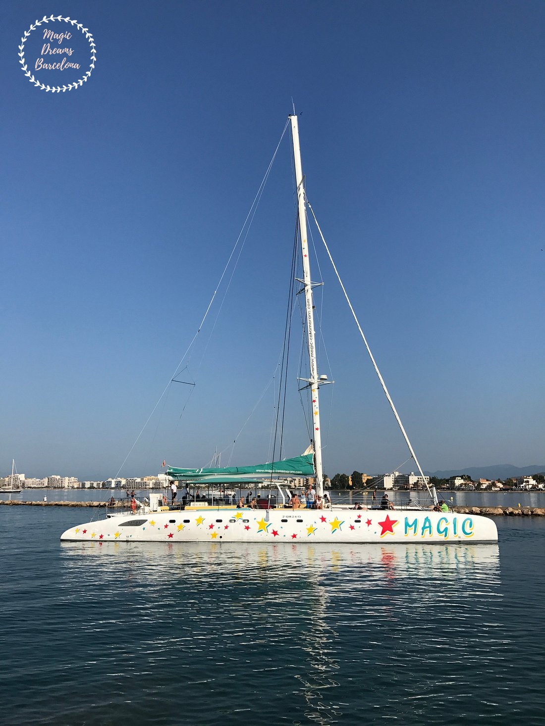
Catamarán Magic Roses.
Castillo de la Trinidad.
Cala Montjoi.
Aquabrava.
Búnquers de punta Falconera – Gordito1869, CC BY 3.0, via Wikimedia Commons.
Located in the heart of the Costa Brava, Palamós is a destination that seamlessly combines history, culture, gastronomy, and beaches of unparalleled beauty. Its coastline, with a spectacular contrast between rocky cliffs and hidden coves, offers a unique experience for those seeking relaxation or adventure. …
Situado en el corazón de la Costa Brava, Palamós es un destino que combina historia, cultura, gastronomía y playas de una belleza inigualable. Su litoral, con un contraste espectacular entre acantilados rocosos y calas escondidas, ofrece una experiencia única tanto para quienes buscan relax como …
In one of the most discreet and elegant corners of the Costa Brava, where the landscape speaks without artifice and time seems to slow down, lies Tamariu: a cove transformed into a destination, and a destination transformed into an experience.
Unlike other locations along the Catalan coast, Tamariu does not seek to impress: it seduces. Its white houses lined along the seafront, its traditional fishing boats resting on the sand, and the unhurried rhythm of local life evoke a natural, almost silent elegance.
The light here is never overwhelming, but beautifully nuanced; the sea does not dominate the landscape, but rather accompanies it.
Located within the municipality of Palafrugell, Tamariu has preserved the essence of the old fishing villages, where the relationship between people and their surroundings still maintains a balance that has almost disappeared from many other Mediterranean destinations.
Access and Connection from Barcelona
From Barcelona, Tamariu becomes an accessible yet deeply transformative escape, both because of the quality of its surroundings and the gradual sense of disconnection that begins during the journey.
Private vehicle: approximately 1 hour 45 minutes to 2 hours via the AP-7 and C-31. This option allows you to discover nearby coves and villages at your own pace.
Public transportation: a combination of train to Girona or Flaçà, followed by a bus to Palafrugell. Estimated journey time: 2.5 to 3.5 hours.
Premium private transfer: comfort, discretion and efficient use of your time.
The journey itself becomes part of the experience: winding roads through pine forests, gentle curves descending towards the sea, and a gradual transition from the pace of the city to the serenity of the Mediterranean.
A Privileged Ecosystem: Flora and Wildlife
Tamariu is more than a beautiful landscape; it is an ecosystem in balance. Its surroundings are a representative example of the Mediterranean coastal environment, where every element plays a precise role.
The vegetation is dominated by Aleppo pine (Pinus halepensis) and holm oak (Quercus ilex), accompanied by an aromatic undergrowth of rosemary, thyme, lavender and mastic.
Adapted to salt, wind and limited water availability, these species create a resilient landscape that is deeply sensory and rich in subtle fragrances.
The surrounding environment is also home to:
Seabirds such as cormorants, gulls and swifts
Coastal species adapted to the cliffs
Marine biodiversity including gilthead seabream, sea bass and cephalopods
The Posidonia oceanica meadows, true lungs of the Mediterranean, contribute to the exceptional environmental quality of these waters, making the area particularly appealing for underwater observation and activities such as snorkeling.
Gastronomy: The Art of Dining by the Mediterranean
Gastronomy in Tamariu follows a clear philosophy: absolute respect for the product, seasonality and a harmonious relationship with the surrounding landscape.
More than simply dining, it is a sensory experience in which the Mediterranean becomes part of the table.
El Clot dels Mussols: a local institution where Mediterranean cuisine reaches a remarkable level of elegance, with seafood, fresh fish and rice dishes prepared with technique and sensitivity.
Es Dofí: located directly on the beach, offering a relaxed and fluid dining experience perfectly integrated into its natural surroundings.
Hostalillo Restaurant: positioned above the bay, providing panoramic views while serving a contemporary interpretation of Catalan cuisine.
In Tamariu, the traditional concept of the beach restaurant is redefined. There is no improvisation here, but rather carefully considered aesthetics, attentive service and a deep coherence with the surrounding environment.
Services, Local Life and Leisure
Tamariu maintains a human scale that encourages authentic experiences and genuine relaxation.
Limited parking, approximately €2–€4 per hour during high season
Carefully selected local shops and services
Water activities such as kayaking and paddleboarding
Hiking along the Camí de Ronda, the historic coastal path
Strict regulations regarding barbecues during the summer due to forest protection measures
Here, luxury is expressed through simplicity, thoughtfully executed.
History: Discretion, Trade and the Sea
For centuries, Tamariu was a small auxiliary port of Palafrugell, closely connected to fishing and the cork industry.
During the 18th and 19th centuries, the cork industry achieved international importance, and coastal locations such as Tamariu served as discreet maritime points for exports, away from the major commercial ports.
The coastline was not without its dangers. The Camí de Ronda served a strategic surveillance function against smuggling and potential maritime incursions, reflecting a time when the coast was both a valuable resource and a frontier.
During the 20th century, tourism began to develop gradually and in a relatively controlled manner.
This moderation is precisely what has allowed Tamariu to preserve much of its original identity and avoid the level of mass tourism found in other Mediterranean destinations.
A Transformative Experience: Magic Dreams Barcelona
Exploring Tamariu can be a visit… or it can become something much more meaningful.
With Magic Dreams Barcelona, every experience begins with a conversation: a process in which we listen, interpret and design completely personalized proposals.
Our guides are native, multilingual and highly specialized professionals with knowledge spanning history, art, architecture, symbolism and botany. They can also offer deeper interpretations of iconic figures such as Gaudí and Dalí.
We design bespoke experiences incorporating:
Private chefs, offering Spanish, Catalan and international cuisine, including themed menus
Live music, from piano and violin to opera performances
Floral design and professional photography
Exclusive routes through carefully selected locations
Premium access to museums and cultural events
Sensory picnics by the sea or aboard a private yacht
We also offer exclusive workshops inspired by trencadís, Surrealism, gastronomy, floral art and natural essences.
Wellbeing and Connection
For those seeking deeper relaxation and reconnection, experiences can include:
Lomi Lomi massages by the sea
Spa, sauna and thermal circuits
Meditation and guided prayer in natural surroundings
Our integrated logistics include private transportation, excursions, hiking and fully customized experiences.
Our philosophy is rooted in a profound sensitivity to culture, nature and knowledge, bringing together art, philosophy, botany and music to create experiences that engage all the senses.
Privacy, Discretion and Security
Our experiences are governed by one fundamental principle: the privacy and discretion of our clients are absolutely non-negotiable.
We provide personalized service based on trust, adapted to each individual profile and supported by an in-depth knowledge of the destination.
All client information and experiences remain strictly confidential.
This commitment is not simply a service standard; it is at the heart of our philosophy.
Conclusion
Tamariu is not simply a destination: it is a state of mind.
It is a place where the Mediterranean reveals itself in its purest form — without artifice, without excess, with an elegance that requires no explanation.
With Magic Dreams Barcelona, that discovery becomes an art form.
A journey where the sea, nature, gastronomy, culture and personal connection come together to create something far beyond a simple visit.
Tamariu is not somewhere you simply go. It is somewhere you experience.
Tamariu.
Tamariu.
Tamariu.
Tamariu.
Camino Ronda – Costa Brava.
Hotel Hostalillo Tamariu.
Tamariu visto desde la GR-92 hacia el sur – By Chris j wood – Own work, CC BY-SA 4.0, https://commons.wikimedia.org/w/index.php?curid=125087399.
En uno de los rincones más discretos y elegantes de la Costa Brava, donde el paisaje se expresa sin artificios y el tiempo parece pararse, está situada Tamariu: una cala convertida en destino y un destino convertido en experiencia. A diferencia de otros enclaves del …
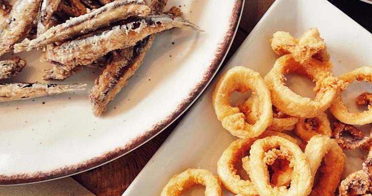
Dos clásicos del Mediterráneo en una sola mesa Las tapas de calamares a la romana y boquerones forman parte de la tradición de bares, tabernas y restaurantes de la costa mediterránea española. Son dos elaboraciones sencillas que reflejan una cocina basada en productos frescos del …
At the southernmost end of the province of Girona, where the Tordera River meets the Mediterranean, begins one of Catalonia’s most iconic coastal territories.
It is Blanes, an ancient fishing town traditionally regarded as the Gateway to the Costa Brava.
Its landscape brings together many of the elements that have made this coastline one of the great Mediterranean destinations: cliffs, hidden coves, golden-sand beaches, pine forests, botanical gardens, historic heritage and crystal-clear waters.
Along approximately four kilometres of coastline, the landscape is constantly changing.
Urban beaches give way to small coves.
Cliffs blend with Mediterranean vegetation.
And elevated paths offer different perspectives over the coastline.
Blanes is also a town deeply connected to the sea.
Its port, fishing tradition, beaches and gardens form part of an identity that combines Mediterranean character with a remarkable historical and natural heritage.
But perhaps the best way to understand Blanes is from its viewpoints.
From the top of Sa Palomera, from Sant Joan Castle or from the gardens overlooking the cliffs, visitors discover a coastline that seems to stretch endlessly northwards.
Welcome to the Gateway to the Costa Brava.
A Landscape Between Sea and Mountains
Blanes enjoys an exceptional geographical setting.
The town lies between the Mediterranean and the first elevations of the coastal mountain range, creating a landscape in which the sea and Mediterranean vegetation are constantly present.
Pines, palms, holm oaks, carob trees and many other species accompany countless routes and trails.
The terrain allows visitors to discover different perspectives of the coastline and makes some of its paths and viewpoints privileged places from which to watch the sunrise, sunset or simply contemplate the immensity of the Mediterranean.
The coastline combines large beaches with small coves and rocky areas.
Among the highlights are Sa Palomera, S’Abanell, Blanes Beach, Punta de Santa Anna, Cala Sant Francesc, Cala Treumal, Cala Sa Forcanera and Cala s’Agüia.
Each has its own personality.
Some are family-friendly and easily accessible.
Others are sheltered by pine forests.
And some remain almost hidden beneath the cliffs.
Sa Palomera – The Gateway to the Costa Brava
If there is one place that symbolizes Blanes, it is Sa Palomera.
This large rocky formation extends into the sea between Blanes Beach and S’Abanell and is one of the town’s great landmarks.
It is also traditionally considered the point marking the beginning of the Costa Brava.
An arch-shaped structure located next to Sa Palomera reinforces this symbolic idea of a gateway.
Climbing to its highest point offers spectacular panoramic views of Blanes.
On one side lies the town.
On the other, the Mediterranean.
Behind you stretches the coastline, while to the north begins the more rugged landscape that gave the Costa Brava its name.
It is the perfect place to stop and observe how the town merges with the sea.
The Fireworks Festival
Sa Palomera also holds a special place in one of Blanes’ best-known traditions.
Every summer, during the Santa Anna festivities, the coastline becomes the setting for the renowned International Fireworks Competition of Blanes.
The shows take place over the sea and attract thousands of spectators.
The natural configuration of the coastline makes the event particularly spectacular: the lights are reflected on the Mediterranean while fireworks illuminate the silhouette of Sa Palomera and the surrounding mountains.
For those visiting Blanes during these dates, watching the spectacle from the sea, from a viewpoint or from a private location can become a completely different experience.
The Botanical Gardens of Blanes
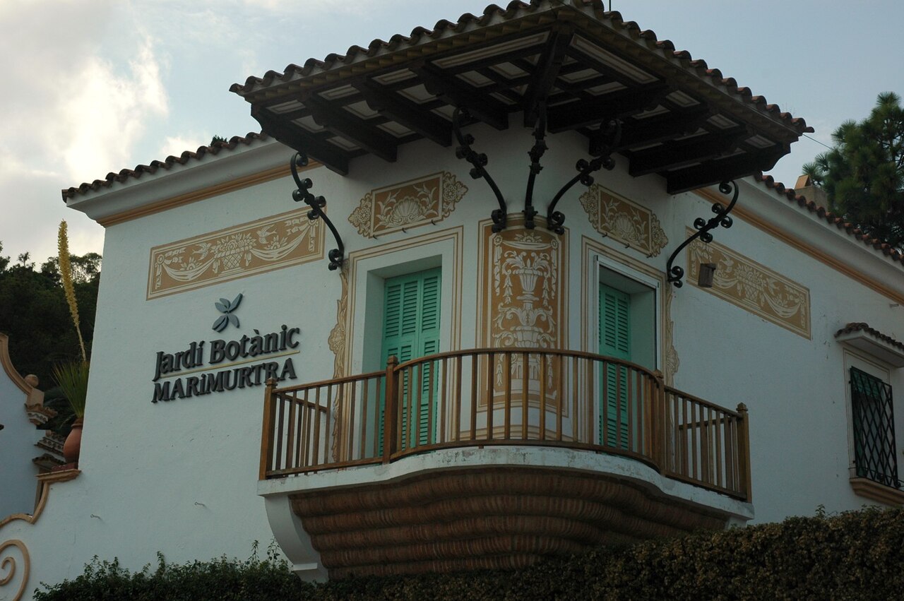
One of Blanes’ great distinctive features is the presence of two botanical gardens of exceptional value: Marimurtra and Pinya de Rosa.
Their presence makes the town much more than a beach destination.
Here, botany, architecture, landscape and the Mediterranean come together in a single setting.
Marimurtra Botanical Garden
Located on the cliffs overlooking the Mediterranean, the Marimurtra Botanical Garden is one of the most extraordinary natural spaces in Blanes.
Created by the German scientist and entrepreneur Carl Faust, the garden was founded with a clear scientific and botanical vocation and has become one of the great references for Mediterranean botany.
The garden contains more than 4,000 plant species from different regions of the world and extends across several hectares of land.
The experience is not simply about observing plants.
Marimurtra combines:
nature,
botany,
architecture,
landscape,
research
and the Mediterranean.
Its paths pass through different plant environments and lead to viewpoints suspended above the sea.
From certain points, the cliffs appear almost vertical beneath the gardens.
The blue of the Mediterranean contrasts with the green vegetation, creating a deeply visual experience.
Marimurtra also has significant heritage value and is officially recognized as an Asset of National Cultural Interest.
For lovers of nature, photography and landscape architecture, it is one of the essential places to visit in Blanes.
Pinya de Rosa
Nearby is the Pinya de Rosa Tropical Botanical Garden, which specializes particularly in cacti and succulent plants.
Its landscape is completely different from Marimurtra.
Here, the sculptural forms of the plants take centre stage.
Cacti, aloes, agaves and other species create natural compositions that resemble contemporary sculptures.
The garden demonstrates once again the extraordinary ability of Blanes’ Mediterranean climate to accommodate species from different parts of the world.
Together, the two gardens offer the opportunity to experience a genuine botanical route along the Costa Brava.
The Carrilet
A different way to explore Blanes and reach some of its main points of interest is by taking the Carrilet, the small tourist train connecting different areas of the town and its surroundings.
For families, private groups or visitors who prefer to reduce walking distances, it can be a comfortable and enjoyable alternative.
The route offers another perspective of Blanes and makes it possible to combine the urban visit with natural spaces.
Cala Sa Forcanera – A Secret Facing the Mediterranean
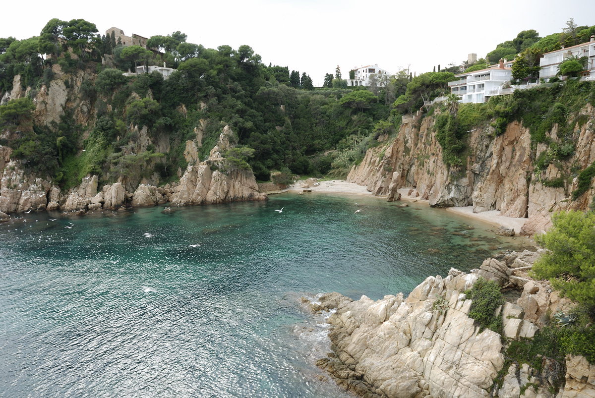
Among the small jewels of Blanes’ coastline is Cala Sa Forcanera.
Located beneath the cliffs, between Santa Anna Beach and Cala Sant Francesc and at the foot of the Marimurtra Botanical Garden, this small cove is one of the most special corners of the coast.
Its isolation is precisely one of its greatest attractions.
Land access is restricted by private property, and the cove is essentially considered accessible by sea.
From a boat, the perspective changes completely.
The cliffs rise above the water.
Vegetation cascades towards the Mediterranean.
And the small beach appears sheltered in an extraordinarily peaceful setting.
It is one of those places where you immediately feel far away from the town.
For a private experience, arriving by boat allows visitors to discover this section of coastline from a particularly privileged perspective.
Cala s’Agüia
Very close to Sa Forcanera lies another small gem: Cala s’Agüia.
It is a much smaller and wilder setting, formed mainly by large pebbles.
It can be accessed by sea and, depending on conditions and the route chosen, also on foot.
The presence of small boats usually anchored nearby and its crystal-clear waters make this an especially interesting spot for those wishing to discover the underwater landscape.
Cala Sant Francesc – Cala Bona
Also known as Cala Bona, Cala Sant Francesc is one of Blanes’ best-known beaches.
It is surrounded by pine trees and offers a particularly pleasant setting for those looking to combine swimming, nature and comfort.
Its size and facilities make it one of the most suitable options for a relaxing day beside the Mediterranean.
From here, the coastal landscape allows visitors to continue towards some of the paths and viewpoints connecting different areas of the coastline.
Cala Treumal
On the border between Blanes and Lloret de Mar lies Cala Treumal, a small bay surrounded by pine trees and rocks.
It is approximately 400 metres long and is one of the most attractive natural spaces along this section of the coast.
Its crystal-clear waters offer excellent conditions for enjoying the sea and exploring the underwater environment.
The beach also offers services such as a restaurant or bar, showers, toilets, lifeguards and boat rental during the season.
One of its most distinctive features is the natural rock passage that visually connects the surroundings of Cala Treumal with the neighbouring Santa Cristina Beach.
Erosion has created rock formations that reinforce the sensation of being on a coastline sculpted almost entirely by the sea.
Santa Cristina
Although Santa Cristina Beach administratively belongs to Lloret de Mar, it lies immediately next to Cala Treumal and forms part of one of the most attractive coastal landscapes in this section of the Costa Brava.
The beach is characterized by shallow waters, fine sand and a natural setting surrounded by vegetation.
The proximity between Santa Cristina and Cala Treumal makes it possible to combine both locations in a single seaside experience.
For families, couples and visitors looking for a day at the beach surrounded by nature, it offers a particularly appealing combination.
Sant Joan Castle
Dominating Blanes from above is Sant Joan Castle, one of the town’s great historical landmarks.
The complex began to be built in the 12th century, although defensive structures had already existed at this strategic location in earlier periods.
Its position was no coincidence.
From this mountain, a remarkably wide section of the coastline can be visually controlled.
For centuries, coastal fortifications served to protect towns from possible attacks and to monitor approaching vessels.
The tower and surviving sections of the walls allow visitors to imagine the strategic importance of this location.
But today there is another reason to climb:
the views.
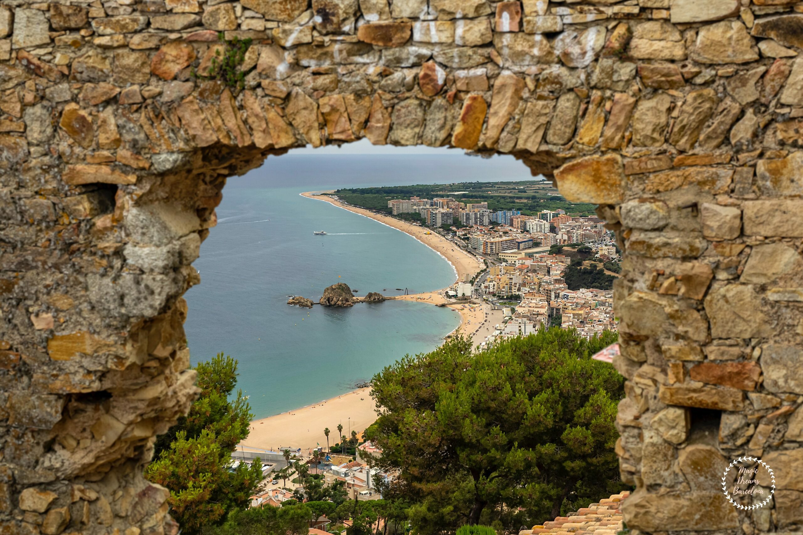
From Sant Joan Castle, almost all of Blanes can be seen.
Sa Palomera is clearly visible from above.
The port lies below.
The beaches stretch along the coastline.
And the Mediterranean opens towards the horizon.
It is one of the best places to understand the geography of Blanes.
The Hermitage of Sant Joan
Next to the castle stands the Hermitage of Sant Joan, dedicated to Saint John the Baptist and historically connected to the defensive complex.
Its origins date back to the Middle Ages.
Its elevated position also makes it one of Blanes’ great viewpoints.
Inside, visitors can find mural paintings created in the 20th century by artist María Teresa Bedós.
There is also a small detail that can easily go unnoticed: a side window allows visitors to see part of the interior and its paintings when the temple is not accessible.
It is one of those small secrets that enrich a guided visit.
The Parish Church of Santa Maria
In the historic centre of Blanes stands Santa Maria Church, one of the town’s principal examples of Gothic architecture.
The building was constructed between the 14th and 15th centuries and formed part of the former palatial complex of the Viscounts of Cabrera.
The façade preserves elements of the original Gothic architecture.
Notable features include the pointed arches of the entrance, the rose window and the square bell tower.
The interior is arranged in three naves.
The church is fundamental to understanding the historical importance of Blanes during the Middle Ages and its relationship with the powerful Cabrera family.
The Palace of the Viscounts of Cabrera
The medieval history of Blanes is closely connected to the Viscounts of Cabrera.
The former viscountal palace and parish church originally formed a single architectural complex, although they were later separated.
This heritage reveals another dimension of Blanes: not simply as a coastal destination, but as a town with a deeply rooted medieval history connected to Catalan feudal power.
The Gothic Fountain
In the centre of the town stands another of Blanes’ most distinctive heritage sites: the Gothic Fountain.
It is a civil Gothic fountain considered an exceptional piece of Catalan heritage.
Built at the end of the 14th century, it remains one of the town’s historic symbols.
For centuries, the water flowing through its outlets was of fundamental importance to the local population.
Today, it remains one of the most interesting testimonies to medieval Blanes.
Hermitages and Religious Heritage
Blanes also preserves several small hermitages and chapels that reveal its spiritual and popular traditions.
Among them is the Ermita de la Antiga, located in Josep Mestres Square.
The space has particular acoustic qualities that make it suitable for concerts and literary recitals.
Another notable site is the Chapel of La Salut, associated with a religious tradition celebrated every 8 September on the occasion of the feast of Our Lady.
These smaller spaces reveal a more intimate side of Blanes, away from the main tourist routes.
The Sanctuary of the Sacred Image of Vilar
A few kilometres from the town centre lies the Sanctuary of the Sacred Image of Vilar, another site connected with the religious and cultural traditions of Blanes.
Its location makes it possible to combine heritage, landscape and tranquillity.
For those wishing to discover the spiritual dimension of the region, it can be an interesting extension to a visit to the historic centre.
The Tordera Delta
Blanes does not end at its beaches.
At the southern end of the town lies the mouth of the Tordera River, an area of particular ecological importance.
The delta is an important environment for migratory birds and is home to a variety of Mediterranean flora and fauna.
It is a completely different landscape from the cliffs in the north.
Here, the terrain opens out.
Freshwater and the Mediterranean meet.
Riparian vegetation gradually replaces the rocky coastal landscape.
At certain times of the year, visitors can observe an interesting variety of bird species.
For lovers of nature, photography and birdwatching, this is another side of Blanes that deserves to be discovered.
Blanes from the Sea
There is one particularly privileged way to understand Blanes:
from the water.
A private boat excursion allows visitors to experience the town from a completely different perspective.
Sa Palomera appears as a great natural gateway.
The cliffs of Marimurtra rise above the Mediterranean.
Sa Forcanera remains hidden beneath the vegetation.
Cala Sant Francesc and Cala Treumal display their different shades of blue.
And the silhouette of Sant Joan Castle dominates the town from above.
Sailing also makes it possible to approach small coves and corners whose land access is limited or non-existent.
For an exclusive experience, private sailing can be combined with swimming, snorkelling, gastronomy on board and a Mediterranean sunset.
The Coastal Path
The coastal paths are another wonderful way to discover Blanes.
The Camí de Ronda allows visitors to explore sections of the coastline along traditional paths beside the sea.
The landscape changes continuously.
In some areas, the path passes through pine forests.
In others, it follows the edge of cliffs.
And in certain places, small hidden coves appear below.
It is particularly suitable for those who enjoy walking, photography and nature.
Blanes’ different viewpoints also offer exceptional perspectives over the coastline.
Mediterranean Gastronomy
Blanes’ relationship with the sea is also reflected in its cuisine.
Fish, seafood, rice dishes and Mediterranean produce form part of a culinary tradition deeply connected to the town.
A gastronomic experience can begin at the market or selected establishments and continue beside the sea.
For international visitors, this dimension makes it possible to discover the Costa Brava not only through its landscapes, but also through its flavours.
Blanes at Sunset
As evening falls, Blanes takes on another personality.
The light begins to change over Sa Palomera.
The façades of the historic centre take on warm tones.
Sant Joan Castle stands out against the sky.
Boats remain anchored in front of the small coves.
And the Mediterranean slowly reflects the last colours of the day.
A walk along the coast at sunset can end at a selected restaurant, on a private terrace or aboard a boat.
It is one of the finest ways to experience the Mediterranean essence of Blanes.
A Bespoke Experience in Blanes
Blanes can be visited in just a few hours.
But it can also become a private experience lasting one or several days.
With Magic Dreams Barcelona, every experience begins with a conversation.
We want to understand what each visitor is looking for.
Nature.
The sea.
Botany.
History.
Gastronomy.
Photography.
Sailing.
Wellness.
Art.
Or simply a day of disconnection beside the Mediterranean.
From there, we design an itinerary adapted to each person’s pace and interests.
Our Services in Blanes
We can arrange experiences including:
Private transportation from Barcelona or anywhere in Catalonia.
Professional tour guides in Spanish, Catalan and English, with other languages available upon request.
Private visits to Sant Joan Castle and Blanes’ historical heritage.
Private tours of Marimurtra and Pinya de Rosa.
Specialist botanical experiences.
Nature and birdwatching tours.
Private walks along the coastline and the Camí de Ronda.
Private sailing along the Costa Brava.
Boat excursions to coves with limited land access.
Snorkelling and swimming experiences.
Private picnics beside the Mediterranean.
Signature catering and personalized gastronomy.
Alcohol-free experiences, with wines, cavas and cocktails without alcohol.
Personalized floral arrangements.
Live music.
Professional photography sessions.
Wellness and mindful experiences.
Creative and cultural workshops.
Gastronomic tours.
Private one- or multi-day experiences along the Costa Brava.
Botany and Nature: Discovering Blanes Through Different Eyes
A visit accompanied by botanical specialists allows visitors to discover a completely different dimension of Blanes.
Marimurtra offers the opportunity to learn about species originating from different regions of the world.
The coastline reveals how Mediterranean vegetation adapts to its environment.
And the Tordera Delta introduces a completely different ecosystem, particularly fascinating from a biodiversity perspective.
For those seeking a more sensory experience, we can incorporate an interpretation of the landscape based on:
scents,
textures,
colours,
sounds,
light,
temperature
and movement.
Nature ceases to be simply the setting.
It becomes part of the experience.
Photography in Blanes
Blanes offers some of the most interesting photographic settings on the Costa Brava.
Sa Palomera.
Sant Joan Castle.
The gardens of Marimurtra.
The cliffs.
The coves.
The coastal paths.
Traditional boats.
The Mediterranean.
And the light of sunset.
We can organize private sessions for:
Couples.
Families.
Celebrations.
Marriage proposals.
Anniversaries.
Private journeys.
Editorial portraits.
Fashion and lifestyle.
Photography does not have to be simply a souvenir.
It can become part of the experience.
A Perfect Day in Blanes
Morning
Departure from Barcelona in a private vehicle.
Arrival in Blanes and a tour of the historic centre.
Visit to Santa Maria Church, the Gothic Fountain and other elements of the medieval heritage.
Then, ascent to Sant Joan Castle and the Hermitage of Sant Joan to admire the views over the town and the Mediterranean.
Midday
Private visit to the Marimurtra Botanical Gardens.
Botanical exploration among Mediterranean and exotic species.
Time for photography and contemplation of the cliffs.
Lunch
The experience can continue with a private gastronomic lunch.
Fish and seafood.
Mediterranean rice dishes.
Catalan cuisine.
Or a personalized proposal based on the visitor’s preferences.
Afternoon
Private boat departure.
Sailing past Sa Palomera.
Cala Sant Francesc.
Sa Forcanera.
Cala s’Agüia.
And Cala Treumal.
Time for swimming, snorkelling or simply enjoying the Mediterranean.
Sunset
Return towards Blanes as the light begins to change.
Sant Joan Castle becomes illuminated above the town.
Sa Palomera turns into a silhouette against the horizon.
And the Mediterranean takes on golden tones.
The day ends with a private dinner or a carefully selected gastronomic experience.
A Luxury Escape Along the Costa Brava
Blanes can also be the starting point for a broader experience.
From here, we can continue towards Lloret de Mar, Tossa de Mar, Sant Feliu de Guíxols, S’Agaró, Begur, Pals or Cadaqués, designing a private journey through some of the most iconic landscapes of the Costa Brava.
We can also combine Blanes with gastronomic experiences, sailing, boutique hotels, spas, photography and cultural activities.
The Costa Brava allows for completely different itineraries.
There is no single way to discover it.
There is the way that best suits each visitor.
Privacy, Discretion and Personalized Service
At Magic Dreams Barcelona, we understand that certain travellers are looking for more than a conventional excursion.
They seek time.
Privacy.
Flexibility.
Discretion.
And truly personalized attention.
That is why every experience can be coordinated from beginning to end.
Transportation.
Guide.
Dining.
Boat.
Photography.
Activities.
Schedules.
And all the small details that transform an excursion into an experience.
Conclusion
Blanes is much more than the gateway to the Costa Brava.
It is a place where the Mediterranean merges with the mountains.
Where botanical gardens overlook the cliffs.
Where a medieval castle dominates the horizon.
Where a rock formation called Sa Palomera symbolically marks the beginning of one of the Mediterranean’s most famous coastlines.
Where small coves remain hidden beneath the cliffs.
Where the Tordera creates a completely different natural landscape.
And where the sea continues to be an essential part of the town’s identity.
Discovering Blanes means walking.
Sailing.
Contemplating.
Tasting.
Photographing.
Breathing.
And allowing the Mediterranean to set the pace.
With Magic Dreams Barcelona, Blanes can become much more than a day trip.
It can be a private experience designed around each visitor, where nature, history, gastronomy, architecture, botany, the sea and wellness come together to discover the Gateway to the Costa Brava from a completely different perspective.
Vista desde el Jardín Botánico (Jardi Botànic Marimurtra) Blanes al Mar Mediterráneo – By Corradox – Own work, CC BY-SA 3.0, https://commons.wikimedia.org/w/index.php?curid=7351159.
Entrada del jardín botánico Marimurtra de Blanes – Josep Renalias, CC BY-SA 3.0 , via Wikimedia Commons.
Cala sa Forcanera, al peu del Jardí Botànic Marimurtra, Blanes (Selva) – Lite, CC BY-SA 3.0, via Wikimedia Commons.
Perspectiva superior aérea del puerto de Blanes.
Puerto de Blanes.
Fuegos artificiales nocturnos en la playa de Blanes.
Perspectiva de parte de la bahía de Blanes, desde el Castell de Sant Joan.
Perspectiva de parte de la bahía de Blanes, desde el Castell de Sant Joan.
In the heart of Baix Empordà, surrounded by cultivated fields, Mediterranean forests, and small winding roads leading towards the Costa Brava, lies Peratallada, one of the most unique and best-preserved medieval villages in Catalonia. Its name derives from the very essence of the place: a …
En el extremo sur de la provincia de Girona, allí donde el río Tordera encuentra el Mediterráneo, comienza uno de los territorios costeros más emblemáticos de Cataluña. Es Blanes, una antigua población marinera considerada tradicionalmente el Portal de la Costa Brava. Su paisaje reúne …
Situado sobre los cerros del Macizo de Begur y bañado por las aguas del Mediterráneo, encontramos uno de los rincones con más personalidad de la Costa Brava. Begur combina un litoral espectacular de pequeñas calas, acantilados y bosques de pinos con un casco antiguo lleno de historia, casas indianas, antiguas torres de defensa y los restos de un castillo medieval.
Es uno de esos lugares en los que merece la pena no limitarse a bajar a la playa. Begur invita a caminar por sus calles, descubrir sus miradores, seguir alguno de sus caminos de ronda, sentarse en una terraza, acercarse a sus antiguas casas de indianos y terminar el día contemplando el Mediterráneo desde alguno de los puntos elevados del municipio.
Destaca precisamente esta combinación entre el núcleo histórico, el antiguo castillo, Esclanyà y sus ocho playas y calas, formando un conjunto paisajístico muy singular.
¿Dónde está Begur y a qué distancia está de Barcelona?
Begur está situada en la provincia de Girona, dentro de la comarca del Baix Empordà, en plena Costa Brava.
Desde Barcelona hasta Begur hay aproximadamente 130-135 kilómetros por carretera, dependiendo del punto de salida y del itinerario elegido. En condiciones normales, el trayecto en coche puede realizarse en torno a 1 hora y 40 minutos o 2 horas, aunque en verano, fines de semana y puentes el tiempo puede aumentar considerablemente.
Por carretera, el itinerario habitual desde Barcelona pasa por la AP-7, cogiendo posteriormente el desvío hacia Vidreres y continuando por la C-35 en dirección a Sant Feliu de Guíxols, Platja d’Aro y Palamós. Desde allí se continúa hacia Palafrugell y finalmente Begur.
¿Cómo llegar a Begur desde Barcelona?
En coche
Es la alternativa más cómoda si la intención es conocer las diferentes calas, ya que muchas de ellas están separadas del centro y las carreteras de acceso son bastante sinuosas.
El recorrido aproximado es de 129-133 km y, sin tráfico, puede realizarse en alrededor de 1 h 40 min-2 h.
Durante julio y agosto conviene salir temprano, especialmente si quieren visitar Aiguablava, Sa Tuna o Sa Riera, ya que el aparcamiento y las carreteras de acceso pueden tener una elevada afluencia.
En autobús
Existe conexión directa en autobús entre Barcelona Estació del Nord y Begur, operada por Moventis/Sarfa.
El trayecto ronda las 2 horas y 35 minutos y el precio orientativo es de aproximadamente entre 23 y 45 € por trayecto, dependiendo de la fecha y del billete disponible.
Es una opción especialmente interesante si no quieren conducir, aunque para moverse después entre las calas dependerán del transporte local, taxi o autobuses de temporada.
En tren
Begur no dispone de estación de tren. La estación ferroviaria más cercana es Flaçà, situada a unos 31 km.
Desde Barcelona pueden coger un tren hasta Flaçà y posteriormente continuar en autobús hacia Palafrugell y Begur.
El viaje combinado puede superar las 3 horas, por lo que resulta menos sencillo que el autobús directo.
Autobús para desplazarse entre las playas
Durante la temporada de verano el Ayuntamiento ofrece el denominado Bus Platges, que conecta el centro de Begur y Esclanyà con las principales zonas de playa: Sa Riera, Sa Tuna y Aiguablava.
Habitualmente funciona aproximadamente desde mediados de junio hasta mediados de septiembre, aunque conviene comprobar cada temporada los horarios concretos.
Un poco de historia de Begur
Begur es mucho más que un destino de playa.
La población se desarrolló alrededor de su castillo medieval y durante siglos estuvo vinculada al mar, a la pesca, al comercio del coral y, posteriormente, al corcho y a la emigración hacia América.
Uno de los episodios más interesantes de su historia es el de los indianos o americanos. Durante el siglo XIX más de 500 begurenses cruzaron el Atlántico en busca de fortuna, especialmente hacia Cuba. Algunos volvieron posteriormente con importantes recursos económicos y construyeron grandes casas de estilo colonial que todavía podemos contemplar recorriendo el centro histórico.
Este legado es tan importante que Begur dispone incluso del Centro de Interpretación de los Indianos de Cataluña, cuya visita y ruta patrimonial con audioguía son gratuitas.
Otro capítulo importante de la historia local está relacionado con los ataques de piratas. Las torres de defensa del siglo XVI se construyeron como refugio ante estas incursiones y forman todavía parte del paisaje urbano de Begur.
El castillo medieval de Begur
En la parte más elevada de la población están situados los restos del antiguo Castillo de Begur, documentado desde principios del siglo XI.
El castillo fue destruido en diferentes momentos de la historia y las guerras napoleónicas supusieron su última gran destrucción en 1810. Actualmente quedan restos de la antigua estructura y el lugar funciona principalmente como magnífico mirador.
Desde aquí pueden contemplar una impresionante panorámica de la costa, las Islas Medas, la bahía del Ter, el paisaje del Baix Empordà y, en días despejados, los Pirineos.
En la cima también encontramos un mapa cerámico que ayuda a identificar algunos de los puntos geográficos que se divisan desde este privilegiado emplazamiento.
Qué visitar en el centro de Begur
Si se alejan por unas horas de las playas descubrirán un Begur completamente diferente.
La iglesia de Sant Pere
La iglesia de Sant Pere es uno de los edificios históricos más importantes del núcleo antiguo. El templo original se documenta desde 1199 y fue ampliado entre 1600 y 1624 siguiendo las características del gótico tardío.
En su interior destaca la pequeña Capilla de la Reserva del Santísimo, uno de los rincones que merece la pena conocer durante el paseo por el centro.
Las casas indianas
Paseando por Begur encontrarán infinidad de casas construidas por los llamados indianos.
Son edificios de arquitectura colonial que reflejan la prosperidad que algunos vecinos alcanzaron después de emigrar a América. La Casa Mas Carreras y la Casa Pere Roger son algunos de los ejemplos que mejor las representan.
El Casino Cultural
Construido en 1870 por iniciativa de los indianos, fue conocido como Casino de los Señores o Casino Viejo. Actualmente forma parte del patrimonio cultural del municipio y conserva una interesante arquitectura con grandes ventanales, molduras y paredes de piedra.
Las Escoles Velles
Las antiguas escuelas forman también parte del patrimonio local. Actualmente el edificio tiene usos culturales y municipales y conserva un bonito patio interior.
Carrer del Castell y Carrer de Vera
Dos calles especialmente interesantes para pasear son el Carrer del Castell, estrecho y escalonado, que antiguamente constituía el acceso natural al castillo, y el Carrer de Vera, relacionado con la antigua tradición de los coraleros de Begur.
No dejen tampoco de acercarse a Es Pedrís Llarg, junto a la iglesia, un antiguo banco de piedra que tradicionalmente era lugar de encuentro y tertulia para los habitantes de Begur.
Esclanyà, otro Begur que merece una visita
Dentro del municipio encontramos también el pequeño núcleo de Esclanyà, situado hacia el noroeste.
Aquí el paisaje cambia y el ambiente resulta mucho más tranquilo. La iglesia de Sant Esteve aparece documentada desde 1280 y conserva elementos de diferentes épocas del románico.
También encontramos la llamada Torre de Esclanyà, perteneciente al antiguo castillo, de la que se conserva una torre rectangular con almenas. Tradicionalmente, la economía de Esclanyà estuvo relacionada con el cultivo de viñedos y olivos y con la producción de baldosas.
Es una visita muy recomendable para quienes quieran conocer la parte más rural e histórica de Begur.
La naturaleza de Begur: pinos, encinas, alcornoques y vegetación mediterránea
El paisaje de Begur está estrechamente relacionado con el Macizo de Begur, una prolongación litoral de la Serralada Litoral Catalana.
La vegetación es fundamentalmente mediterránea. Encontramos importantes masas de pino piñonero, pino carrasco y pino marítimo, además de zonas de encinar y alcornocal.
También aparecen matorrales mediterráneos formados por romero, brezos, jaras y otras especies adaptadas a los periodos de sequía y a los suelos del macizo. Los estudios ambientales del municipio señalan que los pinares han ocupado buena parte del territorio que antiguamente correspondía a encinares y alcornocales.
Esta vegetación llega en muchos puntos prácticamente hasta el mar y es precisamente la combinación entre pinos, roca, acantilados y aguas transparentes la que proporciona a Begur uno de sus paisajes más característicos.
Fauna, ornitología y mariposas
Los amantes de la naturaleza encontrarán en Begur un territorio especialmente interesante para observar fauna mediterránea.
En las zonas forestales se pueden encontrar pequeños mamíferos como ardillas y zorros, además de reptiles y gran variedad de pequeños animales asociados a los pinares, matorrales y zonas rocosas. Los estudios ambientales del municipio también han documentado especies de anfibios en algunos torrentes, entre ellas la ranita de San Antonio y el sapo corredor.
Begur para los aficionados a las aves
En el término municipal se han documentado alrededor de 65 especies de aves, entre ellas especies forestales y rapaces como el búho chico, el búho real, el azor, el busardo ratonero, el halcón peregrino y, de forma ocasional, el halcón de Eleonor.
En los pinares también se pueden observar especies como el carbonero garrapinos, el reyezuelo listado, el torcecuello, el arrendajo o el picapinos, dependiendo de la época del año.
Si su afición es la ornitología, los caminos y miradores del macizo son especialmente interesantes durante las épocas migratorias.
En el entorno más amplio del Baix Ter y del Parque Natural del Montgrí, las Islas Medes y el Baix Ter se han registrado más de 300 especies de aves, por lo que quienes quieran realizar una escapada específicamente ornitológica tienen posibilidades de combinar Begur con los humedales y espacios naturales próximos.
¿Y las mariposas?
Las zonas de matorral mediterráneo, pinares y claros florecidos proporcionan también hábitats adecuados para gran variedad de insectos polinizadores y lepidópteros.
No obstante, no existe una relación municipal única y actualizada de especies de mariposas de Begur equivalente al inventario de aves, por lo que si su visita tiene un interés específico en lepidopterología, recomendamos plantearla con guía naturalista y ampliar el recorrido hacia los espacios naturales próximos del Baix Empordà.
Las ocho playas y calas de Begur
La costa de Begur tiene ocho playas y calas principales: Platja del Racó, Illa Roja, Sa Riera, Aiguafreda, Sa Tuna, Platja Fonda, Fornells y Aiguablava.
Cada una tiene una personalidad diferente y precisamente por eso merece la pena no quedarse solamente con una.
Platja del Racó
Situada junto al límite con Pals, es una playa mucho más extensa que otras calas del municipio.
Desde aquí disfrutarán de magníficas vistas hacia las Islas Medes y pueden enlazar con el camino de ronda que conduce hacia Illa Roja.
Illa Roja
Probablemente sea una de las imágenes más famosa de esta parte de la Costa Brava.
Su enorme roca rojiza, situada frente a la playa, da nombre a la cala. Es una playa de tradición nudista y está situada en un entorno natural y abrupto, sin los servicios habituales de otras playas.
El contraste entre el color rojizo de las rocas, la arena y el agua turquesa hace que sea uno de esos lugares en los que merece la pena llevar la cámara.
Sa Riera
Con unos 300 metros de longitud, Sa Riera es una de las playas más grandes de Begur.
Es una de las opciones más cómodas para quienes buscan servicios, restaurantes, bares y actividades náuticas.
Su nombre procede de la riera que antiguamente atravesaba la playa hasta desembocar en el Mediterráneo.
Aiguafreda
Aiguafreda es completamente diferente.
Pequeña, recogida y protegida por el monte Rodó, está rodeada de pinos y tiene un pequeño espacio acondicionado junto al agua.
No es la típica playa de arena, sino un rincón especialmente interesante para quienes buscan snorkel, fondos rocosos y tranquilidad.
Sa Tuna
Sa Tuna conserva todavía el aspecto de una pequeña población marinera.
Sus casas junto al mar, las rocas que la protegen y sus aguas transparentes convierten esta cala en uno de los lugares más conocidos de Begur.
Dispone de rampas y pasarelas de acceso, bar, duchas y zona de aparcamiento. En verano también existe transporte público.
Desde Sa Tuna pueden caminar por el camino de ronda hasta Aiguafreda.
También merece la pena acercarse a la pequeña Cala S’Eixugador, a la que se puede llegar andando o nadando desde Sa Tuna.
Otro rincón curioso es la Cova de Sant Pau, donde encontrarán una zona de sombra natural junto a la playa. Durante el verano se celebran actuaciones de habaneras, una tradición muy vinculada al litoral catalán.
Platja Fonda
Bajo el Cap de Begur aparece Platja Fonda, una playa de arena oscura que contrasta con el intenso azul del agua.
El acceso es más complicado que en otras playas, ya que hay que descender por una escalera, pero precisamente esa dificultad ha contribuido a conservar un ambiente más natural.
Muy cerca está situado el tramo de costa asociado tradicionalmente al episodio en el que el poeta Ferran Agulló habría utilizado el nombre Costa Brava para describir este litoral.
Fornells
La zona de Fornells reúne varias pequeñas calas: N’Estasia, Ses Orats y Cala d’en Malaret, comunicadas mediante caminos de ronda.
Es una zona muy agradable para caminar junto al mar, observar las casas construidas frente a la costa y descubrir rincones menos evidentes.
Aiguablava
Y llegamos finalmente a una de las imágenes más conocidas de Begur.
Aiguablava, cuyo nombre significa literalmente “agua azul”, está protegida por la Punta d’es Mut y los peñascos de Cala de Cabres y Ses Falugues.
Los pinos y olivos llegan prácticamente hasta el agua y las tonalidades violáceas de las rocas contrastan con la arena fina y las aguas poco profundas de color azul turquesa.
La playa tiene aproximadamente 75 metros de longitud y 25 metros de anchura y dispone de aparcamiento, duchas, actividades náuticas, alquiler de patines y restaurantes.
Los caminos de ronda: una de las mejores maneras de conocer Begur
Si desean descubrir la verdadera esencia de la costa, no se limiten a llegar en coche hasta las playas.
Los caminos de ronda permiten unir diferentes calas y descubrir perspectivas que no son visibles desde la carretera.
Uno de los recorridos más interesantes es el que une Aiguafreda y Sa Tuna, aunque hay tramos con escaleras y desniveles.
También existe la ruta del GR-92, que permite salir desde Begur hacia Sa Tuna y continuar por algunos de los sectores más salvajes del litoral.
Para quienes prefieran los miradores, Begur dispone además de una Ruta de los Miradores con 17 puntos, algunos accesibles en coche y otros a pie. Se puede realizar durante todo el año.
Begur también se disfruta lejos de la playa
Una de las grandes ventajas de Begur es que pueden organizar una escapada incluso cuando no haga tiempo de bañarse.
En otoño e invierno las calles del centro recuperan un ambiente mucho más tranquilo y permiten pasear por las casas indianas, visitar el castillo, acercarse a Esclanyà, realizar alguna ruta de senderismo o recorrer los miradores.
La primavera es especialmente interesante para combinar naturaleza y gastronomía, mientras que el verano concentra la actividad en las calas, caminos de ronda, terrazas, actividades náuticas y fiestas.
En definitiva, Begur es uno de esos destinos en los que la playa puede ser el principio de la visita, pero no tiene por qué ser el final.
Shopping y tiendas en Begur
También encontrarán una interesante oferta comercial.
El centro dispone de tiendas de moda y complementos, decoración, joyería, alimentación, vinos y bodegas, artesanía, cerámica, productos de playa, librerías, arte, cosmética, peluquerías y establecimientos especializados.
Por lo tanto, además de comprar algún recuerdo de su viaje, pueden encontrar productos gastronómicos de la comarca, vinos del Empordà, artesanía y pequeños objetos relacionados con el Mediterráneo.
El mercado semanal y las diferentes ferias y actividades comerciales también contribuyen a mantener animado el centro fuera de la temporada estrictamente veraniega.
Costumbres, fiestas y tradiciones
La cultura de Begur está marcada por el mar, la pesca, la emigración a Cuba y la tradición indiana.
Una de las celebraciones más conocidas es la Fira d’Indians, que se celebra cada año a principios de septiembre.
Durante esos días las calles se transforman y se recrea la relación histórica entre Begur y Cuba con mercado de productos de ultramar, artesanía, música, habaneras, espectáculos y actividades relacionadas con la época.
En 2026 la Fira d’Indians se celebró los días 4, 5 y 6 de septiembre, con una edición dedicada al tema del mar y la vela.
Las habaneras también forman parte de la tradición musical de la costa y pueden escucharse durante el verano en diferentes espacios.
Otra tradición gastronómica fundamental es la Campaña del Pescado de Roca, que se celebra durante la primavera y que recupera uno de los productos más característicos del litoral begurense.
¿Dónde comer en Begur?
La gastronomía de Begur tiene una relación directa con el Mediterráneo.
Encontrarán pescado y marisco, arroces, cocina marinera, platos de temporada, cocina tradicional catalana y propuestas contemporáneas. El pescado de roca ocupa un lugar especialmente importante en la tradición gastronómica local.
Entre los restaurantes que pueden tener en cuenta encontramos:
Restaurant Aigua Blava
Situado en la zona de Fornells, su gran atractivo es la combinación entre cocina tradicional catalana, producto mediterráneo y una espectacular panorámica sobre la bahía.
El restaurante trabaja con carta, menús de temporada y propuestas gastronómicas especiales.
Como referencia, el precio medio de la carta ronda aproximadamente los 40-50 € por persona, aunque puede variar según elección de platos y vinos.
Es otra de las opciones que merece la pena considerar si buscán comer prácticamente suspendidos sobre el Mediterráneo.
La carta actual incluye entrantes como anchoas del Empordà, mejillones, navajas o calamares; diferentes arroces, pescado de lonja, gambas y carnes a la brasa.
Como referencia de precios 2026, el arroz meloso con medio bogavante figura a 38 € por persona, la paella de pescado y marisco a 23 € por persona, el pescado de lonja a 79 €/kg y los postres aproximadamente entre 7 y 8 €. El precio medio indicado para el restaurante es de unos 40 €.
Una opción interesante para comer cerca de la playa de Sa Riera, especialmente si quieren combinar jornada de playa y comida sin desplazarse hacia el centro.
Situado sobre la Punta d’es Mut, a unos 4 km del centro de Begur, el Parador ocupa uno de los emplazamientos más espectaculares de la zona.
Desde sus habitaciones, jardines, piscina y spa se disfruta de vistas al Mediterráneo. El edificio fue reinaugurado en 2020 y mantiene una arquitectura inspirada en la costa mediterránea. Además, alberga una colección de más de 200 obras de artistas catalanes.
Ofrece habitaciones dobles, superiores y suites, restaurante, bar, jardín, gimnasio, piscina exterior de temporada, aparcamiento gratuito y estación de recarga para vehículos eléctricos.
Spa del Parador de Aiguablava
Aquí encontramos uno de los grandes atractivos para quienes busquen una escapada de bienestar.
El spa dispone de:
Jacuzzi.
Sauna.
Terma.
Cascada.
Piscina de chorros e hidromasaje.
Tumbonas térmicas.
Zona de relax.
Solárium exterior.
Tratamientos personalizados.
El circuito básico tiene actualmente un precio de 45 € para clientes no alojados y 40 € para clientes alojados. Los Amigos de Paradores disponen de tarifas específicas y los residentes en Begur tienen una tarifa indicada de 35 €.
El horario del circuito es de 10:00 a 20:00 horas y es imprescindible reservar tanto el circuito como los tratamientos.
En cuanto al alojamiento, ofrece diferentes tarifas de referencia de 124 €, 264 € y 374 €, según la categoría o régimen indicado en la tabla, por lo que conviene consultar la tarifa concreta para las fechas elegidas.
El Hotel Aigua Blava es uno de los establecimientos históricos de la Costa Brava.
Fue fundado por Clara Capellà, conocida como “la Clareta”, en 1934 y continúa actualmente en manos de la misma familia.
Su situación sobre la zona de Fornells y Aiguablava permite disfrutar de magníficas vistas al mar.
Dispone de:
Piscina exterior climatizada.
Jardines mediterráneos.
Tenis.
Pádel.
Gimnasio.
Parque infantil.
Restaurante.
Terraza panorámica.
Aparcamiento privado.
Espacio Wellness.
Peluquería y salón de belleza.
Wellness en Hotel Aigua Blava
Su Espacio Wellness ofrece salas para masajes terapéuticos, tratamientos faciales y corporales, tratamientos estéticos y rituales de belleza.
También ofrece tratamientos en pareja y utiliza marcas cosméticas de alta gama como Natura Bissé, Kérastase, L’Oréal Paris, Scens y Germaine de Capuccini.
Es especialmente interesante para quienes quieran combinar playa, gastronomía y bienestar sin renunciar a una estancia con vistas al Mediterráneo.
Su restaurante
El restaurante del Hotel Aigua Blava está abierto al público y ofrece cocina tradicional catalana basada en productos frescos y de temporada.
Podéis encontrar carta de mediodía, menú de temporada, carta de cena, menú del día, carta de vinos y menús especiales. También se organizan propuestas gastronómicas específicas, como el menú de pescado de roca o el menú de cocina indiana.
Como referencia, el restaurante se sitúa aproximadamente en torno a 40-50 € por persona en carta.
En 2026, por ejemplo, el menú especial de pescado de roca del Hotel Aigua Blava se ofrece a 80 € por persona, con agua, vino Castell de Perelada y café incluidos.
En alojamiento, para el Hotel Aigua Blava referencias de 151 €, 301 € y 421 €, dependiendo de la tarifa y categoría.
¿Cuál es la mejor época para visitar Begur?
Primavera
Probablemente sea una de las épocas más interesantes para quienes quieran combinar naturaleza, senderismo y gastronomía.
Las temperaturas son agradables para recorrer los caminos de ronda y el paisaje mediterráneo comienza a llenarse de flores.
Además, coincide con la Campaña Gastronómica del Pescado de Roca, uno de los grandes acontecimientos culinarios del municipio.
Verano
Es la época de las calas, los baños, el snorkel, las actividades náuticas, las terrazas y las noches junto al mar.
A cambio, es también cuando encontrará mayor afluencia, especialmente en Aiguablava, Sa Tuna y Sa Riera.
Si viaja en julio o agosto, recomendamos madrugar para llegar a las playas y reservar restaurante y alojamiento con antelación.
Otoño
Septiembre resulta especialmente agradable. El mar conserva buena temperatura y las temperaturas exteriores suelen ser más suaves.
Además, Begur celebra su conocida Fira d’Indians a principios de septiembre.
Invierno
Es la época más tranquila.
Las playas cambian completamente de aspecto y los caminos de ronda adquieren un ambiente mucho más solitario.
Es un buen momento para conocer el casco histórico, las casas indianas, Esclanyà, los miradores, la gastronomía y el patrimonio.
Además, algunas rutas de miradores pueden realizarse durante todo el año.
Un día perfecto en Begur
Puede empezar la mañana paseando por el casco antiguo, visitando Sant Pere, las casas indianas y el entorno del castillo.
Después puede subir hasta el antiguo castillo para disfrutar de las panorámicas.
A continuación, puede bajar hacia Sa Tuna o Aiguafreda, realizar un pequeño tramo del camino de ronda y terminar con un baño si la época del año lo permite.
Para comer, pueden elegir entre alguna de las terrazas de Sa Riera, Sa Tuna o Aiguablava, dependiendo de la zona en la que estén situados.
Por la tarde puede acercarse a Aiguablava, recorrer Fornells y terminar contemplando el atardecer desde alguno de los miradores.
Y si quiere convertir la jornada en una experiencia de descanso, puede reservar un circuito de spa en el Parador o disfrutar de un tratamiento Wellness en el Hotel Aigua Blava.
Begur, mucho más que una playa de agua turquesa
Begur tiene esa capacidad de sorprender porque bajo la imagen de su agua transparente encontramos muchas otras historias.
Es el Begur de los pescadores y los coraleros, el de los indianos que volvieron de Cuba, el de las torres construidas para protegerse de los piratas, el de los caminos antiguos hacia Sa Tuna, el de las casas coloniales, el del corcho, el de las habaneras y el de las pequeñas calas escondidas entre pinos.
Y, por supuesto, está el Begur mediterráneo de Aiguablava, Sa Tuna, Aiguafreda, Sa Riera, Illa Roja, Platja Fonda, Fornells y Platja del Racó, ocho rincones diferentes que hacen que cada visita pueda ser distinta.
Por este motivo, si quieren conocer Begur de una manera diferente, no se queden únicamente con la fotografía de la cala de Aiguablava.
Camine por sus calles, suba hasta el castillo, descubra sus casas indianas, siéntese en una terraza, recorra algún camino de ronda, acérquese a Esclanyà, observe su bosque y aves y reserve tiempo para disfrutar de la gastronomía.
Y si quiere vivir esta experiencia y conocer Begur de nuestra mano, escribanos a través de nuestro formulario de contacto. Adaptaremos la experiencia de manera personalizada a sus preferencias, al momento del año en que viaje y a la forma en la que quiera descubrir este maravilloso rincón de la Costa Brava.
Piscina natural privada en Begur.
Perspectiva aérea marítima de parte de Begur.
Desayuno frente al mar en Begur.
Caminando al atardecer por Begur.
Perspectiva desde Begur.
Perspectiva de Begur.
Perspectiva de Begur.
Perspectiva a pie en Begur.
Calles de Begur.
Cala d’Aiguafreda – De Foto pròpia, Dominio público, https://commons.wikimedia.org/w/index.php?curid=2666592.
Sa Tuna – De No machine-readable author provided. Josemanuel assumed (based on copyright claims). – No machine-readable source provided. Own work assumed (based on copyright claims)., CC BY-SA 2.5, https://commons.wikimedia.org/w/index.php?curid=1296373.
Perspectiva de la Bahía de Aiguablava – By Myriam Thyes – Own work, CC BY-SA 4.0, https://commons.wikimedia.org/w/index.php?curid=72844983.
El Mediterráneo catalán sobre una rebanada de pan La tosta de escalivada con anchoas de l’Escala reúne dos productos profundamente ligados a la gastronomía de la costa catalana: las verduras asadas y las famosas anchoas de l’Escala, en la Costa Brava. La escalivada es una …
Perched dramatically above the Mediterranean on the Costa Brava, the Santa Clotilde Gardens in Lloret de Mar offer one of the most beautiful combinations of historic garden design and coastal scenery in Catalonia. Among their most spectacular features is the view towards Cala Boadella, a …
Los Jardines de Santa Clotilde, en Lloret de Mar, son uno de los espacios paisajísticos más elegantes y singulares de la Costa Brava. Situados sobre un acantilado entre Cala Boadella y la playa de Fenals, fueron concebidos como un jardín novecentista inspirado en los grandes jardines del Renacimiento italiano.
Su particularidad está en la combinación de arquitectura, vegetación mediterránea, esculturas, terrazas y mar. El Mediterráneo no aparece simplemente como paisaje de fondo: forma parte de la propia composición del jardín.
Los jardines están construidos sobre el terreno inclinado de un antiguo espacio de viñedos y ocupan aproximadamente 26.830 m².
¿Dónde están los Jardines de Santa Clotilde?
Los jardines se encuentran en:
Paratge de Santa Clotilde
17310 Lloret de Mar, Girona
Cataluña, España
Su posición elevada permite contemplar directamente el litoral de la Costa Brava y, especialmente, Cala Boadella, que queda a los pies de los acantilados.
La localización es uno de sus grandes atractivos: mientras se recorren las terrazas y escalinatas, el paisaje vegetal se abre constantemente hacia el Mediterráneo.
¿Cuándo se construyeron?
La historia de Santa Clotilde comienza a principios del siglo XX.
El marqués Raúl Roviralta adquirió unos terrenos que anteriormente estaban dedicados al cultivo de la vid. En total llegó a poseer siete viñedos en esta zona.
En 1919, encargó el proyecto al arquitecto paisajista Nicolau Maria Rubió i Tudurí, uno de los grandes nombres del paisajismo catalán.
Rubió i Tudurí recibió una fuerte influencia de los jardines clásicos y de las ideas del paisajista francés Jean-Claude Nicolas Forestier. Santa Clotilde se convirtió así en uno de los ejemplos más destacados del Noucentisme aplicado al paisaje.
La historia de Clotilde
El nombre de los jardines tiene una historia personal.
Raúl Roviralta había conocido a Clotilde Rocamora, una joven de Barcelona que llegó a Lloret de Mar en 1917, cuando esta zona todavía estaba dominada por los viñedos.
Clotilde murió en 1927, antes de poder contemplar los jardines terminados.
La construcción quedó paralizada durante un periodo y posteriormente se reanudó después de que Roviralta contrajera matrimonio con su segunda esposa, Odile.
Las obras continuaron hasta después de la Guerra Civil española. Finalmente, el jardín conservó el nombre de Santa Clotilde en homenaje a su primera esposa.
Un jardín de inspiración renacentista italiana
Santa Clotilde no fue diseñado como un jardín botánico convencional.
Rubió i Tudurí creó un auténtico escenario paisajístico utilizando los principios de los jardines italianos clásicos:
Terrazas escalonadas
Escalinatas monumentales
Ejes visuales
Miradores
Fuentes
Estanques
Esculturas
Vegetación mediterránea
Perspectivas abiertas hacia el mar
El resultado es un jardín en el que la arquitectura y la naturaleza están cuidadosamente integradas.
La Generalitat de Catalunya lo considera un ejemplo de jardín novecentista y está catalogado como Bien Cultural de Interés Nacional.
La Escalera de las Sirenas
Uno de los lugares más conocidos de Santa Clotilde es la Escalera de las Sirenas.
Esta gran escalinata constituye uno de los principales ejes del jardín y está acompañada por esculturas de sirenas realizadas por la escultora Maria Llimona.
A medida que se desciende por la escalera, el jardín cambia de perspectiva y el mar aparece progresivamente como telón de fondo.
Es uno de los mejores ejemplos de cómo Santa Clotilde utiliza la perspectiva para convertir el paisaje mediterráneo en parte de la arquitectura del jardín.
La botánica de Santa Clotilde
La vegetación está adaptada fundamentalmente al clima mediterráneo de la Costa Brava.
Entre las especies y grupos vegetales destacados por las fuentes patrimoniales y turísticas se encuentran:
Pinos
Tilos
Álamos
Cipreses
Laureles
Plantas aromáticas
Arbustos mediterráneos
Vegetación ornamental
Los aromas tienen también un papel importante. La propia Generalitat destaca cómo, al descender por las escaleras, se mezclan los olores de las resinas, laureles y plantas aromáticas con el olor del mar.
Un jardín diseñado para el clima mediterráneo
La elección de especies no es casual.
El jardín está situado expuesto al sol, al viento y a la influencia marina, por lo que la vegetación mediterránea forma parte esencial de su identidad.
El resultado es muy diferente al de un jardín centroeuropeo: aquí predominan las plantas capaces de soportar períodos de calor y sequedad, combinadas con especies ornamentales utilizadas para crear volumen, sombra, color y estructura.
¿Qué fauna puede encontrarse?
Santa Clotilde no es un parque zoológico ni una reserva natural, por lo que no existe un catálogo de fauna turística comparable al de un espacio natural protegido.
Sin embargo, su combinación de vegetación, árboles, flores, estanques y proximidad al Mediterráneo crea un hábitat adecuado para observar aves pequeñas, insectos polinizadores y otros animales habituales de los jardines y del paisaje mediterráneo.
Entre los visitantes habituales que pueden observarse en este tipo de entorno se encuentran pequeñas aves de jardín, mariposas, abejas y otros insectos asociados a la vegetación mediterránea.
Además, la proximidad de los acantilados y del mar permite que el visitante pueda observar ocasionalmente aves relacionadas con el litoral.
La fauna, por tanto, forma parte del paisaje vivo del jardín, aunque el gran atractivo de Santa Clotilde continúa siendo la integración entre vegetación, arquitectura y Mediterráneo.
La cala que se ve desde los jardines: Cala Boadella
Uno de los grandes secretos visuales de Santa Clotilde es la cala situada justo debajo de los acantilados.
Se trata de Cala Boadella, también conocida como Sa Boadella.
La cala tiene aproximadamente 250 metros de longitud y se caracteriza por sus agua transparente, arena gruesa y un entorno de pinos y acantilados.
Desde determinados puntos elevados de los Jardines de Santa Clotilde puede contemplarse la cala desde arriba, creando una de las panorámicas más características de este rincón de la Costa Brava.
¿Por qué es tan especial Cala Boadella?
Su situación entre zonas de pinar y acantilados hace que conserve una apariencia mucho más natural que otras playas de Lloret.
El fondo marino presenta zonas rocosas, cuevas y pequeñas formaciones que hacen que la zona resulte interesante también para practicar snorkel y otras actividades acuáticas.
La playa tiene además una tradición nudista, especialmente en determinadas zonas, por lo que conviene conocer esta característica antes de visitarla.
La casa y el patrimonio arquitectónico
Cerca de la entrada se conserva la casa original vinculada al conjunto.
Destacan sus arcadas de medio punto, la gran terraza y una torre de tres plantas.
En la fachada sur de la torre existe además un panel de azulejos pintados dedicado a Santa Clotilde que data de 1930.
El conjunto permite comprender que Santa Clotilde no es únicamente un jardín, sino una obra completa en la que arquitectura, escultura, vegetación y paisaje están concebidos conjuntamente.
¿Cuándo pasaron a ser públicos?
Los jardines permanecieron durante décadas vinculados a la familia Roviralta.
En 1997, el Ayuntamiento de Lloret de Mar decidió adquirirlos, restaurarlos y convertirlos en patrimonio municipal.
Previamente, en 1994, habían sido declarados Bien Cultural de Interés Nacional por la Generalitat de Catalunya.
Horarios actuales
Según la información oficial disponible actualmente:
De abril a octubre:
10:00–20:00 h, todos los días.
De noviembre a enero:
10:00–17:00 h, todos los días.
Febrero y marzo:
10:00–18:00 h, todos los días.
La última admisión es una hora antes del cierre.
El recinto permanece cerrado los días 25 de diciembre, 1 de enero y 6 de enero.
La tarifa reducida se aplica, entre otros casos, a jubilados, titulares del Carnet Jove, estudiantes, familias y personas con discapacidad.
Los grupos de más de 15 personas deben solicitar tarifa específica.
Importante: no se permite la entrada con animales de compañía.
¿Cuánto se tarda desde Barcelona?
Desde Barcelona hasta Lloret de Mar hay aproximadamente 73 km por carretera y el trayecto en coche puede durar alrededor de 58 minutos en condiciones favorables, aunque el tiempo real puede aumentar considerablemente dependiendo del tráfico, especialmente durante los fines de semana y la temporada turística.
Para llegar a Santa Clotilde debe continuar desde Lloret de Mar hacia la zona de los jardines.
Como referencia práctica:
Barcelona – Jardines de Santa Clotilde
Aproximadamente 75–80 km, dependiendo del punto de salida y de la ruta elegida.
Tiempo estimado en coche: aproximadamente 1 h – 1 h 30 min, pudiendo ser superior con tráfico.
Cómo llegar desde Barcelona en coche
Una ruta habitual consiste en:
Barcelona – AP-7 – salida hacia Lloret de Mar – Lloret de Mar – zona de Santa Clotilde/Fenals.
Una vez en Lloret de Mar, siga las indicaciones hacia los Jardines de Santa Clotilde.
La dirección oficial es:
Paratge de Santa Clotilde, 17310 Lloret de Mar, Girona.
¿Se puede llegar en transporte público?
Sí. Lloret de Mar está conectado con Barcelona mediante autobús directo, con servicios que parten de la Estació d’Autobusos Barcelona Nord. El trayecto Barcelona–Lloret ronda aproximadamente una hora en condiciones habituales.
Desde Lloret de Mar deberá continuar hasta la zona de Santa Clotilde mediante transporte local o a pie, dependiendo del punto exacto de llegada y de la temporada.
¿Cuánto tiempo dedicar a la visita?
Para una visita tranquila recomiendo reservar aproximadamente:
1–1,5 horas para recorrer los jardines con calma.
Si desea realizar fotografías, detenerse en los miradores, disfrutar de la arquitectura y observar la vegetación, puede dedicar 2 horas sin que resulte excesivo.
La visita merece especialmente la pena sin prisas, porque buena parte de su atractivo consiste precisamente en ir descubriendo las perspectivas del mar entre las terrazas y las escalinatas.
Curiosidades de Santa Clotilde
1. Antes había viñedos
El terreno donde actualmente se encuentran los jardines estaba dedicado anteriormente al cultivo de la vid.
2. Clotilde nunca llegó a ver los jardines terminados
La primera esposa del marqués murió en 1927, cuando el proyecto todavía no estaba terminado.
3. El mar forma parte del diseño
Los jardines fueron concebidos de tal manera que muchas de sus terrazas, escaleras y miradores dirigen la mirada hacia el Mediterráneo.
4. Las sirenas son uno de sus símbolos
Las esculturas de sirenas de Maria Llimona forman parte de la identidad visual del jardín y acompañan la famosa escalinata principal.
5. Es un jardín novecentista
Santa Clotilde es considerado uno de los ejemplos más representativos del jardín vinculado al Noucentisme catalán, movimiento cultural y artístico que buscó recuperar el orden, el equilibrio y las referencias clásicas.
6. Está sobre un acantilado
Su posición elevada es precisamente la razón por la que se obtienen las impresionantes vistas sobre Cala Boadella y el Mediterráneo.
¿Merece la pena visitar los Jardines de Santa Clotilde?
Sí, especialmente si busca una visita diferente a las playas tradicionales de Lloret de Mar.
Santa Clotilde ofrece algo poco habitual: un jardín histórico de inspiración italiana construido sobre un acantilado mediterráneo, donde las esculturas, las terrazas, los cipreses, las plantas aromáticas y las vistas al mar están diseñados como una única composición.
Y hay un punto especialmente recomendable: busque los miradores desde los que se contempla Cala Boadella desde arriba. Es una de las imágenes más espectaculares de la visita.
Detalle Jardines Santa Clotilde -By krysi@, CC BY 3.0, https://commons.wikimedia.org/w/index.php?curid=61024135.
Fuente Jardines Santa Clotilde – By krysi@, CC BY 3.0, https://commons.wikimedia.org/w/index.php?curid=61024145.
Detalle jardines de Santa Clotilde -By Dawid Glawdzin, CC BY 3.0, https://commons.wikimedia.org/w/index.php?curid=54626861.
Jardines de Santa Clotilde Magic Dreams Barcelona.
Sirena de Jardines de Santa Clotilde – Дмитрий Мозжухин, CC BY 3.0, via Wikimedia Commons.
Jardines de Santa Clotilde – By JopkeB – Own work, CC BY-SA 4.0, https://commons.wikimedia.org/w/index.php?curid=149692532.
Plaza de Jardines Santa Clotilde – By JopkeB – Own work, CC BY-SA 4.0, https://commons.wikimedia.org/w/index.php?curid=149692531.
Esencia marinera, playas, patrimonio y el Mediterráneo de Serrat Calella de Palafrugell es uno de los núcleos de costa del municipio de Palafrugell, en la comarca del Baix Empordà, provincia de Girona, en plena Costa Brava. Es uno de esos lugares en los que el …
Maritime essence, beaches, heritage and Serrat’s Mediterranean Calella de Palafrugell is one of the coastal settlements belonging to the municipality of Palafrugell, in the Baix Empordà region, in the province of Girona, in the heart of the Costa Brava. It is one of those places …
Some people become part of history. Others become legends. Lídia of Cadaqués became both.
Fisherwoman, innkeeper, storyteller and one of the most fascinating characters in the history of Cadaqués, Lídia Noguer i Sabà lived in a very different Cadaqués from the one we know today. It was a small fishing village on the Costa Brava, isolated for much of the year, where stories travelled from one person to another and where extraordinary characters could easily become part of local folklore.
Lídia was one of them.
Her life became intertwined with some of the most important figures in Catalan and European culture during the first decades of the 20th century. Yet one name would become particularly important in her story: Salvador Dalí.
Lídia was not simply a colourful character from Cadaqués. She was the woman who helped Dalí and Gala find a place where they could begin their life together and who, without knowing it, played a decisive role in the story of Portlligat.
Lídia Noguer i Sabà, the Woman Behind the Legend
Lídia Noguer i Sabà was born in Cadaqués on 30 June 1866. She was the daughter of Baldiri Noguer, a sailor, and Dolors Sabà, popularly known as Sabana, a woman remembered in Cadaqués as one of the last witches of the village.
Her mother’s reputation contributed to the extraordinary image that surrounded Lídia throughout her life. In time, Lídia herself would become one of the most intriguing figures in the collective memory of Cadaqués.
But before becoming a legend, she was a working woman.
She worked as a fish seller and later ran a guesthouse. Her home became a meeting point for travellers, artists and intellectuals who were increasingly drawn to Cadaqués and the landscapes of Cap de Creus.
Among the distinguished visitors who passed through her house were Pablo Picasso, Josep Puig i Cadafalch, Jacinto Grau, Agustí Duran Reynals and André Derain.
Cadaqués was beginning to attract artists and intellectuals from across Europe, and Lídia found herself at the heart of this fascinating world.
Lídia and Eugeni d’Ors: Fascination, Literature and Obsession
In 1904, one of the most significant encounters of Lídia’s life took place.
That year, Eugeni d’Ors stayed at her guesthouse. D’Ors was one of the most influential Catalan intellectuals of his generation: a writer, philosopher, journalist and art critic, and one of the key figures of the Noucentisme cultural movement.
For Lídia, meeting him had profound consequences.
Her admiration for the writer gradually developed into an intense fascination and eventually into an obsession. When d’Ors published La Ben Plantada in 1911, Lídia identified herself with Teresa, the central character of the novel. At times, she even claimed that Teresa was her own name.
She became convinced that the articles d’Ors published in his famous Glosario in La Veu de Catalunya contained messages directed personally at her, as if they were responses to the letters she had written to him.
But there was an important difference between Lídia’s perception and reality.
Her feelings were not reciprocated. D’Ors did not answer her letters, although Lídia continued to interpret his writings through the prism of her fascination with him.
This unusual mixture of admiration, imagination and obsession would become one of the most fascinating elements of Lídia’s story—and one that would later capture Salvador Dalí’s imagination.
A Woman Who Fascinated Salvador Dalí
Salvador Dalí had known Lídia since childhood.
He spent much of his early life in Cadaqués and, as a boy, heard the stories Lídia told to the children of the village.
Long before he became one of the most famous artists of the 20th century, Lídia was therefore already part of Dalí’s personal world.
As the years passed, however, she became much more than a colourful local character.
Dalí was fascinated by her extraordinary personality, her stories and her peculiar way of interpreting the world. Lídia seemed to inhabit a space where reality, imagination and personal mythology constantly overlapped.
That quality made her particularly intriguing to an artist whose own work would repeatedly explore dreams, obsession, memory and the unconscious.
And eventually, Lídia would become connected to one of the most important places in Dalí’s life.
When Dalí Broke with His Father
In 1929, Salvador Dalí’s relationship with his father reached a breaking point.
His relationship with Gala and the direction he had chosen for his personal and artistic life created a profound conflict with his father, the notary Salvador Dalí i Cusí.
Dalí needed somewhere to begin a new life with Gala.
And this was where Lídia entered the story.
At a crucial moment, she was the person who helped them.
Lídia made available to Dalí a small fisherman’s hut in Portlligat, where her two sons kept their fishing equipment.
It was an extremely modest building.
There was nothing luxurious about it. The original hut measured only around 22 square metres and had none of the comforts we associate with the house today—not even electricity.
Yet Dalí saw something there that was impossible to measure in square metres.
He saw the landscape.
He saw the light.
He saw the silence.
And he saw the extraordinary isolation of Portlligat.
On 20 August 1930, Dalí purchased the small fisherman’s hut from Lídia Nogués.
That simple transaction would change the history of the place forever.
From a Fisherman’s Hut to Dalí and Gala’s Home
The remarkable part of the story is that the first hut was only the beginning.
Over the following years, Dalí and Gala gradually acquired adjoining buildings and spaces, connecting them and transforming them into a unique home.
The house did not emerge from a conventional architectural plan.
It grew organically.
Room by room, studio by studio, courtyard by courtyard, Dalí and Gala transformed the original fisherman’s hut into the extraordinary residence that we know today as the Salvador Dalí House-Museum in Portlligat.
The house preserves that evolution. Its irregular spaces, studios, patios, gardens and intimate rooms reveal how the residence developed alongside Dalí’s life and work.
Portlligat eventually became Salvador Dalí’s only permanent home, the place where he lived and worked for decades with Gala.
This is why visiting Portlligat means much more than entering a museum.
It means entering the private world where Dalí created, dreamed, worked and lived.
And at the beginning of that story stands Lídia of Cadaqués.
The Woman Who Became a Literary Character
Lídia’s story did not disappear after her death.
It continued to grow.
Her personality, her stories, her fascination with Eugeni d’Ors and her unusual interpretation of the world eventually became material for literature.
Seven years after Lídia’s death, Eugeni d’Ors returned to Cadaqués with Cesáreo Rodríguez-Aguilera to gather information about her extraordinary life.
The result was La verdadera historia de Lidia de Cadaqués, published in 1954.
And d’Ors asked Salvador Dalí to illustrate the book.
The choice was particularly meaningful.
Dalí had known Lídia since childhood. He had listened to her stories and witnessed her extraordinary personality. He was also fascinated by her and was himself considering creating a work about her.
Dalí produced four illustrations for the book.
One of the most striking depicts Lídia as a woman transformed into an olive tree, deeply rooted in the rocks of Cap de Creus.
The illustration is dated 1954 and bears the signature of Gala Dalí together with a deeply meaningful dedication:
“A Lídia, que nos albergó eternamente en Portlligat.”
“To Lídia, who sheltered us eternally in Portlligat.”
Few sentences could express more clearly the place she occupied in the history of Dalí and Gala.
Lídia, Dalí and the Strange World of Cadaqués
One of the other illustrations created for the book refers to Lídia’s peculiar way of dividing the inhabitants of Cadaqués.
In her own particular vision of the village, there were the good and the bad.
The good belonged to what she called the Society of the Secret of Xènius, which included the Dalí and Pichot families.
The others belonged to what she called the Society of Goats and Anarchists.
Dalí turned this unusual classification into part of the visual world of the book.
It may seem like a curious anecdote, but it reveals why Lídia fascinated him so deeply.
She did not simply tell stories about Cadaqués.
She had created her own version of Cadaqués, with its own characters, loyalties, enemies and hidden meanings.
For an artist like Dalí, this was extraordinarily compelling.
The Final Years of Lídia of Cadaqués
Lídia’s life ended far from the Cadaqués that had shaped her identity.
Her family life had also been marked by tragedy. She married Fernando Costa, known as Nando, who died by suicide. They had two sons, Benvingut and Honori, who eventually ended their lives in psychiatric care in Salt.
During her final years, Lídia also suffered a serious deterioration in her mental stability.
She eventually lived at the Gomis Shelter in Agullana, where she died on 30 December 1946 at the age of 80.
She was buried in the cemetery of Agullana.
Her connection with Dalí, however, did not end there.
Dalí later paid for her gravestone, a gesture that showed that, despite the passing of time, Lídia remained an important and deeply memorable figure in his life.
A Woman at the Beginning of the Portlligat Story
Perhaps the best way to understand Lídia of Cadaqués is to return to Portlligat.
Today, the bay seems inseparable from Salvador Dalí. His house, studio, gardens and the surrounding landscape have become one of the most recognisable places associated with the artist.
But before there was a Casa Dalí, before the gardens and studios, before the world came to know Portlligat as Dalí’s private universe, there was a modest fisherman’s hut.
And that hut was connected to Lídia.
Her decision to help Dalí and Gala gave them a place where they could begin their life together.
Over the following decades, that modest beginning became a remarkable home and studio.
Portlligat became much more than a residence.
It became Dalí’s refuge, workshop, stage and personal universe.
And that is why the story of Portlligat cannot be told without remembering Lídia.
The Last Witch of Cadaqués
Lídia of Cadaqués died in 1946, but her story never truly disappeared.
She survived in the memories of the village, in Eugeni d’Ors’s literary work, in Dalí’s illustrations and in the history of the place where her life became unexpectedly connected with one of the greatest artists of the 20th century.
She was a fisherwoman, an innkeeper, a mother, a woman marked by tragedy and the protagonist of an unrequited love that eventually became part of literature and legend.
But she was also something else.
She was the woman who opened a door when Salvador Dalí needed somewhere to begin again.
And that door led to Portlligat.
Today, we can visit the house that grew from that first fisherman’s hut and walk through the landscape that became one of the greatest sources of inspiration in Dalí’s work.
But knowing Lídia’s story allows us to see Portlligat differently.
Because behind the house, behind the mythology of Dalí and Gala, and behind one of the most fascinating landscapes of Cap de Creus, there is also the story of a woman from Cadaqués who, at a decisive moment, chose to help two young people who needed somewhere to build a new life.
Perhaps that is why Dalí’s dedication means so much: Lídia did not simply give them a place to stay. She gave them a place where they could build their own story.
And if we want to discover Cadaqués, Portlligat and the world of Salvador Dalí in a truly special way, Magic Dreams Barcelona can take care of the entire experience: private transportation, guide, visits, gastronomy and logistics, allowing us to enjoy the journey without having to worry about the details.
Because sometimes, to understand an artist, we need to discover the people and places that were there before the legend.
Fotografía del Port Lligat al ataredecer de Magic Dreams Barcelona.
Fotografía del Port Lligat al ataredecer de Magic Dreams Barcelona.
Fotografía del Port Lligat al atardecer frente a la Casa museo de Salvador Dalí y Gala de Magic Dreams Barcelona.
Fotografía del Port Lligat al atardecer de Magic Dreams Barcelona.
Última casa de la Lídia de Cadaqués, vivía en una barraca muy humilde, tras haber pasado por otras residencias como la de Es Llaner – Magic Dreams Barcelona.
Perspectiva a pie de la Casa de Dalí en el Port Lligat de Magic Dreams Barcelona.
Detalle en la última casa de la Lídia de Cadaqués, vivía en una barraca muy humilde, tras haber pasado por otras residencias como la de Es Llaner – Magic Dreams Barcelona.
Existen personajes que forman parte de la historia y otros que, con el paso del tiempo, terminan convirtiéndose en leyenda. Lídia de Cadaqués pertenece a los dos mundos. Pescadera, hostelera, mujer de carácter extraordinario y figura rodeada de historias, Lídia Noguer i Sabà vivió en …
Salvador Dalí’s great surrealist universe The Dalí Theatre-Museum in Figueres is one of the most extraordinary museums in Catalonia and one of the most iconic places associated with Salvador Dalí. Conceived as a total work of art, the museum invites visitors to enter the artist’s …
Perched on the eastern slopes of the Serra de Rodes, overlooking the Mediterranean and the spectacular landscape of Cap de Creus, Sant Pere de Rodes is one of the most extraordinary Romanesque monuments in Catalonia. Its isolated location, monumental architecture, centuries of history and fascinating legends make it a particularly interesting destination for anyone wishing to discover the cultural and natural heritage of the Empordà region.
The monastery stands at an altitude of around 520 metres, in a privileged position overlooking the Gulf of Lion and the coastline stretching northwards towards the French border. Nearby are the remains of the medieval village of Santa Creu de Rodes and the castle of Sant Salvador de Verdera, adding even greater historical and landscape interest to the visit.
Where is Sant Pere de Rodes Monastery?
Sant Pere de Rodes is located in the municipality of El Port de la Selva, in the Alt Empordà region of Girona province, within the spectacular surroundings of Cap de Creus.
Its address is Camí del Monestir, s/n, 17489 El Port de la Selva.
The monastery can be reached by road from Vilajuïga or from El Port de la Selva. The final section of the journey climbs through the Serra de Rodes, with increasingly impressive views over the surrounding landscape.
Its position is one of the great attractions of the site: the monastery is not simply an isolated historic monument, but part of a wider cultural landscape in which mountains, Mediterranean vegetation, medieval settlements and the sea come together.
How far is Sant Pere de Rodes from Barcelona?
From Barcelona, the monastery is approximately 160 kilometres by road, with a driving time of around two hours, depending on traffic and the exact starting point.
A convenient route is to take the AP-7 north towards Girona and Figueres, leave the motorway in the Figueres area and continue towards Llançà and El Port de la Selva. From there, the road climbs towards the monastery.
The journey itself is worthwhile because the landscape changes considerably as you approach the northern Costa Brava and Cap de Creus.
How can you get there without a car?
Although travelling by car is the easiest option, Sant Pere de Rodes can also be incorporated into a journey using public transport.
The R11 railway line connects Barcelona with Figueres and Llançà. Since El Port de la Selva does not have a railway station, Llançà is one of the most useful railway connections, approximately eight kilometres away.
There are also bus connections linking Figueres, Llançà and El Port de la Selva. From El Port de la Selva, a taxi is the most practical option for reaching the monastery without a private vehicle.
For those who enjoy walking, there are also routes connecting the monastery with the surrounding villages and landscapes, although the terrain should not be underestimated.
Can Sant Pere de Rodes be visited?
Yes. Sant Pere de Rodes is open to visitors throughout the year, although opening times vary according to the season.
From 1 October to 30 April, it generally opens from Tuesday to Saturday between 10:00 and 17:30.
From 1 May to 30 September, opening hours are generally extended until 19:00, from Tuesday to Saturday.
On Sundays and public holidays, the usual opening hours are 10:00 to 15:00.
The monument is normally closed on non-holiday Mondays, as well as on 25 and 26 December, 1 January and 6 January. Special opening hours may apply during Holy Week.
Admission generally costs around €7, with reduced admission available in certain cases and free entry for children under 16.
The ticket office closes approximately 30 minutes before the monument itself.
Guided tours are also available on certain dates and can be particularly worthwhile if you would like to understand the architecture, history and legends surrounding the monastery in greater depth.
How much time should you allow for the visit?
We recommend allowing at least two hours for the monastery and its immediate surroundings.
If you wish to explore the architecture carefully, visit the different spaces, admire the views and take photographs, two to three hours is a more comfortable amount of time.
Those who enjoy hiking or wish to combine the visit with Santa Creu de Rodes or the castle of Sant Salvador de Verdera should allow considerably longer.
The location deserves to be enjoyed without rushing.
What architectural style is Sant Pere de Rodes?
Sant Pere de Rodes is considered one of the great masterpieces of Catalan Romanesque architecture.
Its church, constructed mainly during the 10th and 11th centuries, has exceptionally monumental proportions. The architecture reflects the evolution of the monastery over several centuries, with construction and modifications continuing from the 10th through the 13th centuries and additional service buildings added later.
The church is particularly remarkable for its sophisticated spatial organisation, imposing central nave, columns, capitals and monumental architectural forms.
The original entrance portal was attributed to the Master of Cabestany, one of the most fascinating sculptors of the Romanesque period. Fragments of the original white-marble sculpture have survived and provide an indication of the artistic importance of the medieval monastery.
What is inside the monastery?
The complex is much more than a church.
The visit allows you to discover different spaces associated with medieval monastic life, including:
the Romanesque church;
the bell tower;
the cloisters;
the crypt;
the ambulatory;
the chapter house;
the sacristies;
the refectory;
the cellars;
the monastic living and service areas;
the Abbot’s Palace;
the entrance and defensive structures;
and the area known as the galilee.
One of the most interesting features is that the monastery had two cloisters, although they were not used simultaneously.
The earlier lower cloister was eventually buried beneath the later upper cloister and was rediscovered during archaeological investigations.
This makes the monastery particularly interesting from an archaeological perspective, as different periods of its history remain physically visible within the same complex.
The views from Sant Pere de Rodes
The panoramic views are one of the main reasons to visit.
From the monastery, the landscape opens towards the Gulf of Lion, the Mediterranean coastline and the rugged terrain of Cap de Creus.
On clear days, the combination of mountains, sea and small coastal settlements creates one of the most spectacular viewpoints in the region.
The monastery’s position also helps explain its historical importance. Its elevated location provided a strategic and symbolic position overlooking the surrounding territory.
For photography, early morning and late afternoon can be especially attractive, when the Mediterranean light changes the appearance of the mountains and coastline.
The history of Sant Pere de Rodes
The origins of Sant Pere de Rodes are surrounded by uncertainty, tradition and legend.
The earliest documentary reference dates from 878, when the site is mentioned as a monastic cell dependent on Sant Esteve de Banyoles.
Over the following centuries, however, the monastery grew considerably in importance.
Between the 11th and 14th centuries, Sant Pere de Rodes became the principal spiritual centre of the County of Empúries and one of the most important religious institutions in the region.
Its relationship with the papacy also contributed to its prestige.
In the 10th century, Abbot Hildesindo obtained a papal bull in 974 protecting the monastery, followed by another in 979 which helped establish it as a pilgrimage destination.
The monastery subsequently developed a religious tradition of its own, including jubilees intended to give pilgrims a spiritual experience comparable, in certain respects, to pilgrimage to Rome.
The complex continued to evolve over the centuries, although its importance eventually declined and the monastery was abandoned by the monastic community in the 19th century.
Today, its surviving architecture allows visitors to understand the scale and importance that the monastery once possessed.
Did Saint Peter’s relics really arrive here?
This is one of the most fascinating questions surrounding Sant Pere de Rodes.
According to the traditional foundation legend, during a period of danger in Rome, three clerics — Felix, Ponce or Pontius, and Epicinius or Epitacius — were entrusted with taking relics associated with Saint Peter away from the city.
Among these relics were supposedly the head and right arm of Saint Peter, together with other sacred remains.
The three clerics travelled towards the Mediterranean and eventually reached a place referred to in the tradition as Armen Rodes.
They hid the relics in a cave before leaving the area.
When they later returned, however, they could no longer find the cave because vegetation had covered the site.
According to the legend, a church was eventually built at the location, giving rise to the monastery.
But is this story historically true?
There is no historical evidence proving that Saint Peter’s relics were actually brought to Sant Pere de Rodes.
The existence of the monastery itself, however, is historically documented from the 9th century onwards. In addition, medieval documentation demonstrates that the monastery possessed an important collection of relics.
A 15th-century inventory, for example, refers to numerous relics and specifically mentions the head and right arm of Saint Peter.
Therefore, there are two different levels that should not be confused: the possession of relics at the monastery is documented, while the story explaining how those relics supposedly arrived there belongs to the realm of religious tradition and legend.
The Font dels Monjos
Near the monastery is the Font dels Monjos, the Monks’ Fountain.
An inscription dated 1588 reads:
“Qui biberit ex aqua sitiet iterum.”
The phrase refers to the Gospel of Saint John and can be translated approximately as:
“Whoever drinks this water will thirst again.”
It is another small detail that reveals how deeply religious symbolism was incorporated into the landscape surrounding the monastery.
Where to stay near Sant Pere de Rodes?
If you would like to spend the night in the area, El Port de la Selva is one of the most attractive choices.
The coastal village is relatively close to Sant Pere de Rodes and provides a pleasant combination of sea, mountains, traditional architecture and Mediterranean atmosphere.
It is also a convenient base for exploring other parts of Cap de Creus.
The municipality offers several hotels, guesthouses and small accommodation establishments, making it possible to choose between a traditional guesthouse, a hotel overlooking the sea or a more comfortable establishment with additional services.
Staying overnight also allows you to experience the area outside the busiest hours of the day.
What should you eat in the area?
The gastronomy of the northern Costa Brava is closely linked to the Mediterranean and to the fishing traditions of the Empordà.
One of the dishes that should not be missed is suquet de peix, a traditional fishermen’s stew originally prepared with potatoes and the fish available to local fishermen.
Today, versions of suquet may include monkfish, sea bass, squid, prawns, mussels and other seafood.
The local cuisine also includes:
grilled or baked fish;
sardines;
anchovies;
sea bream;
grouper;
scorpionfish;
mussels;
lobster;
seafood rice;
seafood paella;
sea urchins, known locally as garotes;
bread with tomato;
and alioli.
The cuisine of the area is particularly enjoyable when accompanied by local products and, naturally, views of the Mediterranean.
The vegetation around Sant Pere de Rodes
The natural environment surrounding the monastery forms part of the extraordinary ecosystem of Cap de Creus.
The vegetation has been shaped by both human activity and the area’s demanding climate.
For centuries, terraces, dry-stone walls, vineyards, grazing and fires transformed the landscape. At the same time, the powerful Tramuntana wind contributes to the area’s dry and salty conditions.
Among the trees found in the wider area are:
Aleppo pine (Pinus halepensis);
cork oak (Quercus suber);
holm oak;
downy oak;
elm;
ash;
alder;
hazel;
and willows in more sheltered and humid areas.
The Mediterranean scrubland includes lentisk, juniper, heather, rockroses and black broom.
Closer to the coast, the flora becomes even more specialised.
Among the remarkable species are Armeria ruscinonensis, Limonium tremolsii and Seseli farreny, a particularly notable botanical species associated with Cap de Creus.
The area also contains other rare or protected plants, including Euphorbia dendroides, Cneorum tricoccon and Astragalus massiliensis.
This botanical diversity is one of the reasons why Cap de Creus is so interesting for nature lovers.
Fauna around Cap de Creus
The fauna is equally diverse.
Among the terrestrial invertebrates are species such as the beetle Pseudochlamys raholai, the heteropteran Campylosteia serena and the endemic snail Mastigophallus rangianus.
Amphibians include the Mediterranean tree frog and the common toad.
Among reptiles, the area is home to species such as the Mediterranean tortoise, although it is relatively scarce, the Spanish pond turtle, the ocellated lizard and the Moorish gecko.
But birds are undoubtedly among the most spectacular elements of the local fauna.
Birdwatching at Cap de Creus
The cliffs and coastal landscapes of Cap de Creus provide excellent conditions for observing birds, particularly during spring and autumn migration.
Depending on the season and conditions, species associated with the cliffs include:
Bonelli’s eagle;
peregrine falcon;
Eurasian eagle-owl;
European shag;
gulls;
shearwaters;
terns;
and northern gannets.
The combination of cliffs, open Mediterranean terrain and coastline creates an important variety of habitats.
For anyone interested in ornithology, visiting outside the busiest tourist periods can provide a much more rewarding experience.
Butterflies and lepidoptery
Cap de Creus is also an interesting destination for butterfly enthusiasts.
A butterfly monitoring route in the Montjoi area has recorded 54 butterfly species in recent monitoring years, demonstrating the diversity of Lepidoptera found in the region.
Among the species recorded in the area are:
Swallowtail (Papilio machaon), one of Europe’s most recognisable butterflies;
Two-tailed Pasha (Charaxes jasius), the largest day-flying butterfly in Europe;
Peacock butterfly (Inachis io);
Red Admiral (Vanessa atalanta);
Painted Lady (Vanessa cardui);
and Cleopatra (Gonepteryx cleopatra).
The Swallowtail is particularly interesting because its caterpillars feed on plants from the carrot family, including fennel, which is abundant in suitable Mediterranean habitats.
The Two-tailed Pasha is also characteristic of Mediterranean environments and is strongly associated with the strawberry tree, Arbutus unedo.
The area’s lepidopterological interest extends beyond butterflies to moths and other nocturnal Lepidoptera. Surveys in the wider Albera–Cap de Creus region have revealed considerable diversity, including uncommon records, although this fauna remains less thoroughly studied than the area’s daytime butterfly populations.
The legends of Sant Pere de Rodes
Sant Pere de Rodes is a place where history and legend are almost impossible to separate.
One of the most charming local stories is the legend of Sant Pere and Sant Peret de Roda.
According to the tale, a pirate known as Cor de Pedra — “Stone Heart” — captured prisoners in the area of Roses. Among them was a seven-year-old boy named Pere.
The child showed remarkable compassion and comforted the other prisoners.
The pirate was deeply affected by the boy’s behaviour and eventually abandoned his former life, converted to Christianity and took the name Pere.
According to the legend, he and his followers settled near Verdera, and the former pirate became the monastery’s first abbot. The young Pere later succeeded him.
It is a beautiful story, but it belongs to local tradition rather than documented history.
The legend of Barbarossa’s treasure
Another popular legend involves the famous pirate Barbarossa.
According to tradition, papal ships were travelling towards Catalonia carrying gold, precious stones and other treasures.
Barbarossa supposedly ambushed them near Cap de Creus and seized the treasure.
Later, while fleeing from the papal fleet, he is said to have thrown part of the treasure into the sea.
Local tradition claims that on nights with a full moon, the lost treasure — and even the pirate’s sword — can still be seen shining beneath the waters.
There is, of course, no historical evidence proving that the treasure can actually be seen.
Nevertheless, these stories contribute to the extraordinary atmosphere of Cap de Creus.
Charlemagne and the monastery
Another local tradition claims that Charlemagne stayed at Sant Pere de Rodes.
As with many medieval traditions connecting famous rulers with important religious sites, there is no solid documentary evidence proving that Charlemagne actually stayed at the monastery.
The persistence of the story, however, illustrates the symbolic importance that Sant Pere de Rodes acquired over the centuries.
Sant Pere de Rodes: history, nature and legend in one place
A visit to Sant Pere de Rodes is much more than a trip to a Romanesque monastery.
It is an opportunity to discover a landscape in which medieval history, Romanesque architecture, religious traditions, legends, Mediterranean vegetation, wildlife and the sea all come together.
The monastery itself deserves time and attention, but so does its setting.
The views towards Cap de Creus and the Gulf of Lion, the remains of Santa Creu de Rodes, the nearby castle of Sant Salvador de Verdera, the dry-stone landscapes, Mediterranean flora and exceptional bird and butterfly diversity make this one of the most fascinating cultural destinations in northern Catalonia.
And perhaps that is what makes Sant Pere de Rodes so special: here, documented history and centuries-old legends coexist in a landscape that still retains much of the sense of isolation and mystery that has surrounded the monastery for centuries.
If you are looking for a destination where heritage, nature, architecture, gastronomy and legends can be experienced in the same visit, Sant Pere de Rodes is undoubtedly one of the places worth discovering in the Cap de Creus region.
Monasterio de Sant Pere de Rodes – By Photo: Eckhard Henkel / Wikimedia Commons / CC BY-SA 3.0 DE, CC BY-SA 3.0 de, https://commons.wikimedia.org/w/index.php?curid=44585716.
Monasterio de Sant Pere de Rodes – By David Chacobo – Flickr: Sant Pere de Rodes i Castell de Sant Salvador de Verdera, Port de la Selva, CC BY-SA 2.0, https://commons.wikimedia.org/w/index.php?curid=16770826.
Monasterio de Sant Pere de Rodes – By Igor González Martín from Madrid, Spain – IMG_5863, CC BY-SA 2.0, https://commons.wikimedia.org/w/index.php?curid=16972868.
Monasterio de Sant Pere de Rodes – Perspectiva del Conjunto – By Borjaanimal – Own work, CC BY-SA 3.0 es, https://commons.wikimedia.org/w/index.php?curid=16464590.
Monasterio de Sant Pere de Rodes – By Aurica – Own work, CC BY-SA 3.0 es, https://commons.wikimedia.org/w/index.php?curid=16715585.
Monestir de Sant Pere de Rodes – By SBA73 – Flickr: El monestir sobre el mar / The abbey above the sea, CC BY-SA 2.0, https://commons.wikimedia.org/w/index.php?curid=16713847.
Monasterio de Sant Pere de Rodes desde la ermita de Santa Helena – By Pedro José Ponce Asensio – Own work, CC BY-SA 4.0, https://commons.wikimedia.org/w/index.php?curid=152862769.
El Monasterio de Sant Pere de Rodes es uno de los grandes monumentos del románico catalán y uno de los lugares más espectaculares del Alt Empordà. Situado en la ladera de la sierra de Verdera, dentro del entorno del Parque Natural del Cap de Creus, …
One of Europe’s Great Fortresses in the Heart of the Empordà Just a few minutes from the centre of Figueres, on a hill overlooking much of the Alt Empordà, stands Sant Ferran Castle, one of the most extraordinary military constructions in Catalonia. This is not …
A short guide to discovering one of the Costa Brava’s most extraordinary natural treasures.There are landscapes that are not simply seen, but felt, explored and remembered.Cap de Creus Natural Park is one of them.At the easternmost point of the Iberian Peninsula, where the final foothills of the Pyrenees descend towards the Mediterranean Sea, lies one of the most distinctive territories of the Costa Brava. Here, rocks resemble sculptures, the tramuntana wind shapes the vegetation, hidden coves preserve their rugged beauty, and the sea conceals some of the most valuable underwater ecosystems along the Catalan coastline.Located in the Alt Empordà region of the province of Girona, Cap de Creus represents an extraordinary fusion of nature, geology, biodiversity, history and Mediterranean culture.Here, the landscape is far more than a backdrop. It is the result of millions of years of geological transformation, the persistent action of wind and water, and a long-standing relationship between humankind and a territory that is as beautiful as it is demanding.It is no coincidence that Salvador Dalí found an inexhaustible source of inspiration in this corner of the Empordà. Its unusual rock formations, open horizons, contrasting light and almost surreal atmosphere seem to belong to a world suspended between reality and dreams.
For travellers seeking authentic destinations in the Mediterranean, Cap de Creus offers something increasingly valuable: the opportunity to discover a landscape that has retained its own powerful identity.
A Natural Park Between Land and Sea
Cap de Creus Natural Park was established in 1998 and became Catalonia’s first maritime-terrestrial natural park.
Its distinctive character lies in the joint protection of the peninsula’s terrestrial landscapes and an extensive marine area. Cliffs, rocky coves, islets, ravines, ancient agricultural terraces, Mediterranean scrubland, underwater meadows and exceptionally rich seabeds coexist within this protected environment.
The park encompasses areas of the municipalities of Cadaqués, El Port de la Selva, La Selva de Mar, Llançà, Vilajuïga, Pau, Palau-saverdera and Roses, among other areas associated with its natural and scenic surroundings.
Each part of the park offers a different experience.
Around Cadaqués, visitors will find small bays, coastal paths and landscapes closely associated with Dalí’s life and work. Further north, the coastline becomes more rugged, with steep cliffs, secluded inlets and remarkably isolated corners. In the southern sector, around Roses and Cape Norfeu, rock formations, coves and Mediterranean habitats create another distinctive landscape.
This diversity makes Cap de Creus an especially rewarding destination for hiking, nature photography, birdwatching, botany, geology, diving and peaceful escapes from everyday life.
The park can be explored on foot, admired from the sea, studied through its geological outcrops or simply appreciated from one of its viewpoints, where the full scale of the landscape becomes apparent.
Unique Geology: Millions of Years Written in Stone
An Open-Air Geological Museum
Cap de Creus is one of Catalonia’s most remarkable geological sites and a territory of considerable interest to both specialists and enthusiasts of Earth sciences.
Its exposed rock formations reveal Palaeozoic rocks, complex deformation structures and evidence of the tectonic processes that contributed to the formation of the Pyrenees.
Metamorphic rocks are particularly abundant, especially schists and phyllites, although gneisses, marbles, quartzites, amphibolites and other rock types are also present. Certain areas contain igneous rocks, including granodiorites, as well as much more recent volcanic formations.
It is important to distinguish between the age of the original materials and the time when they were transformed. Some of the sediments that eventually became these rocks were deposited during the Palaeozoic Era, while much of their metamorphism and folding is associated with the Hercynian, or Variscan, orogeny, approximately 300 million years ago. Later, the formation of the Pyrenees deformed the rock sequence again, producing particularly complex geological structures.
What Is a Metamorphic Rock?
A metamorphic rock is a rock that has undergone mineralogical and structural changes as a result of variations in pressure, temperature or fluid circulation, without melting completely.
At Cap de Creus, these processes have produced rocks with a wide variety of textures, colours and structures.
Schists display a characteristic alignment of minerals along planes, allowing them to split into layers. Phyllites have fine surfaces with a silky sheen, while gneisses are often distinguished by alternating light and dark mineral bands.
Marble forms through the transformation of carbonate rocks. Quartzite is rich in quartz and resistant to erosion, while amphibolites contain dark minerals that reflect their particular composition and metamorphic conditions.
This variety helps explain why the landscape changes so dramatically from one area to another and why some rock surfaces display grey, ochre, pink or greenish tones.
Erosion: How Rocks Become Sculptures
One of the most characteristic images of Cap de Creus is that of twisted, perforated and seemingly impossible rock formations.
Their appearance results from the interaction of geological processes and erosion.
First, tectonic deformation fractured, folded and rearranged the rocks. Over time, water, waves, wind and weathering gradually wore away the more vulnerable areas. Differences in resistance between minerals and rock types encouraged the formation of cavities, grooves, sharp ridges and rounded surfaces.
The result is a landscape of rocky pinnacles, platforms, small arches, hollows and extraordinary shapes that seem to change expression with the light.
The tramuntana wind plays an important role in this visual identity, although it does not act alone. Marine erosion, rainfall, temperature changes and the internal structure of the rocks all contribute to the process.
This is why Cap de Creus has become a major reference point for field geology. It is not simply a beautiful coastline to admire, but a place where visitors can observe the processes that have shaped and transformed a territory over hundreds of millions of years.
The Landscape That Inspired Salvador Dalí
Between Reality and Surrealism
To understand Salvador Dalí’s relationship with Cap de Creus, we must visit Cadaqués and, in particular, Portlligat.
Here, the artist discovered a landscape that brought together many of the defining elements of his creative universe: ambiguous shapes, open horizons, striking contrasts, eroded rocks and light capable of completely transforming our perception of space.
Rock formations may resemble animals, faces or human figures. The same stone can appear to take on different identities depending on the viewing angle. Long evening shadows and surfaces polished by the water reinforce this sense of strangeness.
Places such as Cala Culleró, Cala Culip and the surroundings of Portlligat allow visitors to experience this relationship between landscape and perception.
This does not mean that every geological formation corresponds to a specific work by Dalí. Rather, the territory as a whole offers a valuable insight into his artistic sensibility.
The Portlligat House-Museum, developed from former fishermen’s huts that the artist gradually transformed over the years, is an especially rewarding visit to complete the experience.
Here, nature and art seem to engage in a continuous dialogue.
The sea fills the windows’ horizons. Light transforms the rooms. Objects acquire unexpected meanings. The landscape outside seems to extend into the house itself.
For a cultural escape along the Costa Brava, combining Cadaqués, Portlligat and Cap de Creus offers a perspective that goes far beyond conventional sightseeing.
Mediterranean Botany: Plants That Learn to Live with the Wind
Vegetation Adapted to Extreme Conditions
The flora of Cap de Creus is one of the most distinctive and fascinating elements of its natural heritage.
At first glance, the landscape may appear austere. Low scrubland, rocky slopes and wind-exposed surfaces dominate many areas. Yet this apparent simplicity conceals an extraordinary diversity of plant life.
Plants must survive several environmental stresses: summer water shortages, intense sunlight, shallow soils, salt carried by sea spray and the force of the tramuntana.
These conditions have encouraged highly specialised adaptations.
Some species develop small, tough leaves or protective surfaces that reduce water loss. Others grow in compact, cushion-like forms that minimise exposure to the wind. Certain plants can even survive in tiny rock crevices where soil particles and moisture accumulate.
Rockroses, Heaths, Rosemary and Mastic Trees
In the park’s inland areas, extensive Mediterranean scrub communities can be found, including heathlands and rockrose-dominated vegetation, depending on the composition of each plant community.
Characteristic species include different rockroses, such as the narrow-leaved rockrose (Cistus monspeliensis) and the sage-leaved rockrose (Cistus salviifolius), together with heaths, rosemary, mastic trees and other plants adapted to summer drought.
In some areas, grasses and small dry grasslands are also present. Their composition depends on the nature of the substrate, wind exposure, the history of wildfires and traditional land use.
The landscape also preserves traces of its agricultural past. Former vineyards, terraces and dry-stone walls form a mosaic of open spaces, scrubland and small abandoned plots.
These features remind us that Cap de Creus is not a wilderness entirely untouched by human activity. For centuries, agriculture, grazing and land management helped shape the landscape we see today.
Broom, Carob Trees and Mediterranean Vegetation
Broom, together with various thorny shrubs, forms part of plant communities adapted to dry, sunny terrain.
Carob trees occur in favourable parts of the Mediterranean landscape, although they do not dominate every habitat in the park. Wild olive trees, mastic trees, junipers and other woody species are also present, depending on altitude, soil conditions and exposure.
In more sheltered and humid areas of the Rodes mountain range, woodland formations containing holm oaks and cork oaks survive, along with small patches of riparian vegetation.
This transition between open landscapes, scrubland, woodland and damp ravines is one of the main reasons for the peninsula’s botanical diversity.
Cap de Creus’s Botanical Treasure
One of the most remarkable plants is Seseli farrenyi, a species with an extremely restricted distribution associated with this territory and of considerable conservation importance.
Other notable species include Roussillon sea lavender (Armeria ruscinonensis) and several species of sea lavender in the genus Limonium, adapted to the conditions of rocky coastal environments.
These plants thrive in habitats where salinity, wind and a lack of soil prevent many other species from surviving.
Their importance goes beyond their beauty. They illustrate ecological specialisation and demonstrate how small coastal areas can support exceptional biodiversity.
Some of these species receive specific legal protection and are vulnerable to habitat disturbance, trampling and visitor pressure. It is therefore essential to remain on marked paths and avoid collecting plants or seeds.
Vegetation Also Tells the Story of the Land
The present-day vegetation is the result of a combination of natural and human influences.
Wildfires, the abandonment of former farmland, grazing and the evolution of scrubland have altered the distribution of plant communities.
The persistent effect of the tramuntana adds another factor, increasing moisture loss and depositing salty aerosols on leaves.
The result is a distinctive botanical mosaic: a seemingly barren territory in which every plant occupies a place determined by wind, soil and water availability.
For nature lovers, spring is one of the most rewarding times to observe flowering plants and discover details that often go unnoticed during the drier summer months.
Terrestrial Wildlife: Small Inhabitants of a Vast Landscape
The wildlife of Cap de Creus is closely linked to the diversity of its habitats.
Cliffs, scrubland, former agricultural fields, woodland and rocky outcrops provide shelter, food and breeding grounds for numerous species.
Although some animals are difficult to spot, the park is particularly rewarding for visitors who enjoy patient and respectful wildlife observation.
Terrestrial Mammals
Mammals associated with the Mediterranean environment include species such as foxes, wild boar, badgers and various small mammals that inhabit scrubland, woodland and transitional areas.
Their activity tends to be more discreet during the hottest hours of the day. Tracks, footprints and droppings can provide more evidence of their presence than a direct sighting.
In such an exposed landscape, ravines and densely vegetated areas play an important role as refuges.
Insects and Other Invertebrates
Invertebrates are an essential part of the park’s biodiversity, although they frequently go unnoticed.
Among the most notable species is the land snail Mastigophallus rangianus, endemic to Cap de Creus and of particular conservation interest.
Another remarkable species is Saga pedo, a large bush-cricket associated with herbaceous vegetation and scrubland. Its reproductive biology is especially unusual because its known populations reproduce through parthenogenesis, without requiring fertilisation by males.
These animals remind us that the ecological importance of a natural area does not depend solely on large or easily photographed species.
Protecting small invertebrates is also essential to maintaining healthy ecosystems.
Herpetology: Reptiles and Amphibians Among the Rocks
Life Among Rocky Outcrops and Scrubland
Herpetology, the study of reptiles and amphibians, reveals another dimension of Cap de Creus.
Reptiles are well adapted to dry, sunny Mediterranean environments. Lizards and other small reptiles may be found in scrubland, along path edges, around dry-stone walls and on rocky outcrops, where they use crevices for shelter.
One species characteristic of Mediterranean environments in the surrounding region is the Algerian sand racer (Psammodromus algirus), which uses low vegetation and open spaces to move around and search for insects and spiders.
Other reptile species native to the region may also occur, depending on the habitat and local conditions.
Snakes, where present, play an important ecological role as predators of small vertebrates and invertebrates. They should never be chased or handled. The appropriate response is to keep a safe distance and allow them to move away.
What About Amphibians?
Amphibians need water to complete their life cycles, so their distribution depends more heavily on the availability of ponds, streams, springs and other damp habitats.
In a territory characterised by summer drought and limited surface water, these habitats are particularly valuable.
Following rainfall, certain damp locations may experience increased amphibian activity. However, conditions vary across the park, and visitors should not expect to find these species on every route.
The best time to observe reptiles is generally during the milder periods of the year, particularly in spring and, depending on weather conditions, early autumn.
In all cases, wildlife observation should take place without lifting rocks, destroying shelters or capturing animals.
Ornithology: Cap de Creus as a Birdwatching Destination
A Remarkable Territory for Birdwatching
Cap de Creus is an important birdwatching destination thanks to its variety of terrestrial and marine environments, its cliffs and its geographical position in the western Mediterranean.
Resident species coexist with migratory birds that use the coastline and the Pyrenean region as part of their seasonal movements.
Cliffs provide resting and breeding sites. Scrubland and open areas offer food and shelter for numerous terrestrial birds. The sea, meanwhile, provides feeding grounds for various pelagic and coastal species.
Birds of Prey and Cliff-Dwelling Birds
Species of particular interest include Bonelli’s eagle, the peregrine falcon and the Eurasian eagle-owl, which are associated with rocky habitats and relatively undisturbed areas.
Observing birds of prey requires patience and a suitable viewing location. Sometimes, a bird appears as a tiny silhouette against the horizon before quickly disappearing behind a cliff.
The presence of a species in the park does not guarantee that it will be seen during a particular visit.
Distance, weather, the breeding season and food availability all influence bird activity.
Seabirds
Along the coast, visitors may encounter gulls, terns and other birds associated with the shoreline. The European shag is particularly characteristic of rocky coastal habitats, where it can sometimes be seen resting on rocks and spreading its wings to dry them.
Shearwaters and northern gannets may also appear while travelling or feeding in open waters.
Storms and strong winds can change birdwatching opportunities by influencing both bird movements and their distribution at sea.
Migration and Seasonal Changes
Spring and autumn are particularly interesting seasons for observing migratory birds.
During these periods, Cap de Creus forms part of a wider migration landscape used by species associated with the coast, open habitats and woodland.
To enjoy birdwatching, we recommend bringing binoculars, avoiding nesting areas and remaining on authorised routes.
Responsible observation reveals a natural heritage that may otherwise go unnoticed during a quick visit to the lighthouse or the best-known coves.
Marine Wildlife: A Mediterranean Full of Life
A Different Landscape Beneath the Surface
The richness of Cap de Creus does not end at the shoreline.
Beneath the water lies a mosaic of rocky seabeds, submerged walls, caves, crevices, sandy areas and seagrass meadows that provide shelter for an extraordinary variety of organisms.
Clear water, diverse substrates and differences between exposed and sheltered areas encourage a wide range of marine communities.
Rocky seabeds support fish, crustaceans, molluscs, sponges, algae and organisms that form complex benthic communities—that is, communities associated with the seabed.
Mediterranean Fish
Species found in the park’s marine habitats include white seabream, saddled seabream, salema, red scorpionfish and dusky grouper.
Seabream move across rocky seabeds in search of food among algae and small invertebrates. Salema primarily feed on plant material, while red scorpionfish use their camouflage to remain motionless and capture prey.
The dusky grouper, a particularly prized sight among divers, uses crevices and cavities for shelter.
Suitable waters may also support European seabass and various pelagic fish, including sardines, which move through the water column.
The presence of each species depends on depth, season, temperature and habitat characteristics.
Octopuses, Lobsters and Other Invertebrates
Octopuses are iconic inhabitants of rocky seabeds. Their ability to change the colour and texture of their skin allows them to blend into rocks and algae.
European lobsters and spiny lobsters occupy rocky shelters, while various crustaceans and molluscs contribute to the functioning of benthic communities.
In the more complex areas of the seabed, every crevice can become a small ecosystem.
Gorgonians and Coralligenous Habitats: Underwater Gardens
One of the most fascinating features of the underwater landscape is the presence of gorgonians and coralligenous communities.
Gorgonians are colonial animals that form branching structures, providing shelter and increasing habitat complexity. Their shapes resemble small underwater trees, and where they grow densely, they create remarkably beautiful seascapes.
Coralligenous habitats, meanwhile, are communities formed by organisms that build calcareous structures and the many species associated with them.
Red coral (Corallium rubrum), a species of considerable ecological and historical importance, is also present in certain parts of Cap de Creus.
These environments are sensitive to physical disturbance, the removal of organisms and certain human activities. They should therefore be observed without touching them and in accordance with diving, fishing and navigation regulations.
Posidonia Seagrass Meadows: The Forests of the Mediterranean
Meadows of Posidonia oceanica are among the most important ecosystems in the Mediterranean.
Although they are often mistaken for algae, posidonia is a marine flowering plant with roots, stems, leaves, flowers and fruits.
Its meadows provide shelter for countless organisms, serve as feeding and nursery grounds for fish and other animals, help store carbon and stabilise seabed sediments.
They also play an important role in coastal protection against waves. Naturally accumulated deposits of seagrass leaves on some beaches can help reduce coastal erosion.
Cap de Creus also contains other marine flowering plants, including Cymodocea nodosa and species of the genus Zostera, distributed according to substrate characteristics and environmental conditions.
These ecosystems are essential to understanding the ecological value of the park and the importance of protecting both the land and the seabed.
Can You See Dolphins?
The marine environment around Cap de Creus is also interesting for cetacean watching.
Bottlenose dolphins and other cetacean species may be found in the surrounding waters, although sightings are never guaranteed and depend on sea conditions and the animals’ movements.
If we are fortunate enough to see dolphins from the shore or during a boat trip, we should maintain a safe distance and avoid pursuing them, surrounding them or interfering with their movements.
Marine wildlife is not an organised spectacle. It is a living part of the ecosystem that deserves to be observed with respect.
The Climate of Cap de Creus: The Realm of the Tramuntana
A Mediterranean Climate with a Character of Its Own
Cap de Creus has the general characteristics of a Mediterranean climate, with warm, relatively dry summers, mild winters and rainfall concentrated during certain periods of the year.
However, its geographical position and exposure to the wind give it a distinctive character.
The undisputed protagonist is the tramuntana, a northerly wind that can blow with considerable force, particularly during certain weather conditions.
It changes the perceived temperature, increases evaporation and can make walking, boating and other outdoor activities more difficult.
Spring: Flowers, Light and Pleasant Temperatures
Spring is one of the best seasons to discover the park’s botanical diversity.
Scrubland becomes more active, wildflowers appear and temperatures are generally favourable for walking.
It is also an interesting time for birdwatching and exploring the trails without the intense heat of summer.
Nevertheless, it is advisable to bring a windproof layer and check the weather forecast before setting out.
Summer: Coves, Sea and Long Days
Summer is the most popular season for enjoying the coves and coastal scenery.
Long days and warm temperatures favour swimming, kayaking and other water-based activities when sea conditions permit.
However, this is also the period of greatest tourist pressure, intense sun exposure and elevated wildfire risk.
When the tramuntana blows, the sea can become unsuitable for swimming or boating, even when the air temperature feels pleasant.
Autumn: Tranquillity and Contrasting Light
Autumn can be particularly appealing to visitors seeking tranquillity, landscape photography and walking.
Fewer visitors, changing light and the return of rainfall allow the territory to be experienced from a different perspective.
It is also an interesting period for observing migratory birds, although weather conditions can change rapidly.
Winter: The Wildest Landscape
In winter, Cap de Creus reveals one of its most dramatic faces.
Wind, waves and changing skies intensify the rugged character of the cliffs and rock formations.
Conditions can nevertheless be demanding. Check forecasts carefully, avoid cliff edges during strong winds and stay away from exposed rock platforms when waves are high.
In this territory, weather is not a secondary consideration. It is an essential part of the experience and determines which activities are safe at any given time.
Cap de Creus Lighthouse: An Icon Overlooking the Mediterranean
Cap de Creus Lighthouse is one of the Costa Brava’s most recognisable landmarks.
Located at the peninsula’s easternmost point, it stands on a rocky promontory overlooking the Mediterranean Sea and the open horizon.
The present lighthouse was inaugurated in 1853 and remains an important reference point for maritime navigation.
Its location creates an extraordinary sense of isolation. The terrain is rugged, the vegetation is adapted to extreme conditions, and the sea surrounds much of the landscape.
A Viewpoint Over the Horizon
From the lighthouse area, visitors can admire cliffs, islets, small inlets and wide expanses of open sea.
The light constantly changes the colours of the rocks and water. Early in the day, the landscape may take on soft, silvery tones. At midday, contrasts become more intense, while towards the end of the day, the rocks can glow with golden hues.
It is an ideal place for landscape photography, contemplation and observing changing weather conditions.
Sunrises and sunsets depend on the season, the visible horizon and atmospheric conditions. The cape’s eastern orientation does not mean that the sun rises from exactly the same point throughout the year.
How to Reach the Lighthouse
The road from Cadaqués to the lighthouse is narrow and winding, crossing a protected natural landscape.
During certain dates and time slots, restrictions are imposed on private motor vehicles to reduce pressure on the natural environment. During these periods, a shuttle bus service operates from the Corral d’en Morell car park in Cadaqués.
These restrictions vary according to the season and annual calendar. Before travelling, it is essential to check the park’s official information and confirm shuttle timetables.
Visitors should not assume that they will always be able to drive to the lighthouse or that the same rules will apply every summer.
The Coves of Cap de Creus: Small Mediterranean Treasures
Cala Jugadora
Cala Jugadora is one of the best-known spots near the lighthouse.
Its landscape combines rocks, transparent water and a coastline with a wonderfully wild appearance. It is ideal for visitors who want to discover the beauty of the coast beyond urban beaches.
Access may involve walking over uneven ground, so suitable footwear is recommended. Check the route conditions before setting out.
Cala Culleró
Cala Culleró stands out for its rock formations and the variety of textures found throughout the landscape.
The contrast between rock and sea illustrates the close relationship between geology and the visual character of Cap de Creus. It is one of the places that help explain why the area is so strongly associated with Dalí.
Cala Culip
Cala Culip lies in the northern part of the park, within a rocky coastal landscape of considerable natural interest.
It is a good choice for visitors seeking hiking and landscape observation rather than the facilities of a conventional beach.
Cala Tavallera
In the El Port de la Selva area, Cala Tavallera is a secluded inlet whose access requires careful planning.
The walk is part of the experience. Bring sufficient water, sun protection and enough time for the return journey.
Portlligat and Its Small Bays
Portlligat offers a different view of the coastline: a sheltered bay, islets that reshape the horizon and a close relationship between the maritime landscape and Dalí’s artistic history.
It is an excellent choice for combining nature, culture and a leisurely visit to Cadaqués.
Important: The wilder coves do not always have lifeguards, showers, bars or other facilities. Many have pebble beaches and may be difficult to access for people with reduced mobility. Check the route, sea conditions and any access restrictions before visiting.
Hiking: Discovering the Park Step by Step
Cap de Creus has trails that reveal its different environments, from the lighthouse surroundings to the Roses and El Port de la Selva areas and former agricultural landscapes.
Choose a route according to the time available, the walkers’ experience, the elevation gain and the weather.
Walking Around the Lighthouse
A visit to the lighthouse can be combined with a short walk along the marked trails in the surrounding area.
This is a good option for discovering the rock formations, observing coastal vegetation and admiring the Mediterranean from different viewpoints.
The duration depends on the route selected and the time spent taking photographs or interpreting the landscape.
Routes from Cadaqués
From Cadaqués, visitors can organise walks towards Portlligat and different sections of the coastline.
These walks reveal the transition between the village, traditional paths, coves and Mediterranean vegetation.
Some routes include steep sections and uneven surfaces, so not all are suitable for every visitor.
Excursions Towards El Port de la Selva
The El Port de la Selva area offers a different landscape, with paths crossing open spaces, former agricultural terraces and rocky stretches of coastline.
Before undertaking a long hike, check that all planned paths are open. Some tracks are subject to seasonal restrictions or closures for safety, conservation or wildfire prevention.
The park’s official information on terrestrial trails is the best starting point for choosing an appropriate route.
What to Pack for a Hike
Hiking footwear with good grip.
Sufficient drinking water, especially in summer.
Sun protection, a hat and sunglasses.
A windproof layer.
A mobile phone with a charged battery and a route checked in advance.
Food for longer walks.
Binoculars if you want to observe birds.
Do not leave marked paths in strictly protected areas or enter closed sections.
Marine Tourism: Kayaking, Snorkelling and Scuba Diving
The sea is one of the main ways to experience the landscape of Cap de Creus.
In suitable conditions, kayaking offers a different perspective on the coastline, allowing visitors to discover small rocky inlets and observe how the terrain changes along the way.
Snorkelling provides opportunities to discover fish, algae and small organisms in shallow water, while scuba diving reveals more complex underwater environments and deeper marine communities.
However, marine activities must always be planned according to sea conditions and current regulations.
The tramuntana can turn an apparently simple excursion into a dangerous activity. Kayaking or taking a small boat out is not recommended when wind, waves or forecasts are unfavourable.
In protected areas, navigation, anchoring, diving and fishing may be subject to specific conditions. Respect buoys, avoid anchoring on posidonia seagrass meadows and do not touch marine organisms.
The best experience does not involve getting as close as possible to wildlife, but observing it without disturbing its behaviour.
History, Heritage and the Culture of the Empordà
Although Cap de Creus is best known for its natural beauty, its landscape also preserves an important cultural heritage.
Dry-stone walls, ancient terraces, traditional paths and remains of agricultural activities recall the historic relationship between the inhabitants of the Empordà and a territory shaped by drought, wind and difficult terrain.
The surrounding area also contains archaeological and monumental heritage, including dolmens, ancient settlements and structures associated with rural and maritime history.
The Monastery of Sant Pere de Rodes, located in the Rodes mountain range, is one of the region’s most rewarding cultural destinations.
Its setting helps visitors understand the relationship between mountainous terrain, historic routes and the Mediterranean landscape.
This combination of nature and heritage makes Cap de Creus suitable not only for active holidays, but also for cultural trips, photography escapes and leisurely explorations of the Alt Empordà.
Mediterranean Gastronomy: Flavours of the Sea and the Land
The Cap de Creus experience can also be discovered through its cuisine.
In Cadaqués, El Port de la Selva and Roses, visitors will find food influenced by local fish, seafood, rice dishes and Mediterranean culinary traditions.
The cuisine of the Empordà combines maritime heritage with agricultural produce, and recipes vary according to the town and season.
Dishes and products worth looking for include locally sourced fish when available, seafood rice, traditional fish stews known as suquets de peix, regional anchovies and wines from the Empordà wine region.
The best approach is to choose establishments that work with seasonal produce and ask which fish come from local catches.
Dining Near the Lighthouse
The restaurant located near Cap de Creus Lighthouse offers a dining experience closely connected to the surrounding landscape.
Its location makes a meal an opportunity to slow down, admire the Mediterranean and enjoy an environment very different from an urban setting.
Check opening times, menus and access arrangements in advance, especially during the high season and on days when traffic restrictions apply.
For a more complete experience, you can also combine a visit to the lighthouse with a meal in Cadaqués or El Port de la Selva, where a wider variety of restaurants and services is available.
How to Get to Cap de Creus from Barcelona
By Car: The Most Flexible Option
The road distance between Barcelona and Cadaqués is approximately 170–180 kilometres, depending on your starting point and chosen route.
The journey generally takes around two and a half to three hours, although it may take longer during summer weekends, holiday departure and return periods, or peak tourist season.
The usual route follows the AP-7 towards Girona and Figueres, continuing towards Roses and finally Cadaqués along the GI-614 road.
The final stretch is winding and requires careful driving. Once in Cadaqués, bear in mind that parking may be limited and that driving to the lighthouse is not always permitted.
Where to Park
Cadaqués has public car parks and parking areas whose availability and charges may vary according to the season.
When access to the lighthouse is regulated, the park provides the Corral d’en Morell car park, from which the shuttle bus departs.
If your plan includes visiting the old town, Portlligat and several coves, consider whether it is more practical to leave your vehicle parked and travel on foot or by authorised transport.
By Bus from Barcelona
Intercity bus services connect Barcelona and Cadaqués at certain times, operated by Moventis/Sarfa.
Journey times depend on the service and number of stops. Before planning a day trip, check the outbound and return schedules, as frequency may vary according to the season.
Tickets and timetables can be checked through Moventis.
This option avoids parking difficulties but offers less flexibility for visiting different parts of the park.
By Train and Bus
Cadaqués does not have a railway station.
One alternative is to take a train to Figueres and continue by bus to Cadaqués, provided the timetables allow a suitable connection.
The Figueres-Vilafant high-speed railway station and the conventional Figueres railway station are different, so check carefully which station is specified on your ticket and how to connect with the bus service.
Train services can be checked through Renfe, while road connections are available through Moventis.
This combination is particularly useful for visitors wishing to avoid driving, although connections need to be planned in advance.
Can You Visit Cap de Creus in One Day?
Yes. A day trip from Barcelona is possible, but it is best to prioritise.
A reasonable plan is to leave early, arrive in Cadaqués, visit the village or Portlligat, travel to the lighthouse if access conditions allow and leave time for lunch before returning.
If you want to undertake a long hike, visit several coves and spend time observing wildlife, it is preferable to allow at least two days.
The distance is not particularly great, but winding roads, access times and the need to walk mean that the territory requires more time than a map alone might suggest.
Park Access and Restrictions: Important Information for 2026
Cap de Creus is a protected natural area, and access conditions may change according to the time of year, wildfire risk and conservation measures.
For the 2026 season, official regulations establish restrictions on motorised traffic towards the tip of Cap de Creus on certain dates and during specific time slots.
During regulated periods, access by private car and motorcycle on the road between Cadaqués and the lighthouse is restricted for unauthorised vehicles. The designated alternative is the shuttle bus from Corral d’en Morell.
Conditions may also change if the highest level of wildfire danger is declared.
Before setting out, check:
The access restrictions in force on your chosen date.
Shuttle timetables and availability.
Parking arrangements.
Any trail and track closures.
Weather alerts and the current wildfire risk level.
The main reference point is the official Cap de Creus Natural Park access information.
Do not rely solely on information from previous years, as dates and timetables may change each season.
When to Visit Cap de Creus
There is no single best time to visit. The ideal season depends on what you want to experience.
Spring: Particularly recommended for botany, walking and birdwatching. Temperatures are generally pleasant, and plant life becomes more active.
Summer: Ideal for enjoying the sea, coves and water-based activities when the wind conditions are favourable. It is also the busiest season, with greater visitor numbers and more access restrictions.
Autumn: An excellent choice for tranquillity, photography and hiking. Weather conditions can be variable, so check the forecast.
Winter: Offers a more austere and wild landscape, with striking contrasts of light and episodes of strong wind. Greater attention to safety is required.
For a first visit combining landscape, nature and culture, spring and early autumn often offer an attractive balance between temperatures, visitor numbers and opportunities for exploration.
Tips for Enjoying a Protected Natural Area
The beauty of Cap de Creus also depends on how we choose to visit it.
To minimise our impact, we recommend:
Staying on marked paths.
Never collecting plants, fossils or other natural objects.
Not feeding animals or approaching their shelters.
Taking all rubbish away and avoiding single-use plastics.
Never anchoring over posidonia seagrass meadows.
Checking regulations for navigation, fishing and land access.
Avoiding fires and following wildfire prevention instructions.
Staying away from cliff edges during strong winds.
Carrying sufficient water and sun protection.
Respecting wildlife and breeding areas.
In strictly protected areas, following authorised routes is particularly important.
Responsible tourism does not diminish the freedom of the experience. It helps ensure that these landscapes remain intact for future generations.
An Essential Destination for Mediterranean Tourism
Cap de Creus is much more than a natural park.
It is a place where we can study rocks transformed by ancient tectonic processes, discover plants adapted to extreme conditions, watch birds soaring above cliffs and explore a Mediterranean Sea full of life.
It is also a territory of cultural memory, traditional paths, small fishing villages and gastronomy deeply connected to the landscape.
Its proximity to Cadaqués and Portlligat adds an artistic and historical dimension to any visit. Its geology makes it an exceptional destination for landscape interpretation. Its biodiversity places it among the most interesting natural areas along the Catalan coast.
And its constantly changing character, shaped by wind, light and sea, ensures that every visit is different.
Here, it is not enough to arrive at the lighthouse, take a photograph and leave.
It is worth walking slowly, studying the shapes of the rocks, discovering vegetation growing between the cracks, pausing to watch a bird of prey and understanding that the visible landscape is only one part of a much more complex ecosystem.
Cap de Creus with Magic Dreams Barcelona
At Magic Dreams Barcelona, we believe that discovering a destination means going beyond its best-known attractions.
That is why an escape to Cap de Creus can become a personalised experience combining nature, culture, gastronomy and wellbeing.
We can organise a private day trip from Barcelona, a romantic weekend getaway or a nature-based experience incorporating Cadaqués, Portlligat, the lighthouse, hiking routes and a carefully selected range of restaurants in the Empordà.
We can also create experiences for photography enthusiasts, geology lovers, botanists and birdwatchers, adapting each itinerary to the desired activity level, season and weather conditions.
A sunrise over the sea.
A walk among rocks millions of years old.
A hidden cove.
A table filled with local Empordà produce.
A conversation as the light transforms the horizon.
Because a truly special journey is measured not only by the places we visit, but by what we feel while we are there.
The Cradle of Light
At Cap de Creus, the light is constantly changing.
In the morning, it can be soft and silvery. At midday, it brings out the textures of the rocks with striking intensity. At sunset, it transforms the cliffs and sea surfaces into a succession of golden, pink and violet tones.
The tramuntana clears the horizon and changes the way we perceive the landscape. Waves draw white lines between the rocks. Plants bend towards the ground, adapted to a force that has become part of their identity.
Perhaps it is this combination of elements that makes Cap de Creus so difficult to forget.
Here, nature never stands still.
It transforms before our eyes.
And within that constant transformation, we discover one of the Mediterranean’s most authentic expressions.
The Memory of Cap de Creus
There are destinations we visit.
There are destinations we remember.
And there are others that eventually become part of the way we see the world.
Cap de Creus belongs to this last category.
A place where the land preserves the memory of millions of years, where plants withstand the force of the wind, where the sea conceals underwater gardens and where light transforms the simplest shapes into extraordinary works of art.
At Magic Dreams Barcelona, we invite you to discover it slowly, with curiosity and with all five senses.
Without rushing.
With respect for nature.
With time to observe.
Because there are landscapes we simply admire…
and others, like Cap de Creus, that stay with us forever.
Una pequeña guía para descubrir uno de los rincones más fascinantes, geológicos y naturales de la Costa Brava Existen paisajes que no se visitan únicamente con los ojos: se sienten, se recorren y permanecen en la memoria. Y el Parque Natural del Cap de Creus …
Magic Dreams Barcelona: Experiencias exclusivas diseñadas a su medida Cada experiencia se inicia con una conversación. Un intercambio sereno en el que escuchamos, comprendemos y damos forma a aquello que realmente se adapta a sus necesidades. Diseñamos experiencias a medida que incluyen alojamientos cuidadosamente seleccionados, …
Mediterranean Charm, History and Wellbeing on the Costa Brava
A dreamlike walled town overlooking crystal-clear waters, a historic fortress steeped in centuries of stories, hidden coves and the remains of Roman villas: Tossa de Mar is a place where every moment becomes an unforgettable memory. An ideal destination for a romantic and wellness getaway, it invites you to reconnect with nature from the very first moment.
Located just 85 km from Barcelona, this charming coastal town combines the tranquillity of the Mediterranean with the rich cultural heritage that shines through its streets and iconic medieval walls. Ava Gardner and James Mason filmed Pandora and the Flying Dutchman here, while Marc Chagall described it as his “Blue Paradise”.
At one of our carefully selected aparthotels in Tossa de Mar, guests can enjoy elegant and welcoming apartments, designed to provide privacy, comfort and a fully personalised experience. From the moment they arrive, they won’t have to worry about a thing: our team takes care of every detail so they can relax and make the most of their stay.
A Tailor-Made Experience
Exclusive Services for an Unforgettable Stay
Our services include:
Private transport included, offering a comfortable and discreet way to get around effortlessly.
An expert local guide, accompanying guests as they discover the most authentic and hidden corners of Tossa de Mar.
Exclusive gastronomic experiences, including tastings at the finest local restaurants and private dining experiences featuring themed menus.
Wellness and relaxation therapies, designed to restore harmony between body and mind.
A direct connection with nature, through walks to hidden coves and along scenic trails, moments of quiet contemplation, and experiences that bring guests closer to the Mediterranean and the town’s natural surroundings.
Discover the Essence of the Mediterranean
Romance, Serenity and Nature on the Costa Brava
Let the Mediterranean light, the history of the medieval walls and the tranquillity of every moment transform your visit into a journey of sensations, emotions and shared memories.
Whether you are looking to enjoy a magical day or a full weekend away, Tossa de Mar offers the perfect setting to fall in love, unwind and experience the Costa Brava with all your senses, in harmony with nature and without having to worry about a thing.
Would You Like to Plan Your Stay in Tossa de Mar?
We Would Be Delighted to Assist You
If you would like more information about our aparthotels and the exclusive services we offer in Tossa de Mar, or wish to arrange a stay tailored to your needs, please do not hesitate to contact us via our contact form, available under the “Contact” tab on our website.
We will get back to you during the day to provide all the information you need, answer your questions and help you organise your stay with the attention and care you deserve.
We would be delighted to advise you and assist you in planning your getaway, so you can enjoy Tossa de Mar with complete peace of mind, with no obligation whatsoever.
Tossa de Mar.
Tossa de Mar.
Anocheciendo en Tossa de Mar.
Perspectiva aérea del castillo de Vila Vella y de la bahía de Tossa de Mar.
Tossa de Mar.
Tossa de Mar.
Castillo de Tossa de Mar.
Detalle en Tossa de Mar.
Castillo de Tossa de Mar.
Fuegos artificiales en Tossa de Mar.
Tossa de mar.
For collaborations, projects or professional inquiries – Reservations and quotes
Please leave your details and phone number, and we will get in touch with you as soon as possible, within the same day.
Nuestra Selección de Pueblos de la Costa Brava. La Costa Brava es mucho más que un destino; es un paisaje emocional donde el Mediterráneo esculpe acantilados, calas escondidas y pueblos que conservan intacta su esencia marinera. En esta sección hemos reunido nuestra cuidada selección de …
Tossa de Mar: la villa marinera de las murallas, el faro, Ava Gardner, las calas y el Paraíso Azul de Chagall Una muralla medieval frente a un Mediterráneo de aguas cristalinas, antiguas torres de vigilancia, calles empedradas que ascienden entre casas de piedra, un faro …
Situado en el corazón del Baix Empordà, en la provincia de Girona, Pals es un destino que combina historia, naturaleza y cultura en plena Costa Brava. Limita con los municipios de Torroella de Montgrí, Regencós y Begur, y alberga poco más de dos mil habitantes repartidos en tres núcleos:
Pals, el casco antiguo medieval, lleno de calles empedradas, arcos de medio punto, ventanas ojivales, balcones de piedra y arquitectura histórica que nos transporta al pasado.
Masos de Pals, zona residencial y turística con una amplia oferta de restaurantes, alojamientos y campings, ideal para quienes buscan comodidad y vida local.
Playa de Pals, un paraíso de arenas doradas que se extienden por casi cuatro kilómetros hasta llegar a Estartit, con zonas abiertas y semiurbanas perfectas para disfrutar del sol y del mar.
Historia y Patrimonio
Pals es una de las ciudades medievales más antiguas de la comarca. Su centro histórico cautiva con calles estrechas y empedradas, arcos de medio punto, ventanas ojivales y balcones de piedra. La Torre de las Horas, de estilo románico, data de los siglos XI-XIII y es uno de los símbolos de la villa. La muralla, con cuatro torres cuadradas que datan del siglo IV, protege el casco antiguo y permite admirar el tiempo detenido en sus piedras.
Entre los rincones imprescindibles destacan:
El mirador de Josep Pla, desde donde se pueden contemplar los campos del Empordà y las islas Medes, un espectáculo natural que combina mar y tierra.
La plaza Mayor, corazón de la vida local y escenario de encuentros y festividades.
La iglesia de San Pere, testigo de siglos de historia y tradición.
El Museo de Arqueología Submarina, situado en «Ca la Pruna», una casona gótica del siglo XV, que combina arte local, arqueología marítima y la historia de la farmacia tradicional de Pals, incluyendo colecciones de cavas y vinos catalanes, así como exposiciones de pintores y escultores locales.
Playas y Naturaleza
El municipio se extiende hasta la costa, con playas que destacan por su belleza y amplitud.
La Platja Gran, más profunda, con arena gruesa y zonas naturistas, perfecta para quienes buscan privacidad y contacto directo con la naturaleza.
La Platja del Grau, tranquila, abierta y semiurbana, con arenas finas y doradas, y donde desemboca el Rec del Molí, un conjunto de marismas de gran valor ecológico incluidas en el Parc Natural del Montgrí, les Medes i el Baix Ter. Esta playa es ideal para practicar windsurf, surf, kitesurf, kayak o snorkel durante todo el año, gracias a los vientos de Tramontana y Gregal.
Golf y Gastronomía
Para los amantes del golf, el campo de golf Platja de Pals, situado sobre dunas cubiertas por un bosque de pinos centenario en la finca Arenals de Mar, es uno de los mejores de España y sede de competiciones internacionales, destacando por su diseño cuidado y el entorno natural único.
La tradición agrícola de Pals se refleja en sus campos de arroz, cultivados desde el siglo XV. Gracias a la climatología de la zona, menos cálida que otras áreas arroceras, el arroz permanece más tiempo en contacto con la tierra, obteniendo una textura consistente y un sabor inigualable. Cada año, desde 1994, durante el mes de mayo, los restaurantes locales celebran jornadas gastronómicas dedicadas al arroz de Pals, ofreciendo menús especiales con el arroz a la cazuela como plato principal.
Escapadas Exclusivas con Servicios Integrales
En nuestras escapadas a Pals, cada detalle está cuidadosamente diseñado para su comodidad y disfrute:
Transporte privado desde Barcelona, cómodo y discreto.
Guía local experto, que descubre los rincones más auténticos y secretos de la villa y sus alrededores.
Experiencias gastronómicas personalizadas, con cocina local, menús tematizados y experiencias privadas.
Bienestar y relajación, con terapias pensadas para armonizar cuerpo y mente tras un día de playa o naturaleza.
Alojamientos elegantes y acogedores, con apartamentos que ofrecen vistas únicas al valle y la montaña, garantizando confort y tranquilidad en cada estancia.
Ya sea para una escapada romántica, un fin de semana de bienestar, o una estancia prolongada, Pals ofrece la combinación perfecta de historia, naturaleza, confort y experiencias memorables, invitando a vivir cada instante con todos los sentidos.
Pueblo medieval de Pals.
Perspectiva a pie calle empedrada de Pals.
Perspectiva aérea de Pals.
Perspectiva a pie calle empedrada de Pals.
Detalle Bomba de agua antigua accionada por energía eólica en Pals.
Perspectiva a pie calle empedrada de Pals.
Perspectiva a pie calle empedrada de Pals.
Perspectiva a pie en Pals.
Perspectiva aérea del campo de golf y playa de Pals.
Perspectiva a pie en el campo de golf de Pals.
Perspectiva en Pals.
Perspectiva a pie calle empedrada de Pals.
Perspectiva de Pals.
Perspectiva aérea de Pals.
Iglesia de Sant Pere de Pals.
Detalle antiguo pozo frente a la capilla de la residencia de la familia Pi y Figueres en Pals.